Klamath, California
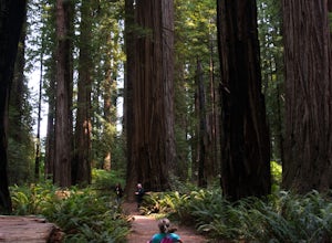
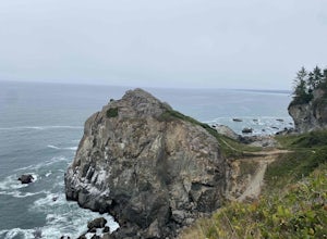
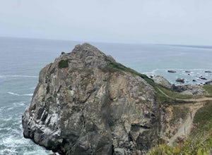
Klamath, California, is a top spot for outdoor adventures, boasting some of the best trails and outdoor activities. One must-visit is the Redwood National and State Parks, where you can enjoy a scenic walk amongst towering redwood trees. The Klamath River is also a popular spot for fishing and river rafting, offering stunning views along its course. For those seeking a challenge, the High Bluff Overlook trail offers a steep climb with rewarding views of the coastline. If you're interested in wildlife, the Klamath Whale Watching Station provides a unique opportunity to spot migrating whales. All these attractions make Klamath a top destination for those seeking outdoor adventures.
Top Spots in and near Klamath
-
Crescent City, California
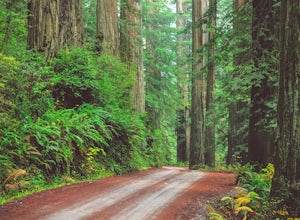
Explore Stout Grove via the Howland Hill Road
4.4The Howland Hill Road is the premier drive through Redwood National and State Parks. Approximately 6 miles long, the hard-packed gravel road varies in surface durability depending on season and when the road was last graded. Expect plenty of dust in the dry summer months and keep an eye out for p...Read more -
Crescent City, California
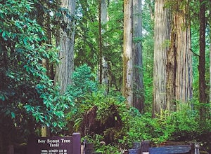
Hike the Boy Scout Tree Trail
5.0With a profusion of titanic trees and an ever expanding landscape, the extraordinary Boy Scout Tree Trail is not so much a hike as it is a showcase of the world's most scenic old growth redwoods. Located within Redwood National and State Parks, this pristine trail feels wonderfully remote. Hardly...Read more -
Crescent City, California
Fern Falls via Boy Scout Tree Trail
4.93 mi / 1050 ft gainFern Falls via Boy Scout Tree Trail is an out-and-back trail that takes you by a waterfall located near Crescent City, California.Read more -
Crescent City, California
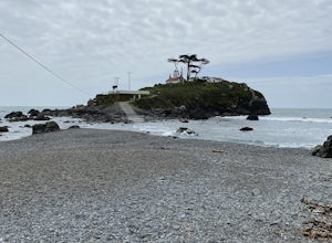
Battery Point Lighthouse
0.5 mi / 13 ft gainBattery Point Lighthouse is an out-and-back trail where you may see local wildlife located near Crescent City, California.Read more -
Crescent City, California
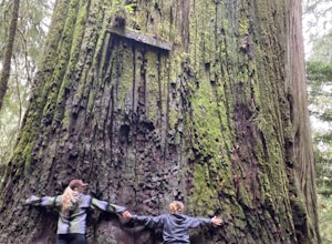
Hike Stout Grove via the Stout Grove Trailhead
4.50.6 miMarked with adequate signage, parking for the Stout Grove Trailhead is off Highland Hill Road, a road through the south end of the park. It's a narrow, dirt road so be cautious traveling through the state park. Pit toilets are available in the parking area. The trail is a .6-mile loop. It is wide...Read more -
Crescent City, California
Camp at Jedediah Smith Redwoods Campground
5.0/ 0 ft gainJedediah Smith Redwoods State Park offers activities for everyone: you can backpack and hike through lush rainforests, or fish, snorkel, and kayak in the Smith River (popular film The Last of the Mohicans was filmed just upstream!). Howland Hill Road is perfect for a scenic drive filled with uniq...Read more -
Crescent City, California
Drive Walker Road
5.0Walker Road is one of the places where parts of Star Wars IV: A New Hope were filmed! It's a beautiful site in the Redwoods with an extra amount of huge, leafy ferns. Once you turn onto Walker Road, it's a quick drive through the redwood trees and ferns to the Smith River at the end. There are a ...Read more -
Humboldt County, California
Hike to Tall Trees Grove, Redwood NP
5.03.9 mi / 690 ft gainNOTE: You need a permit, albeit free, to do this hike.First, you'll need to go to the Thomas H. Kuchel Visitor Center just off Highway 101 south of Orick, CA. Once there, write down your license plate number and go up to the counter and ask one of the rangers for a permit for Tall Trees Access Ro...Read more -
Humboldt County, California
Hike the Emerald Ridge - Redwood Creek Loop
6 mi / 900 ft gainThis loop begins at the Tall Trees Trailhead. To access this parking area, you must have a permit that you can obtain from the Kuchel ranger station. The gate is locked. When you get the permit, the ranger will also give you the combination to the gate. Once you drive through, close the gate ...Read more -
Orick, California
Tall Trees Grove, Redwood Creek, Emerald Ridge Loop
4.44.41 mi / 1043 ft gainDay 1: Check with the Rangers station before heading up for best camping opportunities. Assuming you've checked with the rangers for approval...if there are openings, off of the main road, there are side streets with access to the beaches. Pull into one of these areas and drive down as far as you...Read more -
Crescent City, California
Devil's Punchbowl, Six Rivers National Forest
4.08.33 mi / 1660 ft gainLocated in extreme Northern California, the Siskiyou Mountains are the largest sub-range of the Klamath Mountain range and among the most rugged. The Siskiyou Wilderness, designated in 1984, encompasses three national forests: Siskiyou, Klamath and Six Rivers for a total of 182,802 acres. Because...Read more -
Orick, California
Hike Lyons Ranch
4 miThis is really a dirt road that is gated off from Bald Hills Road. The trail head parking can fit about 6 cars but seldom do people venture out this way. After all, the attraction of Redwood National Park is the redwoods but this high prairie is definitely worth exploring.The walk to the ranch is...Read more -
Trinidad, California
Wedding Rock Trail
5.00.23 mi / 85 ft gainWedding Rock Trail is an out-and-back trail where you may see wildflowers located near Trinidad, California.Read more -
Trinidad, California
Patrick's Point Trail
5.00.21 mi / 92 ft gainPatrick's Point Trail is an out-and-back trail where you may see wildflowers located near Trinidad, California.Read more -
Trinidad, California
Strawberry Rock Trail
5.02.99 mi / 505 ft gainTo get there: From the south, take the Trinidad exit, from which you will take a slight left/ go straight onto Trinidad Frontage rd. From The north, get off at the Trinidad exit, cross under the freeway, and take a left on Trinidad Frontage rd. Once on Trinidad Frontage rd, go straight to the end...Read more -
Del Norte County, California
Backpack to Raspberry Lake
1.012 mi / 1800 ft gainIf you wish to experience the beauty of the Siskiyou Wilderness and avoid the crowds associated with The Devil’s Punchbowl, then consider a visit to Raspberry Lake. Beginning at the Young’s Valley Trailhead (Coordinates: 41.889919, -123.654755), this hike is a great option for those seeking wide...Read more

