Kelseyville, California
Looking for the best hiking in Kelseyville? We've got you covered with the top trails, trips, hiking, backpacking, camping and more around Kelseyville. The detailed guides, photos, and reviews are all submitted by the Outbound community.
Top Hiking Spots in and near Kelseyville
-
Jenner, California
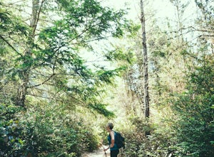
Hike the Central Trail
3.6 mi / 800 ft gainSalt Point State Park, about 90 miles north of San Francisco, features rugged, windswept coastline and dramatic forests of cypress, pine and redwoods. The Central Trail is a great way to experience much of the inland portion of the park including a unique highland Prairie where elk graze and are ...Read more -
Jenner, California
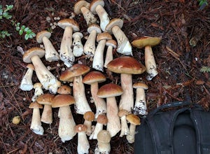
Bolete Mushroom Hunting
Salt Point State Park is a state park in Sonoma County, California, United States. The park covers 6,000 acres (2,400 ha) on the coast of Northern California, with 20 miles (32 km) of hiking trails and over 6 miles (9.7 km) of a rough rocky coast line including Salt Point which protrudes into the...Read more -
Monte Rio, California
Islands in the Sky Vista Loop
4.03.83 mi / 883 ft gainThe Islands in the Sky Vista Loop in Monte Rio, California, is a moderately challenging hiking trail. Spanning approximately 3.83 miles, the loop offers a variety of terrain, including forested areas, open meadows, and rocky outcrops. The trail is well-marked and maintained, making it suitable fo...Read more -
Jenner, California
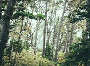
Hike the North Trail to the Pygmy Forest
4 mi / 800 ft gainSalt Point State Park, about 90 miles north of San Francisco, features rugged, windswept coastline and dramatic forests of cypress, pine and redwoods. The North trail is a great way to experience much of the inland portion of the park including the unique Pygmy Forest, named for the stunted trees...Read more -
Santa Rosa, California
Joe Rodota Trail
4.012.67 mi / 174 ft gainJoe Rodota Trail is an out-and-back trail where you may see wildflowers located near Sebastopol, California.Read more -
Jenner, California
Camp and Dive at Salt Point State Park
4.7Camping at Salt Point Sate Park is a dream. You have your choice of camping by the sea at Gerstle Cove campground, or tucked up into the forest at the Woodside campground…and you can’t go wrong with either choice.The rugged and beautiful coastline here is a popular destination for abalone diving ...Read more -
Jenner, California
Hike the Salt Point Trail
3.73 mi / 100 ft gainThere are numerous points at which you can enter the trail from Highway 1, but on the north it begins as the Salt Point / Stump Beach Parking area and proceeds 1.2 miles to the Visitor Center (and south entrance) at the Gerstle Cove State Marine area, one of the first underwater state parks in Ca...Read more -
Santa Rosa, California
Hood Mountain Summit Via Lower and Upper Johnson Ridge Trails
5.95 mi / 2054 ft gainHood Mountain Summit via the Lower Johnson and Upper Johnson Ridge Trails is a 6 mile out-and-back trek located in Santa Rosa, CA. The trailhead starts at the Pythian Road parking lot, accessed from Highway 12. The hike takes 3.5 to 4 hours to complete and is considered strenuous. All trails are...Read more -
Sebastopol, California
Laguna de Santa Rosa Loop Trail
4.03.95 mi / 115 ft gainLaguna de Santa Rosa Loop Trail is a loop trail that takes you by a lake located near Sebastopol, California.Read more -
Santa Rosa, California
Taylor Mountain Loop
4.24.89 mi / 1096 ft gainFrom the northern entrance to the park, you can access an 18-hole disc golf course as well as a number of trails. The Eastern Trail takes you up a steep 1,000 feet to the top of Taylor Mountain, where you can see most of Sonoma County laid out before you. Mt. St. Helena is visible in the distance...Read more -
Sebastopol, California
Thistle - Creek Loop
5.01.45 mi / 69 ft gainThe Thistle - Creek Loop is a loop trail at Ragle Ranch. This trail is used for hiking and running and offers some cover/shade as well as great views of foliage especially in the fall months. This trail is located near Sebastopol, California.Read more -
-
Sebastopol, California
Ragle Ranch Extended Loop
5.01.86 mi / 82 ft gainRagle Ranch Extended Loop is a loop trail where you may see local wildlife located near Sebastopol, CaliforniaRead more -
Jenner, California
Bouldering at Sunset Boulders
5.00.6 miYou can see the boulders off the left side of the road. Couple of different pullouts you can park at to start your approach. It’s about half a mile from the road all downhill. It’s easy going when you’re on your way, but kind of a pain after you’re whooped from climbing. Bouldering, high balls, ...Read more -
Kenwood, California
Pony Gate-Canyon Loop
4.02.17 mi / 568 ft gainThe Pony Gate-Canyon Loop within Sugarloaf Ridge State Park is a new favorite of mine on my list of family and kid-friendly hikes. Our little girls did great with this hike and loved it. If you can get moving early in the day and begin your hike around breakfast time, you might find there are few...Read more -
Occidental, California
Watershed View Trail
4.01.54 mi / 174 ft gainThe Watershed View Trail is located off of Coleman Valley Road and shares a trailhead with the Hunters Camp and Creekside Loop. This trail is a 1.5-mile out-and-back, which makes for a great trail to get the family out on to get some energy out. Be prepared for a muddy trail if there has been rec...Read more

