Half Moon Bay, California
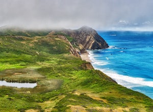
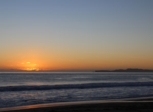
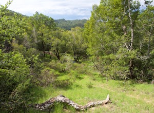
Half Moon Bay, California is an awe-inspiring destination for outdoor adventurers. With its picturesque beaches, lush forests, and winding trails, it's no wonder why it's a top destination for exploring and experiencing nature's wonders. From kayaking in the bay to exploring the nearby redwood forests, there are plenty of must-visit attractions in and near the area. For the adventurous, there are plenty of opportunities for hiking, biking, and horseback riding. The best trails take you through the majestic redwoods, offering breathtaking views and a chance to spot wildlife. For a day of relaxation, you can take a leisurely stroll along the beach or take a boat tour to view the stunning coastline. For a truly unique experience, you can take a guided tour of the historic Fitzgerald Marine Reserve. No matter what you choose, Half Moon Bay, California is the perfect place for an unforgettable outdoor experience.
Top Spots in and near Half Moon Bay
-
Santa Cruz County, California
Camp at Henry Cowell Redwoods Campground
4.8/ 665 ft gainNestled in the Santa Cruz Mountains, Henry Cowell Redwoods State Park is a great weekend option for Bay Area residents. With approximately 30 miles of hiking trails, the incredible Garden of Eden swimming hole, and proximity to Santa Cruz - this campground is not to be missed! On sunny days, view...Read more -
Richmond, California
Explore Point Pinole Shoreline
5.0Point Pinole Regional Shoreline is a 2,315-acre parkland that juts out into the San Pablo Bay. Only a brief car ride from San Francisco, this is a great spot for a Sunday stroll, picnic or simply to find a quiet space.There are several short trails to choose from that wind through eucalyptus grov...Read more -
Bolinas, California
Alamere Falls via Palomarin Trailhead
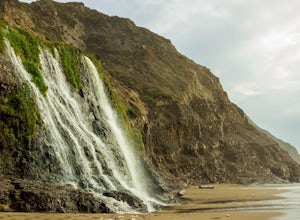
4.513.54 mi / 1614 ft gainAlamere Falls is the tallest waterfall in the bay area. It is known as a tide fall because it empties directly into the Pacific Ocean. This is extremely unique because there are only 34 tide falls in the world and two in California, the other being McWay Falls in Big Sur. Enjoy stunning views of...Read more -
Bolinas, California
Point Reyes' Wildcat Camp via Coast Trail
5.011.19 mi / 1926 ft gainIn order to make this trip possible, go to recreation.gov and make a reservation for Wildcat Camp (available year-round). On your way to the trailhead, make sure to stop by the Bear Valley Visitor Center to grab your camping permit. For more information, visit: http://www.nps.gov/pore/planyourvis...Read more -
Bolinas, California
Bass Lake via Palomarin Trailhead
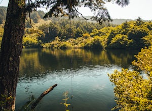
4.26.11 miFollow the Coast Trail from Palomarin Trailhead to Bass Lake. It's a fairly easy ~2.5-3 miles to the Lake. As soon as you pass the lake, on the left you will see a narrow unmarked dirt trail. Take this trail and you'll get to a nice clearing with easy lake access (this will be a great spot for lu...Read more -
Bolinas, California
Glen Camp Loop via the Palomarin Trailhead
4.715.72 mi / 3091 ft gainDay 1 Before heading to the trailhead, make sure to stop by the Bear Valley Visitor Center to pick up your permit. To stay overnight in Point Reyes, you must stay at one of the trail camps. Camping anywhere else in the park is not allowed. Permits for the trail camps can be booked up to 6 mo...Read more -
Bolinas, California
Backpack to Coast Camp in Point Reyes via Palomarin Trailhead
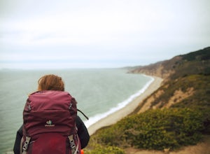
20.5 mi / 2705 ft gainSpanning from just north of the small town of Bolinas (about an hour north of San Francisco) across Inverness ridge and to the top of Tomales Point, Point Reyes National Seashore is as stunning park featuring breathtaking ocean views and solitude among the grassy hillsides and forested ridges. Th...Read more -
Santa Cruz, California
Hike the Rincon Fire Trail
5.01 mi / 300 ft gainThe Rincon Fire Trail Starts at a small dirt parking lot next to CA-9 and traverses down the mountain to the San Lorenzo River Connecting with the Pipeline Trail. The trail can be a simple one of a mile out and back or up to 5 miles depending on your preference. The elevation will change by about...Read more -
San Rafael, California
China Camp Loop
4.09.23 mi / 1716 ft gainPark at the lot in the China Camp State Park. Hop onto the Bay View trail to gain to begin the loop trail. Switchbacks take you up to a long and easy path passing through shaded and open areas. Enjoy the grasslands speckled with oak trees and coyote brush. You can see the San Rafael bay and bridg...Read more -
Walnut Creek, California
Run the Mt. Diablo Foothill Loop
5.06.2 mi / 875 ft gainContinue by car down Castle Rock Road until it dead ends at the beginning of the trail. Parking is usually easy to find. If full, there is another overflow lot about 500 ft back the way you came in.You'll walk a good half mile down the trail before getting the main gate. As you're walking, you'll...Read more -
Danville, California
Summit Mount Diablo via Rock City Trail
5.07.8 mi / 2299 ft gainAlthough steep in sections, this trail is a wonderful workout and hikers are more than rewarded for their efforts. The Rock City Trail is a direct route to the summit of Mount Diablo, and the park is an ecological treasure dear to the hearts of Bay Area residents. The best views are on clear days...Read more -
Danville, California
Hike in Mount Diablo's Madrone Canyon
2.8 mi / 550 ft gainThis hike starts at the Rock City area of Mount Diablo State Park. Begin at the Madrone Canyon Trail, hiking southeast towards the Devils Slide trail. Along this section of the hike, the trail dips into a wooded canyon and follows the path of a small creek. To best experience the beauty of the cr...Read more -
Walnut Creek, California
Castle Rock Trail
5.06.06 mi / 971 ft gainLocated near Walnut Creek, the trail is easily accessible from anywhere in the Bay Area. The trail is kept open year-round, and happens to be part of the American Discovery Trail and the Coast to Crest trail. If you are not done hiking, connecting trails allow you to summit Mt. Diablo. This tra...Read more -
Santa Cruz, California
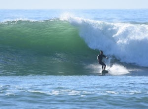
Surf Four Mile Beach
4.0Four Mile is a reef/point break that is a couple of miles north of town. This spot usually picks up more swell than in town so it is a popular spot for many locals to surf. When the swell picks up, it offers long rights towards the beach. The current can be strong when there is a lot of swell in ...Read more -
San Jose, California
Explore Santa Teresa County Park
4.58.3 mi / 2053 ft gainThe Santa Teresa County Park loop is perfect for wildlife viewing! Be ready to see deer, coyote, hawks, turkeys, pigs and cows. The trail is rated as moderate - be cautious with mud if you are visiting the park after a rain shower. Dogs are allowed in the park, but must be kept on leash. There i...Read more -
San Rafael, California
Terra Linda Sleepy Hollow Ridge Trail
5.05.85 mi / 1089 ft gainThis San Rafael neighborhood trail is quite popular, but there is plenty of room for everyone and the parking is easy. After you park at the trailhead, you walk (or bike) up a relatively short and steep path that takes you to the beginning of the trail. This hike takes you along a scenic ridge ...Read more

