Hacienda Heights, California
Looking for the best hiking in Hacienda Heights? We've got you covered with the top trails, trips, hiking, backpacking, camping and more around Hacienda Heights. The detailed guides, photos, and reviews are all submitted by the Outbound community.
Top Hiking Spots in and near Hacienda Heights
-
Newport Beach, California
Explore Deer Canyon
6.9 mi / 1489 ft gainThe Deer Canyon Loop Trail is an easy drive from Orange County and Newport Beach. In the spring, wildflowers are abundant along the trial. This is a favorite spot for trail runners, hikers, and mountain bikers. The trail is kept in great condition year-round and is very wide. There is very little...Read more -
Palos Verdes Estates, California
Bluff Cove
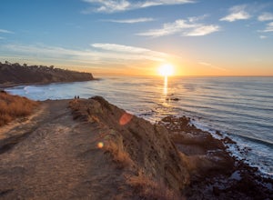
4.40.56 mi / 144 ft gainParking for Bluff Cove is located along the sides of the street of Paseo Del Mar, and the trailhead is located right next to the street. Bluff Cove is one of those unique locations in that there are a variety of activities you can do here. It is a great location for surfing, paddle boarding, bod...Read more -
Rancho Palos Verdes, California
Surf Fishing Off Of Inspiration Point
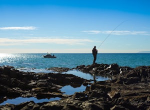
Tucked away, at the base of Inspiration Point in Palos Verdes is an outcropping of rocks, perfect for surf casting and catching ocean fish, away from the crowds. It's a challenge to get there, but the less travelled spot is used by many professional sportsmen, practicing their skills at fishing f...Read more -
Azusa, California
Bighorn Mine Trail
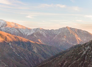
5.03.69 mi / 607 ft gainIf you decide to head over to Wrightwood for some skiing during the winter, make sure to get a hike in while you’re at it. There are several trail systems along the Angeles Crest Highway (Hwy 2), and one of them is scenic Big Horn Mine Trail. The end point of the hike is the historic and abandone...Read more -
Azusa, California
Summit Mt. Baden-Powell
5.07.86 mi / 2808 ft gainThis well maintained and well traveled trail is a popular route with day hikers, backpackers, and Pacific Crest Trail through hikers. Since the trail is on the face of the mountain, snow may linger late into the season. The Pacific Crest Trail is clearly marked on the western corner of the Vinc...Read more -
Rancho Palos Verdes, California
Sacred Cove View Trail
4.52.08 mi / 292 ft gainThis area is spectacular - the views of the cliffs, the channels of water entering the caves, and the marine life (sea lions, whales, dolphins, sea urchin and sea anemone) are huge draws. Bring anyone here that has a sense of adventure and be ready to get wet. Only attempt swimming across the cha...Read more -
Trabuco Canyon, California
The Luge: Santiago Truck Trail Loop
5.07.46 mi / 1371 ft gainThe Luge: Santiago Truck Trail Loop is a loop trail that takes you through a nice forest located near Lake Forest, California.Read more -
Pearblossom, California
Devil's Punchbowl and Devil's Chair
4.57.37 mi / 1870 ft gainWhat a hidden gem! A martian landscape full of faultline desert rock formations and joshua trees against a mountainous backdrop of the San Gabriels. Devil's Punchbowl Natural Area features a 1 mile well-marked, well-maintained single track loop trail inside the Punchbowl (great for kids) and a 7 ...Read more -
Valyermo, California
Blue Ridge Trail via Inspiration Point
4.97 mi / 692 ft gainThere are two trail heads for the Blue Ridge Trail, one via the Grassy Hollow Visitor Center, and the other across from Inspiration Point. When parking gets crowded over at Grassy Hollow Visitor Center, than parking at Inspiration Point is the better option. To access the Blue Ridge Trail from In...Read more -
Santa Monica, California
Santa Monica Pier, Boardwalk, and Beach Trail
4.03.33 mi / 20 ft gainThe Santa Monica Pier, Boardwalk, and Beach Trail in Santa Monica, California, offers a unique blend of coastal and urban hiking. The trail is a flat, paved 3.33-mile loop that is suitable for all skill levels. It starts at the Santa Monica Pier, a historic landmark known for its Ferris wheel and...Read more -
Rancho Palos Verdes, California
Terranea Beach Sea Cave
4.31.63 mi / 210 ft gainHead to the Pelican Cove parking lot where there’s plenty of free parking right at the trailhead. From the parking lot, take the Terranea Beach Trail and you will see views of the Point Vicente Lighthouse down the coast to your right. Continue on the trail through the luxury Terranea Resort whic...Read more -
Rancho Palos Verdes, California
Pelican Cove
0.38 mi / 95 ft gainGetting There Coming from San Pedro, make a U-turn at the Hawthorne Boulevard stoplight onto Palos Verdes Drive South. From here, you can access the parking lot for Pelican Cove, where you'll get a 120° view of the ocean. It might be tempting to take in the sunset from the car, but you should def...Read more -
Laguna Beach, California
El Moro Canyon Trail to Lower Moro Campground
3.56.37 mi / 997 ft gainLocated off of Pacific Coast Highway in Laguna Beach is Crystal Cove State Park. There are three primitive sites located in Crystal Cove: Deer Canyon, Upper Moro, and Lower Moro. The site I stayed at was Lower Moro campground. All three of these sites require the backpacker to hike everything in...Read more -
Laguna Beach, California
El Moro Canyon Trail
5.04.94 mi / 814 ft gainThe trail features a waterfall and is open year-round, but is best used in the spring. Remember to bring $15 cash for the parking fee. The Laguna Beach trail is shared by trail runners, mountain bikers, hikers, and the occasional horseback rider. Dogs are not allowed in Crystal Cove State Park.Read more -
Laguna Beach, California
Hike Willow Canyon, Laguna Coast Wilderness Park
5.06.7 mi / 1208 ft gainThis hike has been a must do since I was young. Do you love scenic views of the ocean and wildlife? You'll see plenty of both, from hawks searching for food to squirrels and deer running through the brush. This is my favorite route in this area but there are plenty of other trails to shorten or a...Read more -
Wrightwood, California
Snow Hike Lightning Ridge
5.1 mi / 900 ft gainWhen you hear the report about snow in the San Gabriels, it's time to plan this hike!Only a short 90 minute drive is all that separates nearly a third of California's population from high-altitude snowy adventures. This isn't about Yosemite, but Southern California's very own San Gabriel Mountain...Read more

