Hacienda Heights, California
Looking for the best hiking in Hacienda Heights? We've got you covered with the top trails, trips, hiking, backpacking, camping and more around Hacienda Heights. The detailed guides, photos, and reviews are all submitted by the Outbound community.
Top Hiking Spots in and near Hacienda Heights
-
Los Angeles County, California
Backbone Trail via Corral Canyon
5.02.08 mi / 89 ft gainThe backbone trail was a vision that started in the 1980’s. It is a trail that stretches 65 Miles starting in Will Rodgers State Historic Park and ending at Thornhill Broome Beach. It has many entrance and exit points but it is anchored in the middle by the Coral Canyon Trail Head. The full trail...Read more -
Canyon Lake, California
Kabian Memorial Park Loop
5.03.48 mi / 335 ft gainKabian Memorial Park Loop is a loop trail that takes you by a lake located near Quail Valley, California.Read more -
Agoura Hills, California
Ladyface Peak
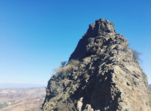
4.52.05 mi / 971 ft gainLadyface is a volcanic ridge that juts up over Agoura Hills. It is a short but steep hike up the ridgeline, and it offers amazing views to either side. Sections of the trail are steep and sandy so it can be challenging to maintain your footing. Trekking poles are optional and can help with the de...Read more -
Malibu, California
Escondido Falls Trail
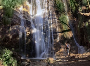
4.33.74 mi / 699 ft gainThis 3.8 mile out-and-back hike takes place on a very easy to use trail. The first 0.75 miles on Winding Way are paved, leading you up to Escondido Canyon Trail. As you head up Winding Way, it’s safest to stay on the side of the road on the dirt. You’ll take this paved road up roughly 200 feet be...Read more -
Malibu, California
Hike the Backbone East from Latigo Canyon
3.8 mi / 780 ft gainStarting in a dusty, generally empty parking lot, at about 2,000' ASL, you'll go immediately due north, up a few more feet before you drop down into another canyon covered in live oaks (and poison oak), thistles, ferns, and wildflowers. There's only one trail. It's windy, it's not hilly, it just ...Read more -
Malibu, California
Point Dume
4.80.95 mi / 141 ft gainFrom the parking lot, make your way towards Point Dume. You will find the entrance to the trail at the end of the lot. The trail is a bit sandy, but fairly easy. Be careful of the cactus plants along the trail! Make your way up towards the cliff and you'll notice ropes hanging on the edge. Don't...Read more -
Malibu, California
Paradise Cove via Point Dume
5.04.74 mi / 338 ft gainYou will start your beach-hiking to Paradise Cove from Point Dume which is located 20 miles north of Santa Monica on Pacific Coast Highway (PCH). On PCH, take left on Westward Beach Road and follow it to the end. Try to park as close to the end of the paid parking lot. You can use the automated m...Read more -
Oak Park, California
China Flat Trail to Simi Peak
5.05.03 mi / 1398 ft gainFrom the trailhead, simply follow the trail headed up the mountain. The first 2 miles is the hardest part of the hike, because of the steep ascent. Continue on until you hit a junction. Turn left, and you will eventually see an old rusty gate, and a sign which says "China Flat Trail". You will ...Read more -
Avalon, California
Camp at Catalina's Two Harbors
4.8An island camping escape is a mere 50 minute boat ride away from the southern California coast. If you're feeling generous with your funds, you can also opt for a helicopter ride, leaving out of Long Beach and 15 minutes later landing in Catalina Island.Two Harbors campground is unique with the a...Read more -
Avalon, California
Visit Two Harbors, Catalina Island
5.0Just 30 miles from the commotion and congestion of Los Angeles, is a small island village that time seems to have left behind. You won't find the usual traffic, development, and big crowds here. You won't find movie theaters, concert venues, hotels, nightclubs, or sporting events either. At Cata...Read more -
Lancaster, California
Little Butte Trail
4.02.09 mi / 213 ft gainLittle Butte Trail is an out-and-back trail that is moderately difficult located near Llano, California.Read more -
Lancaster, California
Saddleback Butte State Park Loop
0.58 mi / 46 ft gainSaddleback Butte State Park is a state park in the Antelope Valley of the western Mojave Desert. It’s oftentimes looked over, but you’d be surprised what you can find there. Definitely a place to stop. It is located east of Lancaster. It can get hot so make sure to bring lots of water and wear su...Read more -
Malibu, California
Backbone Trail via Kanan Dume
5.04.47 mi / 1089 ft gainFair warning, it can get very hot in Malibu, especially in the summer or fall. We started at the Kanan Dume Road lot. It fills up quick, both directions offer beautiful hiking, but most people tend to go west, it seems. While that's beautiful, you end on a decent uphill, so if hiking is new or c...Read more -
Malibu, California
Newton & Zuma Canyon Falls
4.32 mi / -600 ft gainThree waterfalls in one short hike?!...I'll take it! That's what you'll get if you make the visit to these falls in the Santa Monica mountains in Malibu. The trailhead starts on Kanan Dume road, which is also where the Backbone trail meets. Park in the designated (free) parking area and take the ...Read more -
Two Harbors, California
Day Hike across Catalina: Two Harbors to Avalon
21 miThis hike was one of the most difficult and definitely one of the most memorable hikes I’ve ever done. The view of the island and the surrounding water is surreal and I am yet to be anywhere like this hike. The dry California vegetation of the mountains matched with the bright blue endless backgr...Read more -
Avalon, California
Camp at Parsons Landing
5.07 mi / 0 ft gainThe distance can vary depending on where you start. It is a 2.5 mile hike from Emerald Bay or 7 mile hike from Two Harbors or you can kayak in. There are 8 primitive campsites (6 people/ site) which means there is no running water, no supplies...you must pack in everything. The campsites are spre...Read more

