Top Spots in and near Golden Gate National Recreation Area
-
Pacifica, California
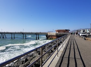
This is a great place for fishing or just taking a walk to watch the sunset. It's a great place to walk or jog, or even bring a pup! There are lot of people fishing throughout the pier.
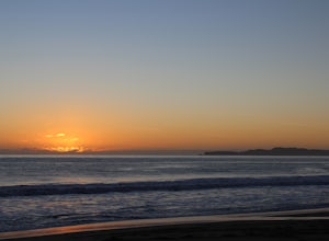
A short walk away is Sharp Park Beach, where you can relax and bring a picnic to watch the sunset.
Read more
-
Pacifica, California
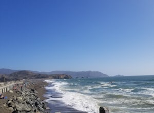
A medium size beach with darker sand with big rocks and a paved path for walkers and joggers. The beach is a great place to bring a picnic and watch the sunset. It is located next to Pacifica Pier, which is popular for fishing.
Read more
-
Kensington, California
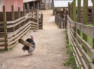
First make sure to stop at the store and stock up on fresh lettuce and celery for the animals. Your kids (or just the kid in you) will love to feed them! Note that they're only allowed to eat lettuce and celery, so don't try to feed them your own snacks or get creative. ;)
If you want to make it...
Read more
-
Berkeley, California
4.5
1.44 mi
/ 663 ft gain
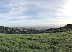
From the trailhead at Stonewall Road, the 1.5-mile trail makes for an excellent before or after-work run. But the steep hills and loose ground aren’t for those looking to find an easy nature walk.
The incline starts well before the Stonewall-Panoramic trailhead, so you won’t even have time to w...
Read more
-
Berkeley, California
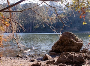
Lake Anza makes for a great warm weather swimming hole. The parking area is close to the beach along with the trail, which will take you around the lake. The beach gets plenty of sun and is fairly wind protected, which makes for a relaxing day. Bring some picnic food out to the lake and snag your...
Read more
-
Berkeley, California
4.5
4.28 mi
/ 1007 ft gain
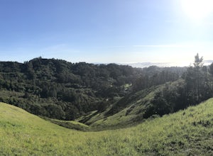
The trail is dog and horse friendly, and many trail loops make Tilden Regional Park fun for families and those of any skill level. The Seaview and Big Springs Trail loop is typically used by avid hikers, trail runners, or mountain bikers. The first half of the trail is exposed to the sun and rock...
Read more
-
Bolinas, California
4.5
13.54 mi
/ 1614 ft gain
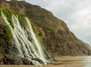
Alamere Falls is the tallest waterfall in the bay area. It is known as a tide fall because it empties directly into the Pacific Ocean. This is extremely unique because there are only 34 tide falls in the world and two in California, the other being McWay Falls in Big Sur. Enjoy stunning views of...
Read more
-
Bolinas, California
5.0
11.19 mi
/ 1926 ft gain
In order to make this trip possible, go to recreation.gov and make a reservation for Wildcat Camp (available year-round). On your way to the trailhead, make sure to stop by the Bear Valley Visitor Center to grab your camping permit. For more information, visit: http://www.nps.gov/pore/planyourvis...
Read more
-
Bolinas, California
Follow the Coast Trail from Palomarin Trailhead to Bass Lake. It's a fairly easy ~2.5-3 miles to the Lake. As soon as you pass the lake, on the left you will see a narrow unmarked dirt trail. Take this trail and you'll get to a nice clearing with easy lake access (this will be a great spot for lu...
Read more
-
Bolinas, California
4.7
15.72 mi
/ 3091 ft gain
Day 1
Before heading to the trailhead, make sure to stop by the Bear Valley Visitor Center to pick up your permit. To stay overnight in Point Reyes, you must stay at one of the trail camps. Camping anywhere else in the park is not allowed. Permits for the trail camps can be booked up to 6 mo...
Read more
-
Bolinas, California
Spanning from just north of the small town of Bolinas (about an hour north of San Francisco) across Inverness ridge and to the top of Tomales Point, Point Reyes National Seashore is as stunning park featuring breathtaking ocean views and solitude among the grassy hillsides and forested ridges. Th...
Read more
-
Berkeley, California
4.7
4.16 mi
/ 459 ft gain
Tilden Park is a beautiful recreational area with scenic hiking trails, a swimming lake, small animal farm, a steam train and botanical gardens. The versatility of this park makes it very family and kid friendly, and those who are looking for a moderate hike within the park have almost forty mile...
Read more
-
Orinda, California
4.0
5.89 mi
/ 1050 ft gain
From Inspiration Point, head toward Nimitz gate. Once you pass through the gate, keep an eye out for Curran Trailhead; this is the trail you'll be starting on. After about 1/8 of a mile, you'll reach a junction with the Meadows Canyon Trail. Turn right onto this trail to continue the loop. This p...
Read more
-
San Bruno, California
4.5
3.88 mi
/ 646 ft gain
Starting from the parking lot on Sneath Lane Trail, you’ll head through the gate and continue on the path up Sweeney Ridge. This is a 5.7 mile out-and-back trek. There is a 600 ft. elevation gain, which comes mainly in the first 1.5 miles of the trail. Your legs and lungs may hurt a bit, but if t...
Read more
-
San Geronimo, California
5.0
2.37 mi
/ 430 ft gain
Roy's Redwoods Preserve is an easily missed pocket of Redwoods off Nicasio Valley Road in Marin County. Don't miss it: heading North on Sir Francis Drake Blvd turn right onto Nicasio Valley Rd--the gate for this little park is about a half mile up on the right. From the main entrance you enter a ...
Read more
-
Pacifica, California
4.8
2.54 mi
/ 276 ft gain
Start at the parking lots close to the pier, where bathrooms are also available. Walk along the pier to watch the sunset as it begins.
Next, walk along Sharp Park Beach to discover the plethora of wild flowers and friendly locals always ready to guide you on your walk.
Take the stairs up to the...
Read more

