Glendale, California
Looking for the best photography in Glendale? We've got you covered with the top trails, trips, hiking, backpacking, camping and more around Glendale. The detailed guides, photos, and reviews are all submitted by the Outbound community.
Top Photography Spots in and near Glendale
-
Topanga, California
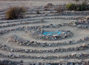
The Labyrinth at Tuna Canyon Park
1.45 mi / 299 ft gainThis is a simple but steep 2.4 mile round-trip hike to a clearing on a mountaintop in Topanga/Malibu, about an hour's drive west of downtown LA. At the end of the hike you'll reach a clearing with incredible views. On a cloudy or foggy day, it feels like you're floating above the clouds; on a cle...Read more -
Topanga, California
Calabasas Peak Motorway
7.23 mi / 1565 ft gainGetting There You can, from Los Angeles, go one of three ways: take I-405 to US-101 and head west, or from downtown, take US-101 the whole way, OR, get on I-10 from the Westside or east of there and take that until it becomes PCH, then take that to Topanga Canyon (turn left onto Old Topanga Cany...Read more -
Los Angeles, California
Stoney Point Park Loop
4.00.73 mi / 141 ft gainOnce you've parked along Topanga Canyon Blvd, make your way down the street and start the trail off near the steel gate, close to the horse stables. As you make your way in, you will notice some rock climbers practicing on the lower elevation rocks. Make your way around this rocky park, counter-...Read more -
Stevenson Ranch, California
Hike the Towsley Canyon Loop
4.75.1 mi / 1340 ft gainThe Towsley Canyon Loop can be done in either a clockwise or counter-clockwise loop. The clockwise path starts with a gradual ascent through Wiley Canyon and steep descent into the Towsley Gorge while a counter-clockwise route starts with a steep climb out of Towsley Canyon and a gradual descent ...Read more -
Los Angeles, California
Cave of Munits
4.51.53 mi / 299 ft gainAre you looking for a hike that offers trail running, scenic views, hiking, and CAVE exploring? This short, but exciting trail leads you on a short 0.8 mile hike to the Cave of Munits. When starting at the main trailhead, El Scorpion Park, take the wide paved dirt road all the way till you get to...Read more -
Pearblossom, California
Snowshoe Buckhorn Ridge Trail
2.5 mi / 700 ft gainLocated 1 mile east of the Mt Waterman Ski Resort, Buckhorn Ski Hill is a great place to enjoy a leisurely stroll through a snow-covered forest, complete with views of towering Mt Waterman. To get here take I-210 toward La Canada, exit on to California Highway 2 (Angeles Crest Highway) heading no...Read more -
Pearblossom, California
Mt. Waterman
5.05.87 mi / 1499 ft gainMt. Waterman is accessed along Highway 2 in the Angeles National Forest. Heading east from La Canada look for mileage marker 58.0 (34 miles from La Canada) just past the closed ski resort. Park at one of the large paved turnouts on your left. Display an Adventure Pass ($5 at Ranger Station or Big...Read more -
Ventura County, California
Hike the Upper Las Virgenes Canyon Open Space Preserve Trail
8.6 mi / 1851 ft gainThe most popular point of entry is through the Victory Trailhead, which has ample parking. You can park on the street or you can pay $3 to park at the trailhead parking lot. You can also enter at the Upper Las Virgenes Canyon Trailhead at the northern end of Las Virgenes Canyon Road in Calabasas....Read more -
Agua Dulce, California
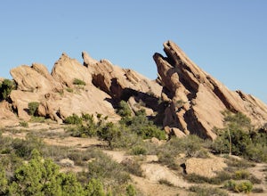
Vasquez Rocks
5.02.42 mi / 367 ft gainThis is a Natural Park Area located in Santa Clarita, within the Sierra Pelona Mountains. It features amazing diagonal rock formations, created because of the force between two tectonic plates pushing against each other. This place is a photographer's paradise, and every spot in this 900+ acre l...Read more -
Pearblossom, California
Cooper Canyon Falls via Burkhart Trail
5.03.01 mi / 755 ft gainBurkhart Trail is well-defined and easy to follow through an unbelievable old growth of Jeffrey pines, incense-cedars and surprisingly, redwoods! At 0.25 miles, there is a steep spur trail near a large pile of boulders that leads to a popular swimming area, often frequented by guests of the campg...Read more -
Signal Hill, California
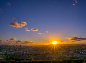
Hilltop Park
4.7Hilltop Park is located in Signal Hill and offers an unmatched panoramic view of the Los Angeles Basin. If you go on a clear day, you may even be lucky enough to see Catalina Island and the Santa Monica and San Gabriel Mountains. This park is the perfect spot for families, dogs, and even dates. T...Read more -
Malibu, California
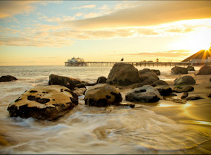
Photograph the Iconic Malibu Pier
3.2Less than a mile South from the small town center, Malibu Pier stretches out into the Pacific. The Pier has been in Malibu since 1905 and though much of Malibu has been built up around it, it has remained quite similar to when it was first constructed. You can either pay for parking right at the ...Read more -
Palos Verdes Estates, California
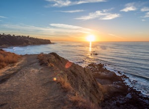
Bluff Cove
4.40.56 mi / 144 ft gainParking for Bluff Cove is located along the sides of the street of Paseo Del Mar, and the trailhead is located right next to the street. Bluff Cove is one of those unique locations in that there are a variety of activities you can do here. It is a great location for surfing, paddle boarding, bod...Read more -
Azusa, California
Lewis Falls
1 mi / 732 ft gainLocated deep in the Angeles National Forest above Azusa, this short but at times challenging hike rewards you with a beautiful fifty-foot waterfall. The base of the waterfall is only a foot at its deepest, so I wouldn't rush to bring a bathing suit with you. Protected by the heavy forestry around...Read more -
Agoura Hills, California
Rock Climbing in Malibu Creek
A great day trip! Referred to by many as the "Yosemite of Southern California," Malibu Creek offers a huge selection of bolted sport routes on generously pocketed volcanic rock. This is the perfect place to bring a first time climber or even your most seasoned climbing buddies. Routes range from ...Read more -
Long Beach, California
Red Car Greenbelt
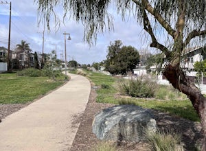
5.00.63 mi / 0 ft gainThe Greenbelt used to be the right-of-way for the long lost Pacific Electric Red Car, an amazing system of public transportation that connected Long Beach, LA, Orange Coutny, and even San Bernardino. The pathways are landscaped with plants typical of the area and plenty of native flowers for the...Read more

