Gilroy, California
Looking for the best hiking in Gilroy? We've got you covered with the top trails, trips, hiking, backpacking, camping and more around Gilroy. The detailed guides, photos, and reviews are all submitted by the Outbound community.
Top Hiking Spots in and near Gilroy
-
Boulder Creek, California
Camp at Big Basin Redwoods State Park
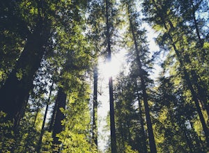
4.00.5 miBig Basin is currently closed including the campgrounds. Please visit the Parks.ca.gov site for updated details. An hour away from the thrumming city of San Jose, ancient immense trees live in a forest full of vibrant ferns and rushing waterfalls. Big Basin Redwoods State Park encompasses 10,00...Read more -
Boulder Creek, California
Hike the Ocean View Summit Loop
4.06 mi / 600 ft gainThis hike begins at the Big Basin park headquarters. If you're up for 6 miles through giant redwoods and along serene creeks, and with an ocean view, then this is the hike for you. Ocean view summit loop starts on the Gazos Creek Road bridge, next turn right on to the Middle Ridge Fire Road, whic...Read more -
Boulder Creek, California
Hike the Old Growth Redwoods Trail
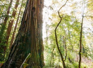
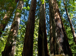
4.50.5 miQuick half-mile stroll through the old growth Redwoods that will show you the nature of the ever-living redwood tree.Redwoods are capable of withstanding storms, floods, fire, droughts, and even termites. These legendary trees can live for over 2,000 years and possess incredible strength, vigor, ...Read more -
Carmel-by-the-Sea, California
Hike along the Carmel River Beach Trail
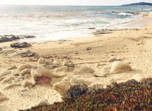
1 mi / 100 ft gainKnown as "Ribera Beach" by locals, this stretch of land nestled between Carmel River State Beach and Monastery Beach is not to be missed! The trails are easy to get to and can be accessed by 4 locations. The first entrance is on Highway 1 at the Bay School (between Ribera Road and Monastery Beach...Read more -
Carmel-by-the-Sea, California
Hike to the Top of Inspiration Point
5.01.3 mi / 850 ft gainThis magnificent trail was recently converted into part of the Monterey Regional Parks System. Walk through pastures of cows, through coast oaks, up a steep incline with vast views of Carmel Valley, Carmel and the Pacific Ocean up to the top where a picnic table awaits you at Inspiration Point. T...Read more -
Sunol, California
Little Yosemite via Canyon View Trail
4.03.01 mi / 705 ft gainPlease note this is a fragile ecosystem and watershed. There is NO swimming allowed in Alameda Creek and trespassing is prohibited on Water Department lands that are not accessible to the public. You can learn more about the restrictions and the area at ebparks.org. After entering the kiosk you...Read more -
Davenport, California
Hike around Greyhound Beach and Climb Greyhound Rock
0.7 mi / 0 ft gainThe trailhead is at the Greyhound Rock State Marine Conservation Area which is directly off Highway 1. There is a large paved parking lot with a good amount of trees so finding a shady parking spot isn't that difficult (if that's important to you). The parking lot is located on the beach cliffs ...Read more -
21600 Big Basin Way, California
Hike the Sequoia Trail at Big Basin Redwoods SP
4.04.3 mi / 600 ft gainThis 4.3 mile hike in Big Basin Redwoods SP is a peaceful break from the hustle and bustle of everyday life. In the first half, there is a quick detour you can take to Sempervirens Falls. Just listen for sounds of water, read the signs, and cross the road. The detour itself is as far as cross...Read more -
Fremont, California
Mission Peak via Hidden Valley Trail
4.26.16 mi / 2116 ft gainBreathtaking views of the Bay Area are your reward for making this climb to the top of Mission Peak. It’s a 3-mile trek to the top of the peak and then back down the same way. This is a moderate hike that provides a nice workout – so be prepared. Park at the Stanford Avenue entrance gate. There ...Read more -
La Honda, California
Hike through Portola Redwoods State Park
4.87 miLike redwood hikes? We do too, they're always very scenic and take you away from the hustle and bustle of the bay area. Not to mention, they also stay cool during the summer months. If you want a hike in the middle of the peninsula, this is a great bet.When starting this hike, head out from headq...Read more -
Carmel-by-the-Sea, California
Whalers Cove Loop
4.31.42 mi / 253 ft gainPoint Lobos is one of the hidden gems of the California coast. Located just off of Route 1 right after Monterey, Point Lobos is a state park on the coast. The cost to explore inside is ten dollars, but so worth it. As you explore, be sure to hike around Whalers Cove, which is incredible at sunse...Read more -
Santa Clara County, California
Black Mountain via Rhus Ridge Trail
9.75 mi / 2992 ft gainJust outside of Los Altos is a very long ridge of mountains, one of which is Black Mountain. This is a very dry hike, with no tree canopy, so it can get very hot! Be aware that this can make the hike feel a lot more difficult with the sun beating down on you. Follow Rhus Ridge Trail to Black Mo...Read more -
Carmel, California
Point Lobos Natural Preserve Loop
4.77.14 mi / 640 ft gainPoint Lobos contains headlands, coves and rolling meadows, and its offshore area forms one of the richest underwater habitats in the world, popular with divers. Wildlife includes seals, sea lions, sea otters, migrating gray whales (from December to May), and thousands of seabirds, who also make t...Read more -
Carmel-by-the-Sea, California
Cypress Grove Trail via South Shore Trail
5.01.72 mi / 121 ft gainCypress Grove Trail via South Shore Trail is a family-friendly loop hiking trail located near Carmel-by-the-Sea, California. Along this hike in Point Lobos State Natural Reserve, you'll get a chance to see beautiful coastal views with rugged cliffs, views across Monterey Bay, and Cypress trees as...Read more -
Livermore, California
Hike to Murietta Falls
4.012 mi / 4175 ft gainGet ready for one of the toughest, lung busting hikes in the east bay with over 6-miles and 4,000ft of climbing in one direction. When you make it to the hike, it's also important to realize that without recent rain, there many not actually be a waterfall. With that said, you're still getting in ...Read more -
Los Altos, California
Hike to Black Mountain and Stevens Creek Canyon
4.06 mi / 950 ft gainThis hike can be done during any season, but for the creek to be running and for more comfortable temperatures, it is best to go on a cool winter or spring day. Starting at the preserve parking lot, take the Stevens Creek nature trail, allowing you to witness spectacular views of a large, foreste...Read more

