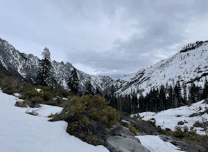
Gazelle, California
Looking for the best hiking in Gazelle? We've got you covered with the top trails, trips, hiking, backpacking, camping and more around Gazelle. The detailed guides, photos, and reviews are all submitted by the Outbound community.
Top Hiking Spots in and near Gazelle
-
Fort Jones, California
Sky High Lakes in the Marble Mountains
5.011.88 mi / 2070 ft gainThe Marble Mountains are part of the Klamaths, a biologically and geologically diverse range of peaks and ridges often overshadowed by its western neighbors in the Cascades. The Marble Rim is the signature feature of this subrange, a white wall of rock that glimmers in the sun. The nearby Sky Hig...Read more -
McCloud, California
McCloud Middle Falls Short Trail
3.00.79 mi / 85 ft gainMcCloud Middle Falls Short Trail is located near McCloud, California. This route makes for an abbreviated version of the longer Middle McCloud Falls adventure which is 2.5 miles roundtrip. The parking area has an established parking lot and a vault toilet. The shorter trail with minimal elevati...Read more -
Ashland, Oregon
Hike and Climb Pilot Rock
8 mi / 1000 ft gainPilot Rock is one of the most prominent features in the Cascade-Siskiyou National Monument and is visible from over 40 miles away in the Shasta Valley of northern California and the Rogue Valley of Southern Oregon.Similar to Devil’s Tower in Wyoming, though much smaller in stature, Pilot Rock is ...Read more -
McCloud, California
Algoma Campground
The Algoma Campsite is a free campsite along the Upper Portion of the McCloud River. It features eight sites and a pit toilet. Unlike the other campgrounds in the area, this site receives very little traffic and has no fee. To get there, take SR 89 east from the McCloud Ranger Station for 13 mi...Read more -
Forks of Salmon, California
Hike to the Caribou Lakes, Shasta-Trinity Alps
4.016 mi / 3000 ft gainHike through the most majestic and unforgettable mountain ranges, alpine terrains, glacier lakes outside of the Sierra Nevada in Northern California. Yes, it's a long drive there and a lengthy hike, but if you have any doubts about whether this is worth the effort, just go! I struggled with the s...Read more -
Ashland, Oregon
Hike to Hobart Bluff
2.5 mi / 200 ft gainHobart Bluff is part of the Western Cascades, a range of weathered volcanic mountains that are much older than the High Cascades that most people think of today, the range of Shasta, Rainier, and Hood. These mountains are shorter as a result of the work of time and usually have summits wrapped in...Read more -
Ashland, Oregon
Summit Mt. Ashland
5.05 mi / 1550 ft gainSituated in Southern Oregon right near the California border lies the Siskiyou Mountain Range's tallest peak, Mount Ashland. Mount Ashland is a very popular area for many recreational activities, one of the most popular activities is skiing. The ski area was opened up in 1963 and has changed hand...Read more -
Trinity Center, California
Backpack to Bear Basin and The Four Lakes Loop
30.1 miDay 1 Swift Creek Trail Head to Bear BasinThe trip begins at the Swift Creek trailhead in the Trinity Alps Wilderness. Permits are very easy to get, just stop by the Ranger station in Weaverville, CA. They are free and can be self-issued in front of the ranger station, or you can go in if you wou...Read more -
Forks of Salmon, California
Grizzly Lake via China Gulch Trailhead
4.414.6 mi / 5112 ft gainGrizzly Lake is in the Trinity Alps Wilderness. The lake is know for its brilliant waterfall flowing from the lake's surface straight off the side of a cliff and roughly 600 feet down to the meadow below. Grizzly lake is located in some of America's most amazing and remote alpine wilderness, incl...Read more -
Trinity Center, California
Camp at Hayward Flat on Trinity Lake
We drove all around Trinity Lake and this was the best campground we found! Located right on Trinity Lake you will find Hayward Flat Campground. From Weaverville California you will follow highway 3 north about 20 miles. Then take a right on Hayward Flat road two miles. Boom, you are there. The...Read more -
Trinity Center, California
Stuart Fork Trail to Emerald and Sapphire Lakes
5.027.06 mi / 4213 ft gainThe trail begins just past the Trinity Alps Resort, a private collection of cabins near Weaverville, CA. Hikers wanting an early start can spend the night at the Bridge Camp Campground, located next to the trailhead. The path starts out wide and level, following an old road to the wilderness bou...Read more -
Trinity Center, California
Stuart Fork to Alpine Lake
16 mi / 4265 ft gainNestled in the heights of the Trinity Alps, this hike to Alpine Lake is not for the faint of heart. Before embarking on this adventure call the Weaverville Ranger station to check snow levels as well as the flow of the Stuart Fork River. If you are too early in the summer season the snowpack wi...Read more -
Trinity Center, California
Backpack Stuart Fork to Emerald and Sapphire Lake
25 mi / 4448 ft gainThe Stuart Fork to Emerald and Sapphire Lakes trail features many beautiful lakes, meadows, and an area that resembles a jungle. Dogs are able to use this trail. This trail can be done as a day hike, an overnight, or a three-day backpacking trip. If you choose to make it a three day, the meadows ...Read more

