Gaviota, California
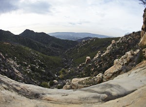
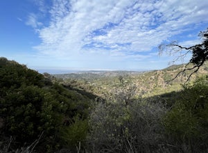
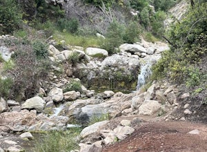
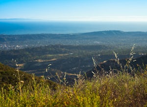
The best Trails and Outdoor Activities in Gaviota, California, include the Gaviota Peak Trail, a top pick for hikers. This 6-mile round trip trail is moderately difficult, with steep inclines and rocky paths. It's a must-visit for its scenic views of the Pacific Ocean, the Channel Islands, and the Santa Ynez Mountains. The Gaviota Wind Caves are another highlight, featuring fascinating sandstone formations shaped by wind and weather. For a more leisurely outdoor adventure, try the Gaviota State Park beach, perfect for picnics and bird watching. Nearby, the Nojoqui Falls Park offers an easy hike to a beautiful waterfall, making it a popular attraction. These outdoor activities make Gaviota a great destination for those seeking scenic trails and natural beauty.
Top Spots in and near Gaviota
-
Santa Barbara, California
La Cumbre Peak via Tunnel Trail
9.96 mi / 3310 ft gainTunnel Trail is a great way to get to the top of La Cumbre Peak. You get to the trailhead by taking Tunnel Road until it dead ends at a large water tower, there you can park your car and start on foot. You take Spyglass Ridge Road up which is a paved fire road until it becomes dirt when you get o...Read more -
Orcutt, California
Hike or Trail Run the Rice Ranch Trail
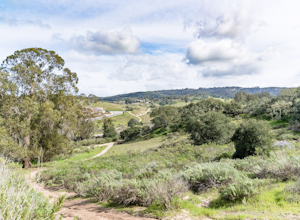
4.03.2 mi / 400 ft gainHike, mountain bike, or trail run the Rice Ranch Trail in Orcutt, CA. This park is relatively small, but a great place for a hike or run. I did a 3 mile loop and could easily have added on a couple more miles. Hike up to water towers at the top and enjoy views overlooking Santa Maria Valley and o...Read more -
Santa Barbara, California
Red Rock Pools
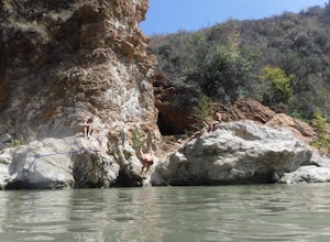
0.89 mi / 10 ft gainRed Rock Pools is a relatively popular swimming hole located along the Santa Ynez River about an hour outside of Santa Barbara, California. The trail to the swimming hole is relatively short, but more pools can be found if you follow the Gibraltar Trail down to the Gibraltar Dam (an additional ...Read more -
Montecito, California
Cold Spring Trail Loop
5.02.67 mi / 883 ft gainCold Spring Trail Loop is a loop trail that takes you by a river located near Santa Barbara, California.Read more -
Montecito, California
Tangerine Falls
4.51.15 mi / 886 ft gainThis waterfall can be fairly dry during the year, so keep your eyes out for a recent rainstorm to get things going. When you start the hike on East Folk Trail, at 0.25 miles, cross over the creek and join West Fork Trail. A little over another half mile, West Fork starts to head uphill, but you c...Read more -
Montecito, California
West Fork of Cold Spring Trail
3.45 mi / 1135 ft gainIf you love the mountains above Santa Barbara but hate the crowds, stick to the canyon trails on the east side. The trails running up Cold Spring canyon offer a variety of experiences without all the noise. To find the West Fork of Cold Spring Trail, take the Olive Mill Rd. exit from the 101 fre...Read more -
Montecito, California
Saddle Rock Loop
4.03.37 mi / 984 ft gainBegin at the trailhead in the parking area on E. Valley Road. You'll gain some elevation (don't forget your water). You'll know when you arrive at Saddle Rock--you can't miss this conspicuous rock formation. Enjoy the sights from here. If you plan carefully and hike up on a clear day, you may eve...Read more -
Santa Barbara County, California
Beach Camp on Santa Rosa Island
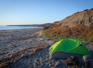
5.019.72 mi / 3097 ft gainChannel Islands National Park is California's least visited National Park. If you visit, you will see many unique plants and animals, including a rare native fox species, and Torrey Pines, only found here and in a small grove near San Diego. This adventure is not for the inexperienced. There is ...Read more -
Santa Barbara County, California
Water Canyon Campground
3.28 mi / 128 ft gainYou can get a wonderfully detailed description of what to expect from the Channel Islands/Santa Rosa Island and how to get there from fellow Explorer Michael Wigle's "Beach Camp on Santa Rosa Island" adventure (which I highly recommend you check out for the information and the photography, so I'm...Read more -
Santa Barbara County, California
Torrey Pines Trail
4.71 mi / 584 ft gainThe vast diversity of terrain of Santa Rosa Island in the Channel Islands National Park is matched in uniqueness only by its own flora and fauna, in particular the endangered and endemic Torrey Pine. The best way to view and experience these strange, broad trees is via the Torrey Pines Trail, whi...Read more -
Santa Barbara County, California
Lobo Canyon Trail via Santa Rosa Campground
12.03 mi / 984 ft gainThe National Park Service describes this hike in the following: "Strenuous. A spectacular canyon with wind- and water-sculpted sandstone cliffs, a year-round stream, riparian vegetation, and a spectacular coast at its mouth. Well worth the effort." I couldn't agree more with the last sentence...Read more -
Santa Rosa Campground
East Point via the Coastal Road
13.76 mi / 486 ft gainOne could a lifetime exploring, and attempting to describe, the beauty of the Channel Islands National Park and Santa Rosa Island in particular: its wildly diverse terrain, endemic flora and fauna, and also the only of the Islands to allow backcountry beach camping. While the opportunities for di...Read more -
Santa Barbara County, California
Black Mountain via Cherry Canyon Trail
6.54 mi / 1329 ft gainWords fail in describing the beauty of the Channel Islands National Park and Santa Rosa Island, the second largest of the Channel Islands and perhaps the most diverse in terms of terrain, flora and fauna, and also the only to allow backcountry beach camping. While the opportunities for exploratio...Read more -
Carpinteria, California
Camp at Carpinteria State Beach
3.7There are 2 campgrounds close to Rincón, but Carpinteria State Beach is a little bigger and easier to find a spot. There are 4 campgrounds: Santa Cruz, Anacapa, San Miguel and Santa Rosa. Most of them are RV sites, but if you stay at Santa Cruz Campground you can set your tent right at the beach,...Read more -
Rincon Point, California
Surf Rincon Point
5.0A cobblestone rocks cover a crescent shaped bay and a creek mouth spreads sand perfectly along the bay after a winter rain. Not to mention the indicator that refracts waves into the inside cove. It's no wonder famous surfers, such as Kelly Slater, Bobby Martinez, Tom Curren, Connor and Parker Cof...Read more -
Ventura, California
Chinese Harbor via Prisoners Harbor
14.11 mi / 2703 ft gainThe hike to Chinese Harbor is a 14-mile out-and-back hike from Prisoners Harbor on Santa Cruz Island or a much more manageable 8-mile out-and-back hike from Del Norte backcountry campground. If you are spending the day on the island courtesy of Island Packers, a trek to Chinese Harbor might be di...Read more

