Fremont, California
Fremont, California is a true outdoor enthusiast's dream. With its abundance of attractions, activities, trails, and views, there is something for everyone in this picturesque paradise. From Mission Peak's challenging hiking trails to the Quarry Lakes' stunning vistas, outdoor lovers can find plenty to explore. Wildlife watching and fishing at Coyote Hills and Lake Elizabeth make for a perfect day, and the Niles Canyon Railway is a thrilling way to explore the area. Whether you're an adrenaline junky or prefer a more relaxed experience, Fremont promises an awe-inspiring adventure that you are sure to adore.
Top Spots in and near Fremont
-
Oakland, California
East & West Ridge Loop
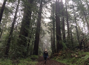
4.53.47 mi / 833 ft gainTucked away in the hills of Oakland, you will find one of the homes of California's Coastal Redwoods. Created by a unique geographical circumstance, this forest breathes winds funneled through the Golden Gate across the bay, which created environment opportune for Redwood growth. These Redwoods a...Read more -
Burlingame, California
Hike the Ed Taylor Loop Trail in Mills Canyon
4.01.4 mi / 300 ft gainThis hike can be done at any time of year. Hiking in winter and spring means that many varieties of wildflowers will be present, and the creek will have much more water. Summer and fall mean higher temperatures and drier conditions, but the hike is still a pleasant experience. Begin the hike at t...Read more -
La Honda, California
Hike the Brook Trail Loop
7.1 mi / 1500 ft gainThe Brook Trail Loop is a beautiful hike, starting off in Sam McDonald County Park and later entering into Pescadero Creek County Park. This adventure can be done in any season, with the trails almost entirely shaded for even the hottest summer days. Starting off from the Heritage Grove trailhead...Read more -
Saratoga, California
Skyline-to-the-Sea Trail
4.530.8 miWant to experience one of the bay area's most memorable backpacking trips? We've got the details to get you out on the trail. To start the trek, drop your car at the Castle Rock State Park Parking Lot, which is located ~2.5 miles south of the junctions of Highways 35 and 9 off of Highway 35. Not...Read more -
Saratoga, California
Backpack Castle Rock State Park
4.7Castle Rock Trail Camp has a different policy than other backcountry camps in the area (i.e. campsites along Skyline to the Sea). This campground is open all year and is available on a first come, first served basis. If you can, grab a spot a Frog Flat Camp. To get to the camp, park your car at t...Read more -
Los Gatos, California
Hike the Saratoga Gap Trail
4.64.7 miThe Saratoga Gap Trail is relatively lightly trafficked trail that is good year round, although waterfalls peak in late winter and spring. Overall, this 4.7 mile partial loop hike is moderate, with about 1000 feet in elevation change. Trailhead elevation is about 3090 feet. The featured hike desc...Read more -
Walnut Creek, California
Camp at Juniper Campground in Mount Diablo SP
Mount Diablo's summit in Mount Diablo State Park rises to 3,848ft, with Juniper Campground in Mount Diablo SP is at approximately 3,000ft in elevation. Juniper Campground overlooks the valley below and some of the San Francisco Bay. Reservations for Juniper Campground can be made at Reserveamer...Read more -
Walnut Creek, California
Sugarloaf Open Space Loop
1.91 mi / 243 ft gainSugarloaf Open Space Loop is an almost 2-mile loop for hiking, running and walking. This trail is relatively easy and takes under one hour to hike. This loop is dog friendly.Read more -
Walnut Creek, California
Juniper to the Summit Loop Trail and Meridian Ridge
6.56 mi / 2037 ft gainJuniper to the Summit Loop Trail and Meridian Ridge is a loop trail that is strenuous located near Diablo, California.Read more -
La Honda, California
Sam McDonald Park Loop
5.012.19 mi / 2192 ft gainThe Pescadero Creek Park Complex is a great place to escape for a day or overnight hike in the heart of the Bay Area. You will need to get a permit to stay overnight - these can be attained on a first-come, first-serve basis from the ranger station. Most of the campsites here are also available f...Read more -
Half Moon Bay, California
Goat Yoga at Lemos Farm
5.0This is a great way to destress and have fun! Goat yoga is like normal yoga, but with goats. Goats tend to like higher ground and flat surfaces. So, when you are in table top position, they are highly likely to jump onto your back! These goats are still young, and so do not weigh as much as f...Read more -
Walnut Creek, California
Run the Mt. Diablo Foothill Loop
5.06.2 mi / 875 ft gainContinue by car down Castle Rock Road until it dead ends at the beginning of the trail. Parking is usually easy to find. If full, there is another overflow lot about 500 ft back the way you came in.You'll walk a good half mile down the trail before getting the main gate. As you're walking, you'll...Read more -
Oakland, California
Sibley Volcanic Trail Labyrinths
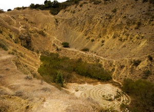
3.52 mi / 144 ft gainFrom Skyline Blvd, pull into the staging area for Sibley Volcanic Regional Preserve, you'll see the sign. Parking here is usually easy to find. You'll find an unstaffed visitor center with a restroom, park maps and informational displays featuring the history and geology of the park. Sibley is a...Read more -
Mount Hamilton, California
Stargaze at Lick Observatory
3.8Hop on Road 130 heading out of San Jose and follow the winding two lane road up, up, up to to the top of Mt. Hamilton and the Lick Observatory. There are lots of deer, wild turkey, and pigs in the area. If you are lucky you will get to see a herd of deer grazing in a meadow. But be careful that y...Read more -
San Jose, California
Hike the Quicksilver Trail
4.35.1 mi / 915 ft gainThe trails are well maintained and offer good visibility. The trail can be muddy after it rains, and does not have much shade (so bring extra water in the summer). Dogs are allowed on this trail but must be kept on leash. Keep your eyes peeled for wildlife - this trail is frequently used for bir...Read more -
San Francisco, California
San Francisco Crosstown Trail
5.016.71 mi / 1975 ft gainThe San Francisco Crosstown Trail runs point-to-point from Candlestick Point to Land End. The SF Crosstown Trail officially opened in 2014. It connects park trails to neighborhoods and communities. In it's in entirety it's almost 17 miles long with 5 Sections available for those looking to bre...Read more


