Felton, California
Looking for the best hiking in Felton? We've got you covered with the top trails, trips, hiking, backpacking, camping and more around Felton. The detailed guides, photos, and reviews are all submitted by the Outbound community.
Top Hiking Spots in and near Felton
-
Woodside, California
Hike through Wunderlich County Park
5.04.5 mi / 1400 ft gainLocated in the iconic Silicon Valley town of Woodside, Wunderlich County Park offers a number of hiking trails as well as some horseback riding trails through the wilderness. Once in the parking lot, you will see a number of stables, riding ring, as well as a beautiful historic stable that was o...Read more -
Redwood City, California
Hike or Bike the Old Growth Redwood Loop at El Corte de Madera
4.48.8 mi / 1900 ft gainThis hike starts at the middle parking lot of the El Corte de Madera Open Space Preserve. The middle lot is located roughly a mile south on Skyline Boulevard from the Skeggs Point Vista. From the parking lot, take the Methuselah Trail for 0.3 miles until you reach the Timberview Trail. Take this ...Read more -
Redwood City, California
Hike the Methuselah and El Corte De Madera Creek Loop
6.2 mi / 1800 ft gainThis loop hike will provide people with the opportunity to experience the tranquility of the lower canyons of the preserve, which tend to be more isolated than the heavier-trafficked trails that are closer to the main highway. Be warned that this hike is fairly strenuous because of the large amou...Read more -
San Jose, California
North Rim Trail to Eagle Rock
5.01.94 mi / 240 ft gainNorth Rim Trail to Eagle Rock is an out-and-back trail that takes you past scenic surroundings located near San Jose, California.Read more -
Redwood City, California
Hike the Crystal Springs Trail Loop
5.6 mi / 1300 ft gainThis is a great hike for any season of the year, with rushing streams during the winter, wildflowers in the spring, and cool, shaded canyons during the summer. Starting from near the Zwierlein Picnic area, take the Crystal Springs to the left into the redwood forest. Stay straight at the next tra...Read more -
Pacific Grove, California
Visit the Monarch Grove Butterfly Sanctuary
1 miThousands of monarchs can be found here October through February. It's a small park with a path through the center. Park near the Monarch Grove hotel at the sign that says "Caution: Butterflies present", and cross the street to walk down the short path (pink houses will be on your right) and to t...Read more -
Marina, California
Explore Fort Ord Dunes State Park
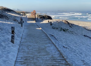
5.0One of the best parts of Monterey is the beaches – but their popularity is also their weakness, so if you want seclusion head to the lesser-known Fort Ord Dunes for solitude and beautiful views of Monterey Bay and the Pacific Coast. Historically, this location was chosen as the location for Fort ...Read more -
Morgan Hill, California
Backpack to Mississippi Lake
5.026.4 mi / 3600 ft gainIf you're tired of trying and failing to get reservations for backcountry camping around the bay area, then Henry Coe State Park is the perfect place to visit. No reservations need to be made prior to the trip. All you need to do is get to the HQ on the morning of your trip, get your permits and ...Read more -
Pacific Grove, California
Spanish Bay Trail
5.02.8 mi / 78 ft gainSpanish Bay Trail is an out and back trail that takes you past scenic views located near Monterey, California.Read more -
Redwood City, California
Hike Purisima Creek Redwoods OSP
4.67 miThere are two places to park for this specific loop- the main parking area on Highway 35 (Skyline Boulevard) and a smaller parking lot on the western end of the park. I would recommend parking at whichever is closest. Find directions to both on Openspace.org. From the main parking lot, the trail ...Read more -
Redwood City, California
Hike Whittemore Gulch at Purisima Creek Redwoods OSP
4.09.3 mi / 2109 ft gainThis trail starts out going downhill towards the ocean for the first half, which makes for a tough end to the hike as you trek back up the ridge. However, there are nice ocean and hilltop views that are worth the climb. On this trail, you'll pass 60+ banana slugs if conditions are right. They ar...Read more -
Half Moon Bay, California
Purisima Creek Trail and Craig Britton Trail Loop
4.06.95 mi / 1411 ft gainThis hike is perfect for any time of year, always staying cool because it is near the coast, and there are multiple creeks that flow year-round. Even on foggy days, the fog condenses on trees to make it seem like it is "raining." Be warned that this hike has a lot of elevation change and is stre...Read more -
Redwood City, California
Hike the Pulgas Ridge Open Space Preserve Loop
3.75.5 mi / 1000 ft gainGetting there: exit Highway 280 at Edgewood Road, travel .75 miles east, turn left on Crestview Drive, then immediately left again on Edmonds Road.Once parked, there are several different path options through the park. All of them connect in a large loop, and return to the parking lot. The Cordil...Read more -
Half Moon Bay, California
Hike the Cowell-Purisma Trail
5.07 mi / 400 ft gainThis is a popular trail that has beach access to Cowell Ranch Beach. Along the trail, there is a steep staircase that goes down to the beach. The trail also features fields, a bridge, and beautiful views of California's rugged coastline. This trail is paved in some parts, and can also be biked...Read more -
Fremont, California
Mission Peak via Hidden Valley Trail
4.26.16 mi / 2116 ft gainBreathtaking views of the Bay Area are your reward for making this climb to the top of Mission Peak. It’s a 3-mile trek to the top of the peak and then back down the same way. This is a moderate hike that provides a nice workout – so be prepared. Park at the Stanford Avenue entrance gate. There ...Read more -
Gilroy, California
Redfern Pond via Hunting Hollow
5.07 mi / 1263 ft gainHenry W. Coe State Park, northern California's largest, provides outdoor enthusiasts with over 89,000 acres of land to explore, as well as 22,000 acres of designated wilderness area. With all of this space, the outdoor adventures are seemingly endless. We recommend a multi-day backpacking trip to...Read more

