El Portal, California
Top Spots in and near El Portal
-
Angels Camp, California
Upper Natural Bridge Trail
1.9 mi / 410 ft gainUpper Natural Bridge Trail is an out-and-back trail that takes you by a river located near Columbia, California.Read more -
Friant, California
Pincushion Peak
2.49 mi / 1043 ft gainHead North on Friant Rd. It will begin to head East, becoming Millerton Rd. Stay on Millerton Rd for 4.2 mi. Turn left onto Sky Harbor Rd (street JUST before Table Mountain Casino). Follow Sky Harbor Rd for 5.8 miles to the end of the road. Parking is available along the road. There are port a po...Read more -
Lee Vining, California
Hike Panum Crater Trail
3.3 mi / 874 ft gainIf you are visiting Mono Lake, the Panum Crater Trail is not to be missed! From 395, take highway 120 east for about 2.5 miles. Look for a small wooden sign for Panum Crater and turn left onto a dirt road. If you reach the turn-off to the South Tufa Area, you have gone too far! After about a mile...Read more -
Crowley Lake, California
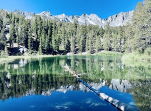
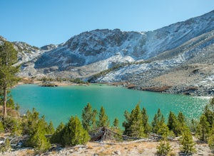
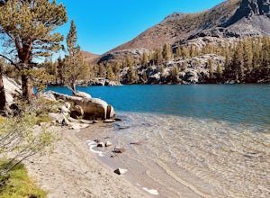
Emerald Lake
4.01.76 mi / 417 ft gainEmerald lake is a relatively short 1.7 mile out-and-back hike. There is ample parking at the parking lot and trailhead. There is also overflow parking at the upper lot for Duck Lake and Skelton Lake. The trail has a decent amount of uphill, but you should arrive shortly (<30 mins) at your de...Read more -
Mammoth Lakes, California
Lake Basin Path
5.04.43 mi / 554 ft gainLake Basin Path is an out-and-back trail where you may see beautiful wildflowers located near Mammoth Lakes, California.Read more -
Mono County, California
Leavitt Lake in Stanislaus National Forest
4.07.44 mi / 1385 ft gainSituated on the eastern edge of Emigrant Wilderness, Leavitt Lake is a great introduction to backpacking in the Sierra Nevada. Leavitt Lake is located at the end of Forest Service Route 077 off of Highway 108. It is actually possible to drive to Leavitt Lake, but a high clearance vehicle is requi...Read more -
Mammoth Lakes, California
Duck Lake via Duck Pass Trail
4.79.29 mi / 1880 ft gainThe Duck Pass trail in the John Muir Wilderness combines breathtaking views, wildflowers and plenty of icy mountain lakes for swimming into a trail that is moderate in both difficulty and distance. With multiple lakes along the way to pitch your tent and plenty of day hike options from a base cam...Read more -
Mammoth Lakes, California
Arrowhead Lake
5.02.25 mi / 538 ft gainIf you make your way to the Goldwater Campground there is plenty of parking. The trailhead you take leads to many lakes but the Duck Pass trailhead is the on you want to take. This is a easy trail to follow and walk with very little obstacles. You follow it along for around a mile and you won't ...Read more -
Mammoth Lakes, California
Pika Lake via Duck Pass Trail
9.41 mi / 1880 ft gainAs many of the other hikes start in this area, you start at the Goldwater Creek Campground where there is plenty of parking and restrooms. You will take the Duck Pass Trailhead for this hike. • I wanted to point out that this is not the easiest hike to do as a day hike. Many people do overnighte...Read more -
Mammoth Lakes, California
Skelton Lake Trail
5.03.2 mi / 804 ft gainThe hike to Skelton Lake in Mammoth Lakes, CA starts off at the Duck Lake Pass trailhead just past Lake Mary. The hike starts off with quite a few switchbacks as you climb through the John Muir Wilderness. About one mile up the trail, you'll see an option to veer off to Arrowhead Lake. Continue o...Read more -
Mammoth Lakes, California
Heart Lake
5.02.11 mi / 500 ft gainYou will see a couple of trailheads starting by parking at the Coldwater Creek Campground parking lot. This one is specifically marked Heart Lake. There will be a couple of forks in the trail, but if you stay right and on the more obvious path, you will be up to Heart Lake in no time. (Going left...Read more -
Mammoth Lakes, California
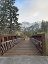
Waterford Bridge
The Waterford Gap bridge creates a picturesque view of the Eastern Sierra as it crosses over Mammoth Creek as part of the town loop and connects Majestic Pines Dr, which runs up to Eagle Lodge, with old Mammoth Road, which is a main road along the south and east edges of town. This is a great spo...Read more -
Pinecrest, California
Camp at Baker Campground
5.0/ 6224 ft gainBaker Campground is a first come, first serve campground. Each site is equipped with a fire ring, picnic table, and bear boxes. The cost for a single family site is $20 per night and a double family site is $40 per night. The campground provides bathrooms and potable water. The campground is typi...Read more -
Highway 108, California
Backpack to Blue Canyon Lake
5.03.6 mi / 1280 ft gainTrailhead Coordinates: 38º 19'08.46"N 119º39'49.26"W Elev 8897ftThe trail is kind of tricky to find. It is West of the PCT trailhead at Sonora Pass and it is not marked. You park along the side of Hwy 108 and scramble down an embankment where a creek flows at the bottom. Cross this creek and you ...Read more -
Highway 108, California
Hike to Deadman Lake
6 mi / 1700 ft gainStart: 38º19'08.46"N 119º39'49.26"W Elev 8879ftPark along Hwy 108, head down the bank and across the stream at the bottom. There you will find the start of the trail.This is a challenging hike without much of an actual trail to follow for the majority of it. The hike is very steep in certain are...Read more -
Lee Vining, California
Mono Lake's South Tufa Loop
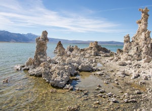
4.40.91 mi / 39 ft gainMono Lake is was formed at least 760,000 years ago, making it one of North America's oldest lake. Explore the coastline of this unique lake filled with unusual rock formations called tufas. Photograph the tufa towers with the majestic mountains in the background. The towers can make for some very...Read more

