El Granada, California
Looking for the best running in El Granada? We've got you covered with the top trails, trips, hiking, backpacking, camping and more around El Granada. The detailed guides, photos, and reviews are all submitted by the Outbound community.
Top Running Spots in and near El Granada
-
Loma Mar, California
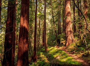
Camp Under the Redwoods at Memorial Park
With old growth redwoods and a creek swimming area, Memorial Park is a perfect escape from the hustle and bustle of the Bay Area. Memorial Park is only a few miles east of the town of Pescadero. To get here, you can either approach from Highway 1 and drive up Pescadero Creek Road or take Highway ...Read more -
Loma Mar, California
Bike Pescadero Creek County Park
5.012.5 mi / 1350 ft gainPescadero Creek County Park and the connected Sam McDonald and Memorial Park are located deep in the Santa Cruz Mountains holding a vast network of secluded trails. From biking to backpacking, this area is a perfect place for a day or weekend adventure. This area also has the added bonus having r...Read more -
San Francisco, California
Lands End Trail
4.73.26 mi / 500 ft gainThe Lands End Trail is a 3.26 mile out-and-back hike located in the northwest corner of San Francisco along the city's rugged coastline. Offering spectacular views of the Golden Gate Bridge, Marin Headlands, and the Pacific Ocean, the hike is one of the most popular trails in San Francisco for ...Read more -
San Francisco, California
Presidio Loop
5.95 mi / 823 ft gainThis route starts and ends on Jackson street in the Presidio Terrace neighborhood of San Francisco. This loop can be started in several areas of the Presidio including off of the Lyon street steps, but this starting point creates a good midpoint of the loop. Along the route, be sure to keep an ...Read more -
San Francisco, California
Presidio Ecology Trail
5.01.82 mi / 427 ft gainPresidio Ecology Trail is a loop trail through the Presidio located near San Francisco, California. This loop can be started at the Upper Ecology Trail off of Arguello Blvd near Pacific or down at the Lower Ecology Trail near the Inn at the Presidio. This trail is dog friendly on-leash.Read more -
San Francisco, California
Presidio Bay Area Ridge Trail
5.02.73 mi / 203 ft gainPresidio Bay Area Ridge Trail is a point-to-point trail where you may see wildflowers located near San Francisco, California.Read more -
San Francisco, California
Lover's Lane, Ecology, Mountain Lake Trail Loop
4.52.04 mi / 344 ft gainTucked into a corner of the Golden Gate National Recreation Area is the Presidio, a beautiful little oasis of forests, beaches, and sweeping views that locals love. While the coastal trails get most of the attention here, the park covers 300 acres of prime real estate with lots of notable attract...Read more -
Los Altos, California
Hike the Monte Bello Open Space Preserve Loop
4.52.9 mi / 600 ft gainThis hike is best done in the late fall, winter, and spring so that the creek is running and the hills are green. Starting at the preserve parking lot, the first half of the hike is predominantly downhill. At the main trailhead, start in the direction of the Stevens Creek Nature Trail, as told by...Read more -
Redwood City, California
Hike Russian Ridge
4.54 miRussian Ridge offers a great place to jump on the trail and in the right season, see some of the best wildflowers blooming. On top of that, you get access to amazing views from the ridge. Once you hit your parking space, add a little extra warm up before jumping on the trail to make this 3.7-mil...Read more -
San Francisco, California
Lyon Street Steps
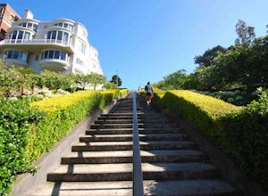
4.5Rumor has it there are almost 300 stairs from top to bottom. This is a great place to get some exercise in if you're up for running or walking up the stairs. Do a few laps (roundtrip) and you'll be pretty happy with your workout. If you're really looking to get after it, throw in a few pushups an...Read more -
Sand Ladder, California
Baker Beach Sand Ladder
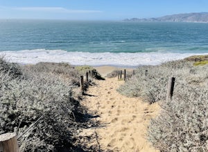
4.40.25 mi / 138 ft gainThe Baker Beach Sand Ladder is a section of the Pacific Coast Trail that is comprised of 200 ten foot poles tied together to form stairs down to North Baker Beach from Lincoln Blvd. If you’re looking for a lung and butt-busting workout, and you’d like a break from your standard routine, you need...Read more -
San Francisco, California
Run the Coit Tower Stairs
3.8There are 2 sets of stairs for Coit Tower on Sansome St. The first set is at Greenwich and the second is at Filbert. The Filbert steps are a little deeper per step and are mostly wood and concrete. The Greenwich steps are a little tougher because of the shallower, brick stairs as you get toward t...Read more -
San Francisco, California
Run to Hopper's Hands
4.6Hundreds of people touch Hopper's Hands every day as a turn-around point on their runs in and around Crissy Field and The San Francisco Bay Trail. Running west through Crissy Field, passing the Warming Hut and pier, you follow Marine Drive until you dead end at Fort Point. If you continue through...Read more -
Pescadero, California
Hike the Canyon Rim Route in Butano State Park
5.011.7 miLocated deep within the Santa Cruz Mountains, Butano State Park boasts a large redwood canyon with many miles of hiking trails as well as campsites. This state park is one of the quietest and least visited parks on the peninsula making a perfect place to escape the hustle of the Bay Area Butano S...Read more -
Sausalito, California
Slacker Hill
5.01.02 mi / 344 ft gainAlthough the Headlands can be crowded, particularly at the parking-lot chaos of the Vista Point and pull-offs along Conzelman Road, the three routes leading to the summit of Slacker Hill remain relatively quiet, even during busy weekends. Each can be tied into larger loops throughout the Headland...Read more -
Sausalito, California
Ninja Loop
9.37 mi / 1831 ft gainThis loop can start from several different locations, including Rodeo Beach and the Golden Gate Bridge parking lot. Starting from the GGB will add 2 more miles onto this run. I like to start at the Coastal Trailhead parking lot off of McCullough and Conzelman Roads (just a notch down from Hawk Hi...Read more


