Descanso, California
Looking for the best photography in Descanso? We've got you covered with the top trails, trips, hiking, backpacking, camping and more around Descanso. The detailed guides, photos, and reviews are all submitted by the Outbound community.
Top Photography Spots in and near Descanso
-
Borrego Springs, California
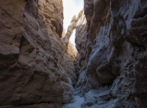
The Slot
4.72.2 mi / 266 ft gainHiking The Slot From the parking lot, you will take the trail into the canyon that is directly in front of you. This will be the hardest and steepest part of the hike. There are no trail markers for the Slot. You can take the trail to the right of the parking lot very briefly, but make sure or y...Read more -
Borrego Springs, California
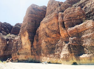
Off-Road through Split Mountain in Anza Borrego
4.011 mi / 0 ft gainFor all you desert lovers- this is a must. Or for all you SD residents that want to try something new and take a break from the populated trails within the county- spend a day in Anza Borrego and include this on your list.This state park is just a quick jaunt outside of the town of Julian. This m...Read more -
Borrego Springs, California
Anza Borrego Metal Sculptures
4.6Here's a map I made that marks where most of the sculptures are (here). First, you enter the park and drive through the little city of Borrego Springs. There will be a roundabout you can't miss, so you know you're on the right path. There is nowhere to park to get to the sculptures specifically,...Read more -
Escondido, California
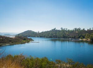
Camp at Dixon Lake
2.1 mi / 295 ft gainDixon Lake is Escondido's best kept secret! A man-made reservoir located right next to Daley Ranch, Dixon Lake offers overnight camping, boat rentals, fishing, and hiking, along with picnic areas, a kids park, and more. The campground is open year-round and is located next to the lake with a lof...Read more -
Coronado, California
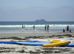
Spend a Day at Silver Strand State Beach
5.0A day at the Silver Strand State Beach is a must, playing in the surf and searching for seashells. Parking can be challenging, as all beaches on Coronado Island are very busy. I recommend coming early in the morning and planning to stay all day. Lots of food options are close to every beach...Read more -
Coronado, California
Explore Bayview Park
5.0Even though I am quite familiar with this spot, I doubt that most San Diegans have sat in the benches at this little park to take in the sunset, sunrise, or spectacular views of downtown San Diego. I'm absolutely positive that most out-of-towners have no idea that this little gem exists. I want t...Read more -
San Diego, California
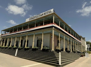
Old Town San Diego State Historical Park
4.51 miFrom where Father Junipero Serra established the first of 21 California Missions in 1769, this area was the first permanent European settlement in the San Diego region. Today, past and present meet in a preserved historical park located near Downtown San Diego. You can explore life as it was in ...Read more -
Escondido, California
Lake Hodges Overlook
4.66.73 mi / 1407 ft gainElfin Forest is one of the most beautiful and unique trails in all of San Diego, CA. The parking is free as well as the overflow parking area. There is an Interpretive Center located in the staging area where you can speak to park rangers, learn about the wildlife and trail locations. The parking...Read more -
Coronado, California
Coronado Beach
4.6Photograph the iconic and historic Hotel Del and Coronado Beach on Coronado Island. The Del is a beautiful Victorian resort, which is the second-largest wooden structure in the United States. The Del offers amazing photo opportunities during sunset and during sunrise when it is beautifully backli...Read more -
Imperial Beach, California
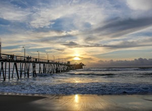
Catch a Sunset at the Imperial Beach Pier
5.0From San Diego, head South on Hwy 5 for 12 miles. Take a right on exit 5A for Palm Ave/CA-75. Take CA-75 west for 1.6 miles. Stay on Palm Ave as it splits from CA-75. Take Palm Ave for 1 mile until it reaches the coast. Turn left on Seacoast Dr and take it for 1 mile until you reach the Imperial ...Read more -
San Diego, California
Hike to the beach at Border Field State Park
2 mi / 26 ft gainThe beach at Border Field State Park is southernmost beach in California. This beach begins (on US Maps) at the Mexican border and continues north to the mouth of the Tijuana River. The State Park shares its land with the Tijuana River National Estuarine Research Reserve which are both operated b...Read more -
San Diego County, California
Hike Sheep Canyon
5.03 mi / 1000 ft gainSheep Canyon is probably the most remote palm canyon in Anza-Borrego Desert State Park in California. While Palm Canyon is easily accessed from the State Park campground, Sheep Canyon is on a dirt road that requires stream crossings and potentially a high-clearance 4WD vehicle. The canyon is nam...Read more -
San Diego, California
Black's Beach via the Gliderport
4.30.7 mi / 269 ft gainPark at the Torrey Pines Gliderport, which is conveniently empty before sunrise. The hike down to Black's Beach features a steep hike down a winding path of natural and manmade steps along the cliff face, but stay left and cruise the bluff for endless opportunities to observe, reflect and explor...Read more -
San Diego, California
Torrey Pines Gliderport
4.5Park at the Torrey Pines Gliderport and walk to the railing over the cliffs. From there you can see north to Black's Beach and the Torrey Pines golf course. To the south you can see La Jolla Shores and La Jolla cove. Walk the path down to Black's Beach if you want some exercise. There is food and...Read more -
San Diego County, California
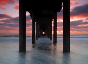
Photograph Scripp's Pier
4.9Parking is easy, there are tons of random street you can park on just a little walk away. Be sure to arrive on scene at least an hour before sunset. Make sure to look up the sunset time and the weather forecast. Clouds will make for the most dramatic images with the most color from the sunset. Ex...Read more -
Palomar Mountain, California
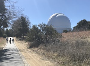
Hike to Palomar Observatory from the Palomar Observatory Campground
5.04.4 mi / 718 ft gainSituated in the Palomar Mountains of Cleveland National Forest, Palomar Observatory Campground offers many amenities for enjoyable camping and exploring the area. A portion of the campsites loop has been cleared of trees with level cement pads to allow campers to set up their own telescopes. Dr...Read more

