Culver City, California
Looking for the best hiking in Culver City? We've got you covered with the top trails, trips, hiking, backpacking, camping and more around Culver City. The detailed guides, photos, and reviews are all submitted by the Outbound community.
Top Hiking Spots in and near Culver City
-
Rancho Palos Verdes, California
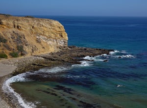
Sacred Cove View Trail
4.52.08 mi / 292 ft gainThis area is spectacular - the views of the cliffs, the channels of water entering the caves, and the marine life (sea lions, whales, dolphins, sea urchin and sea anemone) are huge draws. Bring anyone here that has a sense of adventure and be ready to get wet. Only attempt swimming across the cha...Read more -
Los Angeles, California
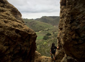
Cave of Munits
4.51.53 mi / 299 ft gainAre you looking for a hike that offers trail running, scenic views, hiking, and CAVE exploring? This short, but exciting trail leads you on a short 0.8 mile hike to the Cave of Munits. When starting at the main trailhead, El Scorpion Park, take the wide paved dirt road all the way till you get to...Read more -
Ventura County, California
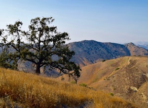
Hike the Upper Las Virgenes Canyon Open Space Preserve Trail
8.6 mi / 1851 ft gainThe most popular point of entry is through the Victory Trailhead, which has ample parking. You can park on the street or you can pay $3 to park at the trailhead parking lot. You can also enter at the Upper Las Virgenes Canyon Trailhead at the northern end of Las Virgenes Canyon Road in Calabasas....Read more -
Rancho Palos Verdes, California
Pelican Cove
0.38 mi / 95 ft gainGetting There Coming from San Pedro, make a U-turn at the Hawthorne Boulevard stoplight onto Palos Verdes Drive South. From here, you can access the parking lot for Pelican Cove, where you'll get a 120° view of the ocean. It might be tempting to take in the sunset from the car, but you should def...Read more -
Rancho Palos Verdes, California
Terranea Beach Sea Cave
4.31.63 mi / 210 ft gainHead to the Pelican Cove parking lot where there’s plenty of free parking right at the trailhead. From the parking lot, take the Terranea Beach Trail and you will see views of the Point Vicente Lighthouse down the coast to your right. Continue on the trail through the luxury Terranea Resort whic...Read more -
Altadena, California
San Gabriel via Sam Merrill and Mount Lowe Trails
17.55 mi / 5614 ft gainSan Gabriel via Sam Merrill and Mount Lowe Trails is a loop trail where you may see beautiful wildflowers located near Altadena, California.Read more -
Whittier, California
Sycamore Canyon Trail in Turnbull Canyon
2.03.47 mi / 627 ft gainThe Sycamore Canyon Park Trailhead can be found at the end of the dirt parking lot off Workman Mill Road. The entrance is off a small road which is pretty easy to miss, but there is a sign off the main road. Soon after you start on the trail, the path opens up onto a larger dirt road for vehicle ...Read more -
Altadena, California
Millard Falls
3.01.27 mi / 289 ft gainTo get to the trail, park at the Millard Campground Trailhead parking lot, where you'll find plenty of parking. Follow the trail that leads away from the lot and past the Millard Campground. If necessary, you'll find bathrooms at the campground. Follow signs for Millard Falls as the trail veers r...Read more -
Rancho Palos Verdes, California
Surf Fishing Off Of Inspiration Point
Tucked away, at the base of Inspiration Point in Palos Verdes is an outcropping of rocks, perfect for surf casting and catching ocean fish, away from the crowds. It's a challenge to get there, but the less travelled spot is used by many professional sportsmen, practicing their skills at fishing f...Read more -
Altadena, California
Echo Mountain and Inspiration Point Loop
4.110.16 mi / 3369 ft gainThe trail switchbacks up the mountain before reaching the first historic marker, in 3 miles. These are the remains of the Mount Lowe Railroad, which brought customers to Echo Mountain Resort, also in ruins, nearby. Explore the historic sites, then head up Castle Canyon Trail. A steep climb will ...Read more -
Agoura Hills, California
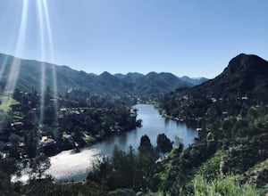
Malibu Lake Overlook
5.04.12 mi / 741 ft gainTo get to the trail, use the address 27800 Mulholland Highway, Agoura Hills, CA 91301. This will take you to a dirt pull off right off the Mulholland Highway. At the southern part of the pull off, you'll see a dirt path leading up and away from the road. This is the Cistern Trail Trailhead. You'l...Read more -
Altadena, California
Thalehaha Falls
1.71 mi / 679 ft gainThe trails starts in a foothill neighborhood of Altadena CA at the corner of Pleasantridge Dr. and Rubio Vista Rd. This is one of the better entries into the Angeles National Forest because it is one of the lesser known. Find a place to park on the street and head out on the trail into Rubio Cany...Read more -
Los Angeles, California
Reseda Point
4.00.2 mi / 30 ft gainFrom the 118 FWY, exit Reseda and head north until you pass by Calle Vista Circle. Once passed, make a U-turn and park on the side of the street. Here you will find the trailhead for the Palisades Trail Hike. To get to the scenic lookout, simply walk up the short trail leading up the hill, and h...Read more -
Altadena, California
Eaton Canyon to Idlehour Trail Camp
4.510.99 mi / 3291 ft gainIdlehour is nestled deep in the Angeles National Forest, so it feels like you're in the heart of some untapped wilderness instead of six miles away from a bustling metropolis. The trail camp is accessible by foot through a variety of locations, but the most popular route is through Eaton Canyon, ...Read more -
Pasadena, California
Eaton Canyon Falls via Eaton Canyon Trailhead
4.23.54 mi / 528 ft gainThe hidden forty-foot-tall Eaton Canyon Falls fills an amphitheater at the top of Eaton Canyon Trail, tumbling into a wide pool that you can rest alongside or wade in. Normally the water is waist deep, but during this recent trip, we found the water only to stop at our ankles as it tends to fluct...Read more -
Whittier, California
Hellman Park Trail
3.04 mi / 850 ft gainThis trail is great if you're looking for a quick, but intense workout. The hike itself is only 4 miles out- and-back and can be easily completed within a couple of hours. However, be prepared for a steep and steady incline for the first 1.5 miles. The trail itself is pretty wide, and if you sho...Read more

