Corte Madera, California
Looking for the best fitness in Corte Madera? We've got you covered with the top trails, trips, hiking, backpacking, camping and more around Corte Madera. The detailed guides, photos, and reviews are all submitted by the Outbound community.
Top Fitness Spots in and near Corte Madera
-
Lafayette, California
Lafayette Reservoir via Nature Area Rim Trail
5.05 mi / 758 ft gainLafayette Reservoir is perfect for canoeing, mountain biking, trail running, and hiking. The Reservoir trail system is also used for nature walks and birding. The loop has several high points that have amazing views. The trails become very muddy after wet weather - so tread with caution. Th...Read more -
San Bruno, California
Sweeney Ridge via Sneath Lane
4.53.88 mi / 646 ft gainStarting from the parking lot on Sneath Lane Trail, you’ll head through the gate and continue on the path up Sweeney Ridge. This is a 5.7 mile out-and-back trek. There is a 600 ft. elevation gain, which comes mainly in the first 1.5 miles of the trail. Your legs and lungs may hurt a bit, but if t...Read more -
Pacifica, California
Mori Point Loop
4.82.54 mi / 276 ft gainStart at the parking lots close to the pier, where bathrooms are also available. Walk along the pier to watch the sunset as it begins. Next, walk along Sharp Park Beach to discover the plethora of wild flowers and friendly locals always ready to guide you on your walk. Take the stairs up to the...Read more -
Oakland, California
Run the Circumnavigation of Redwood Regional Park's Ultimate Trail Loop
5.07.5 mi / 1600 ft gainIt’s difficult to have a car in San Francisco, but oh-so worth it when it comes to weekend getaways, especially with all the Bay Area has to offer. This is a super accessible trail system just 30 minutes outside of the city that makes for a fun, easy trail run or hike.Redwood Regional Park, part ...Read more -
Inverness, California
Hike the Estero Trail
5.08 mi / 200 ft gainJune sunshine blazes on your shoulders during this scenic stroll through the Point Reyes Seashore. The trail is alive and awash with colorful wildflowers around every corner.Beginning at the trailhead, just off Home Ranch Road, with a convenient parking lot and bathroom, you'll wade through a hal...Read more -
Half Moon Bay, California
Gray Whale Cove Loop
5.01.22 mi / 518 ft gainStarting at the parking lot adjacent to Gray Whale Cove State Beach, proceed to the start sign indicating "Grey Whale Cove Trail". GWCT is a fun brisk hike with slight elevation gain that should be easy enough to take a small group or even children to. Take note of the tight spaces you may encou...Read more -
Half Moon Bay, California
Gray Whale Cove Trail
4.52.23 mi / 367 ft gainGray whale cove trail is a splendid, short, and easy hike for the entire family with beautiful ocean views. The starting point is conveniently located near a parking lot that accesses Montara State Beach. From the south end of the parking lot, follow the trail up through the coastal scrub. Within...Read more -
Half Moon Bay, California
Montara Mountain North & Middle Peaks Loop
4.37.22 mi / 1929 ft gainNOTE: as of 2019, North Peak has been fenced off around the installation of a radio tower and weather station. Additionally, the summit has been found to be a habitat for the endangered San Bruno elfin butterfly. The Gray Whale Cove State Beach is a popular seaside trail that’s just 20 minutes s...Read more -
Moraga, California
Bollinger Creek Loop Trail
1.43 mi / 213 ft gainLas Trampas Regional Wilderness offers an extensive trail system for hikers, horseback riders and mountain bikers. The trail is open year round and dogs are allowed. The Las Trampas and Bollinger faults spread apart to reveal a wonderful wilderness area with ancient remnants of beaches. The entir...Read more -
Napa, California
Westwood Hills Park Loop
4.02.12 mi / 476 ft gainThis park can get a little crowded on weekends, so best to go early if possible. In terms of parking, there's a lot at the trailhead, but also plenty of available street parking. The loop can be broken up in a various ways as there are several offshoots from the main trailhead/trail leaving fro...Read more -
San Mateo County, California
Run Sawyer Camp Trail
5.012 mi / 300 ft gainThe Sawyer Camp Trail is a popular paved trail that stretches alongside the Crystal Springs Reservoir all the way to Hillcrest Blvd. The sixth mile crosses over the San Andreas Dam with nice views of San Andreas Lake.There are markers every half mile which makes timing and tracking your run easy....Read more -
Napa, California
Lake Marie Road, Marie Creek, Buckeye Trail Loop
3.55.8 mi / 961 ft gainEnter the parking lot just off of Hwy 221. Plan to pay a $5 entrance fee at the kiosk. The trail head begins at the edge of the parking lot where you'll soon be passing by the Martha Walker Native Habitat Garden on your right. Veer left to continue along Lake Marie Road where you'll enter the blu...Read more -
Foster City, California
Paddle the Foster City Lagoon
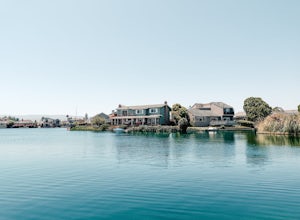
The Foster City Lagoon is one of the most calm waters to paddle on. This is a great spot for beginners to learn how to paddleboard for the first time. The lagoon gets very still and makes it the perfect spot for reflection photos. On sunny days, there are many kayakers, SUP, small boats, and ev...Read more -
Walnut Creek, California
Castle Rock Trail
5.06.06 mi / 971 ft gainLocated near Walnut Creek, the trail is easily accessible from anywhere in the Bay Area. The trail is kept open year-round, and happens to be part of the American Discovery Trail and the Coast to Crest trail. If you are not done hiking, connecting trails allow you to summit Mt. Diablo. This tra...Read more -
Walnut Creek, California
Run the Mt. Diablo Foothill Loop
5.06.2 mi / 875 ft gainContinue by car down Castle Rock Road until it dead ends at the beginning of the trail. Parking is usually easy to find. If full, there is another overflow lot about 500 ft back the way you came in.You'll walk a good half mile down the trail before getting the main gate. As you're walking, you'll...Read more -
Santa Rosa, California
Hike Crane Creek Regional Park
4.03.5 miWith multiple loops of varying length, this park is great for anyone looking for a casual hike around a beautiful area in the foothills of Rohnert Park. Crane Creek has nice secluded picnic areas next to the creek in the cover of willow, alder, buckeye and bay trees. There's also an 18-hole disc ...Read more

