Channel Islands National Park, California
Looking for the best hiking in Channel Islands National Park? We've got you covered with the top trails, trips, hiking, backpacking, camping and more around Channel Islands National Park. The detailed guides, photos, and reviews are all submitted by the Outbound community.
Top Hiking Spots in and near Channel Islands National Park
-
Ventura, California
Chinese Harbor via Prisoners Harbor
14.11 mi / 2703 ft gainThe hike to Chinese Harbor is a 14-mile out-and-back hike from Prisoners Harbor on Santa Cruz Island or a much more manageable 8-mile out-and-back hike from Del Norte backcountry campground. If you are spending the day on the island courtesy of Island Packers, a trek to Chinese Harbor might be di...Read more -
Ventura, California
Prisoner's Cove to Scorpion Anchorage
5.013.19 mi / 2474 ft gainTo get to Santa Cruz Island you will need to book a ferry with Island Packers. On their website, you can only book roundtrip tickets in and out of the same location so for this trip you will need to call and book a ferry into Prisoner's Harbor and out of Scorpion Anchorage. You can call them at (...Read more -
Ventura, California
Potato Harbor Trail
5.04.34 mi / 404 ft gainAs California’s largest island, Santa Cruz Island of the Channel Islands is the perfect little getaway from Los Angeles. Getting to the island is possible only by a one hour boat ride through Island Packers, click here to find out more about them. Be sure to pack light since you’ll be carrying ev...Read more -
Ventura, California
Scorpion Ranch Campground
4.00.72 mi / 43 ft gainAccessible only by Ferry, this little-known national park is a backpacker's dream. You can catch the ferry out of Ventura or Santa Barbara, only a short distance from LA. The ride to the island is around 1 hour. We chose to take Island Packers Ferry out of Ventura to Santa Cruz Island. The ferry...Read more -
Ventura, California
Smuggler's Cove
3.57.72 mi / 1342 ft gainSave one stretch of elevation close to the cove itself, this 8-mile, round-trip hike is a leisuring trek across one of the countries most beautiful, though less famous National Parks - the Channel Islands. Smuggler's Cove is located on the Santa Cruz Island, which also happens to be the largest i...Read more -
Ventura, California
Potato Harbor via North Bluff Trail
4.49 mi / 463 ft gainThe 4.5-mile North Bluff Trail traverses the colossal cliffs of Santa Cruz Island in Channel Islands National Park from Scorpion Anchorage to Potato Harbor. Arrive via an Island Packers boat to Scorpion Anchorage and, upon disembarking, walk straight ahead. Just past the restrooms (one of only tw...Read more -
Ventura, California
Cavern Point & Potato Harbor Loop
4.99 mi / 545 ft gainTucked away in the Pacific Ocean just 25 miles from the coast, the Channel Islands are one of Southern California’s hidden gems. With towering cliffs and isolated beaches that hug the coast, this place makes you feel worlds away from home. Channel Islands National Park is comprised of five island...Read more -
Ventura, California
Kayak Santa Cruz Island
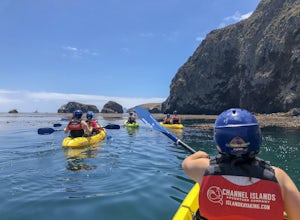
4.5As the largest of the Channel Islands, Santa Cruz Island in the Channel Island National Park is an ecological treasure, and to kayak it is to get to experience it in a manner unlike any other. Getting to the island is easiest through Island Packers where you can also reserve a kayak (so pack effi...Read more -
Santa Barbara County, California
Beach Camp on Santa Rosa Island
5.019.72 mi / 3097 ft gainChannel Islands National Park is California's least visited National Park. If you visit, you will see many unique plants and animals, including a rare native fox species, and Torrey Pines, only found here and in a small grove near San Diego. This adventure is not for the inexperienced. There is ...Read more -
Santa Barbara County, California
Water Canyon Campground
3.28 mi / 128 ft gainYou can get a wonderfully detailed description of what to expect from the Channel Islands/Santa Rosa Island and how to get there from fellow Explorer Michael Wigle's "Beach Camp on Santa Rosa Island" adventure (which I highly recommend you check out for the information and the photography, so I'm...Read more -
Santa Barbara County, California
Lobo Canyon Trail via Santa Rosa Campground
12.03 mi / 984 ft gainThe National Park Service describes this hike in the following: "Strenuous. A spectacular canyon with wind- and water-sculpted sandstone cliffs, a year-round stream, riparian vegetation, and a spectacular coast at its mouth. Well worth the effort." I couldn't agree more with the last sentence...Read more -
Santa Barbara County, California
Torrey Pines Trail
4.71 mi / 584 ft gainThe vast diversity of terrain of Santa Rosa Island in the Channel Islands National Park is matched in uniqueness only by its own flora and fauna, in particular the endangered and endemic Torrey Pine. The best way to view and experience these strange, broad trees is via the Torrey Pines Trail, whi...Read more -
Santa Barbara County, California
Black Mountain via Cherry Canyon Trail
6.54 mi / 1329 ft gainWords fail in describing the beauty of the Channel Islands National Park and Santa Rosa Island, the second largest of the Channel Islands and perhaps the most diverse in terms of terrain, flora and fauna, and also the only to allow backcountry beach camping. While the opportunities for exploratio...Read more -
Santa Rosa Campground
East Point via the Coastal Road
13.76 mi / 486 ft gainOne could a lifetime exploring, and attempting to describe, the beauty of the Channel Islands National Park and Santa Rosa Island in particular: its wildly diverse terrain, endemic flora and fauna, and also the only of the Islands to allow backcountry beach camping. While the opportunities for di...Read more -
Ventura, California
East Anacapa Island Loop
2.31 mi / 269 ft gainLeaving from either Ventura or Oxnard via Island Packers, this full-day hike is in the middle of the Santa Barbara Channel on a small island, about one hour from Los Angeles by car and one additional hour by boat. Without a beach on which to anchor, your boat will pull into Landing Cove and idle ...Read more -
Montecito, California
Saddle Rock Loop
4.03.37 mi / 984 ft gainBegin at the trailhead in the parking area on E. Valley Road. You'll gain some elevation (don't forget your water). You'll know when you arrive at Saddle Rock--you can't miss this conspicuous rock formation. Enjoy the sights from here. If you plan carefully and hike up on a clear day, you may eve...Read more

