Cathedral City, California
Top Spots in and near Cathedral City
-
Twentynine Palms, California
4.5
16.12 mi
/ 1539 ft gain
The Boy Scout trail connects the main part of the National Park to the outer rim campground, Indian Cove Campground. All backcountry overnight trips must be registered at a registration board (free, self-registration). Start this trip at the registration board located in either Indian Cove Campgr...
Read more
-
Twentynine Palms, California
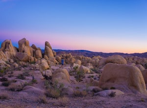
This is a rock formation very popular with young crowds at Joshua Tree. The views from this hike are spectacular. If you hike this trail at sunset, the gorgeous colors of the ski are reflected onto the rocks.
There is a plaque along the trail detailing rock formations and facts about the parks ...
Read more
-
Riverside County, California
White Tank Campground is in the perfect spot to get a taste of all that Joshua Tree has to offer. As a central location to nearby hiking and climbing, it is easy to access the various parts of the park. Removed from the border of the park, White Tank doesn't attract as many visitors as the more p...
Read more
-
Riverside County, California
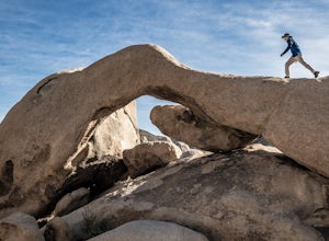
If you're setting up camp, be sure to check out White Tank Campground, which is home to one of the most epic rock formations. The Arch is located here. It's only about 1/2 round trip of walking to this spot. Geology Tour Road offers some flat wide open views of Joshua Trees in all directions. If ...
Read more
-
Pioneertown, California
The Pioneertown to Big Bear trail via Burns Canyon Road and 2N02 is a unique hiking route in Pioneertown, California. This trail is known for its diverse terrain and stunning views. The trail starts in the historic Pioneertown and winds its way up to Big Bear, a popular mountain resort. The tra...
Read more
-
Twentynine Palms, California
5.0
3.08 mi
/ 653 ft gain
Just off highway 62 lies an easy 1/2 day hike with incredible views of the Morongo Valley. Though technically part of the park, the out-of-the-way-ness of the hike means you don't need to pay the $20 National Park fee. Parking is ample, and there's a pit toilet at the trailhead (beware of bees an...
Read more
-
Forest Falls, California
A hiking permit is required to hike in the San Gorgonio Wilderness. Apply for the permit early as the Vivian Creek Trail is the second most popular trailhead for the area and quotas fill up in advance. The permits are free and the entire process can be handled via fax or mail. All the information...
Read more
-
Forest Falls, California
Vivian Creek Trail to San Gorgonio Peak is an out-and-back trail that takes you by a waterfall located near Forest Falls, California.
Read more
-
Riverside County, California
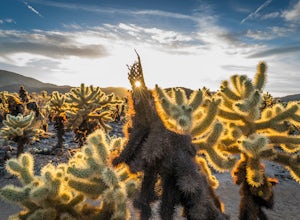
The Cholla Cactus Garden is something everyone can appreciate and enjoy. The trail is in total about a 0.25 loop, but you are certainly free to wander around more. Plan on spending at least 30 minutes to an hour enjoying the scenery.
If you are a photographer, you will be enthralled by the light...
Read more
-
Borrego Springs, California
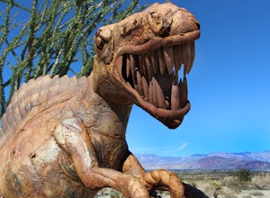
Here's a map I made that marks where most of the sculptures are (here).
First, you enter the park and drive through the little city of Borrego Springs. There will be a roundabout you can't miss, so you know you're on the right path. There is nowhere to park to get to the sculptures specifically,...
Read more
-
-
Borrego Springs, California
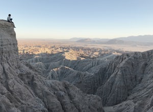
The best time to go to Fonts point is right before the sun sets. It is located in the desert, so be sure to dress warmly and bring a blanket or two.In order to get to Fonts Point, you'll have to drive through roughly 4 miles of sand and rocks. 4x4 is strongly recommended, but keep an eye on road ...
Read more
-
Borrego Springs, California
5.0
3.25 mi
/ 450 ft gain
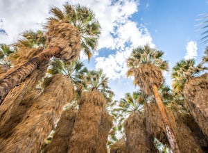
Borrego Palm Canyon Trail is located just north of the park visitor center, making it a convenient place to begin your exploration of the Anza-Borrego Desert. To reach the trailhead, drive through Borrego Palm Canyon Campground, the largest developed campground in the park, where an $8 day use fe...
Read more
-
Borrego Springs, California
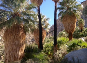
With over 600,000 acres, Anza-Borrego Desert State Park is the largest state park in the contiguous United States. 500 miles of dirt roads, 12 wilderness areas and miles of hiking trails provide visitors with an unparalleled opportunity to experience the wonders of the Colorado Desert. The park i...
Read more
-
Borrego Springs, California
This is an out and back 1.6 mile round trip with 636 feet of elevation gain. The top has excellent views of Anza Borrego. It is close to the visitor center.
Read more
-
Angelus Oaks, California
If you want to experience beauty and solitude in SoCal look no further than Jenks Lake. Not too far from Big Bear Lake, but secluded enough to keep most away in the winter, Jenks Lake is a small but lovely alpine lake near HWY 38 in Angelus Oaks.
Driving to the lake is beautiful in itself as HWY...
Read more

