Castella, California
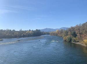
The best Trails and Outdoor Activities in Castella, California include the Castle Crags State Park trail. This 5.5-mile hike is a top pick for its scenic views of granite spires, the Sacramento River, and Mount Shasta. The trail's difficulty level is moderate, making it a must-visit for those seeking outdoor adventures. Additionally, the Pacific Crest Trail, an iconic long-distance hiking trail, passes through the park, offering further exploration opportunities. For water-related activities, the Sacramento River offers fishing and rafting spots. Nearby, Lake Siskiyou provides a perfect setting for boating, swimming, and fishing. This area is rich in natural beauty and offers a variety of outdoor activities making it a top choice for those seeking the best of California's outdoors.
Top Spots in and near Castella
-
Redding, California
Arboretum Loop Trail
3.52.07 mi / 43 ft gainArboretum Loop Trail is a loop trail that takes you by a river located near Redding, California.Read more -
French Gulch, California
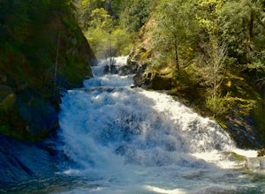
Hike to Crystal Creek Falls in Whiskeytown National Recreation Area
0.6 miFrom Redding pass the visitor center on highway 299 and pass the lake. Make a left turn on to Crystal Creek Road. Follow this road for about 2 miles. There will be signs to make a left turn to Crystal Creek Falls. This is less of a hike and more of a walk. The trail is paved. It is less than a ha...Read more -
French Gulch, California
Hike to Whiskeytown Falls in Whiskeytown National Recreation Area
2.8 mi / 787 ft gainComing from Redding pass the visitor center and heading down highway 299. Make a left turn on Crystal Creek Road. Drive about 3.75 miles and on your left will be the Mills Creek Trailhead. Start hiking. You will start headed downhill towards the creek. You will cross Crystal Creek on a footbridge...Read more -
Igo, California
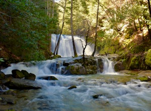
Hike to Brandy Creek Falls in Whiskeytown National Recreation Area
5.03 mi / 500 ft gainMy favorite hike in Whiskeytown National Recreation Area. From the visitor center you will take Kennedy Memorial Drive towards the dam, make a left at Brandy Creek Road. At a junction for Sheep camp/Shasta Bally make a left. You will arrive at the trailhead. This hike follows a beautiful stream t...Read more -
Shasta County, California
Hike Kanaka Peak
4.53.5 mi / 1100 ft gainHead to the Peltier Bridge Campground after entering Whiskeytown National Recreation Area and then go 1.1 miles along the road through the campground until you reach the trailhead for Kanaka Peak. The road from the campground is open from late spring to late fall, otherwise hikers will need to pa...Read more -
Shasta County, California
Hike to the top of South Fork Mountain
5 mi / 4181 ft gainStarting from the Kanaka Peak Trailhead, follow the Kanaka Peak Trail all the way, continuing on past the Peltier Trail Junction and the Kanaka Cutoff Trail Junction until the trail begins to head east (about 2-2.5 miles from the trailhead) and there is a gently sloping hill on your right that is...Read more -
Etna, California
Hike to the Etna Mountain Summit
6 mi / 800 ft gainTo start off, you're going to want to navigate to the Etna Summit Trailhead (5956 ft). There's a small parking lot off to the side and we did not need any passes for our overnight trip. Since the summit isn't the main destination for many people in this area, you'll want to follow the Pacific Cre...Read more -
Forks of Salmon, California
Grizzly Lake via China Gulch Trailhead
4.414.6 mi / 5112 ft gainGrizzly Lake is in the Trinity Alps Wilderness. The lake is know for its brilliant waterfall flowing from the lake's surface straight off the side of a cliff and roughly 600 feet down to the meadow below. Grizzly lake is located in some of America's most amazing and remote alpine wilderness, incl...Read more -
Junction City, California
Canyon Creek Lakes
4.314.35 mi / 2605 ft gainNumerous starting points with over 550 miles of trail and easily 50+ different featured trails depending on length and what type of activity you are are looking for. One of the more popular trails, and rightfully so, is Canyon Creek Lakes Trail. This 16 mile roundtrip hike has an overall elevatio...Read more -
Junction City, California
Scramble Thompson Peak
4.022.7 mi / 6100 ft gainThis adventure begins at the Canyon Creek Lakes in the Trinity Alps wilderness. Park at the Canyon Creek Trailhead near Junction City and hike the well-maintained and easy-to-follow trail for 8 miles. Once you reach the Canyon Creek Lakes, your off-trail adventure officially begins. I’d recommend...Read more -
Junction City, California
Backcountry Camp in the Canyon Creek Drainage
9 mi / 2600 ft gainThe first half of the Canyon Creek Drainage is one of the most popular destinations within the Trinity Alps, but the second half goes largely unexplored and uninhabited by sojourners. Four peaks – Thompson Peak, Wedding Cake, Mt. Hilton, and Sawtooth Peak – surround the basin and offer adventurer...Read more -
Douglas City, California
Camp at Steel Bridge Campground
Steel Bridge is located along the Trinity River. About three miles east of Douglas City on State Highway 299, turn north onto Steel Bridge Road and go about 2 miles to the campground.This campground is open from Mid-May until winter weather forces closure. The campground is home to 12 camping s...Read more -
Siskiyou County, California
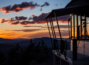
Camp Out at Little Mt. Hoffman Lookout
4.0If you've never stayed in a lookout, you should. It's not a thrilling get your adrenaline type of adventure, but more of a private, secluded, let's enjoy epic views and incredible company type of get away.Little Mt. Hoffman lookout is one of a few remaining historic lookouts that was built in the...Read more -
Shasta County, California
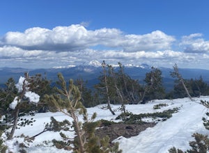
Magee Peak & Crater Peak
7.19 mi / 2887 ft gainThe trail to Magee Peak and Crater Peak makes for a fairly strenuous hike (mostly due to altitude). This USFS out-and-back trail has incredible views of the major peaks in the Northern California & Southern Oregon. Take in a spectacular close-up of Lassen NP and great views of Shasta, Castl...Read more -
Douglas City, California
Camp at Douglas City Campground
The campground amenities include 20 tent/trailer campsites, group picnic area, picnic tables, telephone, beach, paved loop road, flush and vault toilets, potable water, and fire rings. MAX trailer length is 28 feet.Douglas City is located along the Trinity River. Follow State Highway 299 to Dougl...Read more -
Junction City, California
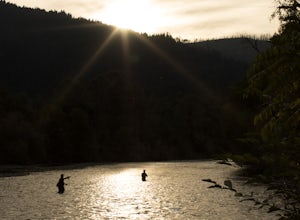
Fly Fish the Trinity River
The Trinity River is one that is rarely visited by your typical Bay Area resident. In fact, much of true Northern California is "untouched" in the eyes of those who live in The City, which is what drew me to this place to begin with. After a five hour journey from San Francisco, we made it to our...Read more

