Campo, California
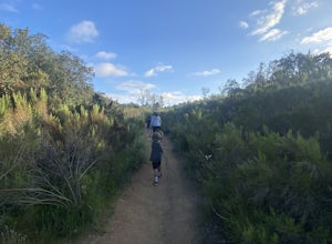
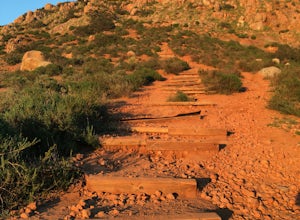
The Pacific Crest Trail in Campo, California is one of the top must-visit outdoor adventures. This hiking trail offers a scenic route stretching over 2,650 miles from Mexico to Canada. The trail features a variety of landscapes from deserts, forests, and mountain ranges, providing a unique outdoor activity. In Campo, the trail starts with a moderate difficulty level, making it a perfect choice for both beginners and seasoned hikers. Along the trail, you'll come across Lake Morena, a beautiful spot for a picnic. If you're lucky, you might spot a variety of wildlife like mule deer and coyotes. The best Trails and Outdoor Activities in Campo, California, are not limited to hiking. Other attractions include horseback riding and camping near the trail. The Pacific Crest Trail is a must-visit for those seeking scenic outdoor adventures.
Top Spots in and near Campo
-
San Diego, California
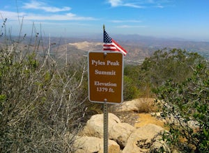
Pyles Peak
5.06.03 mi / 1706 ft gainMost people who live in San Diego have heard of, if not hiked, Cowles Mountain. At 1591 ft., Cowles is the highest peak in the city of San Diego. It's a hugely popular destination for day hikers and trail runners looking to get in a little trail time and take in the 360 degree views the summit h...Read more -
Santee, California
Kwaay Paay Trail
2.4 mi / 846 ft gainPark your car in the small gravel parking lot at the southwest corner of Father Junipero Serra Trail and Bushy Hill Drive (this is especially important if you plan to take the sunset hike, so you'll be outside the locked park gate when you descend). There will be other hikers parked there, but I'...Read more -
Borrego Springs, California
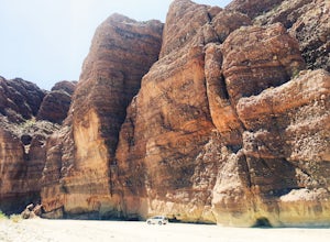
Off-Road through Split Mountain in Anza Borrego
4.011 mi / 0 ft gainFor all you desert lovers- this is a must. Or for all you SD residents that want to try something new and take a break from the populated trails within the county- spend a day in Anza Borrego and include this on your list.This state park is just a quick jaunt outside of the town of Julian. This m...Read more -
Santee, California
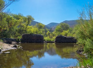
Oak Canyon in Mission Trails Regional Park
5.03.22 mi / 249 ft gainStarting on Father Junipero Serra Trail, drive 0.7 miles west to the Old Mission Dam parking lot on the left. The park closes the gates at 7pm, so make sure to park early, or plan your hike in such a way that you don't get locked in! If you think you'll need longer, you can park out on the main r...Read more -
San Diego, California
Visitor Center Loop Trail
5.01.46 mi / 148 ft gainThe Visitor Center Loop Trail is a 1.4 mile hike in San Diego that features river views and allows dogs.The Visitor Center Loop Trail is a well maintained, quick hike with shady spots scattered along the path and open year-round. This trail is great for kids and dog owners. There is a great netwo...Read more -
Poway, California
Hike around Goodan Ranch
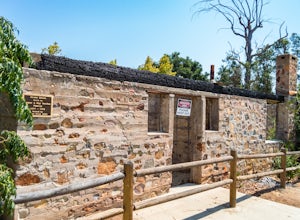
5.03 miStarting at the Sycamore Canyon Trail head, you will see the sign and gate that leads to Goodan Ranch. Head down the gravel road for 1.1 miles, until you reach a 3-way directional split. Heading straight for another .5 miles will take you directly to the ruins of the old Goodan house. Here you wi...Read more -
Santa Ysabel, California
Hiking in Santa Ysabel
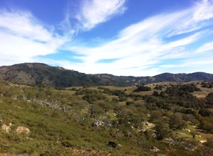
3.0Starting at the trailhead on Hwy 79, enter through the gate and make sure to close it behind you - the preserve is open range area for herds of cows, make sure not to disturb them when hiking. From the gate you'll see the sign with a detailed map of trails that are available for hiking. The trail...Read more -
San Diego, California
Hike to the beach at Border Field State Park
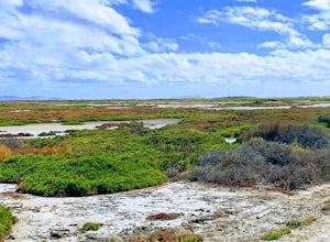
2 mi / 26 ft gainThe beach at Border Field State Park is southernmost beach in California. This beach begins (on US Maps) at the Mexican border and continues north to the mouth of the Tijuana River. The State Park shares its land with the Tijuana River National Estuarine Research Reserve which are both operated b...Read more -
San Diego, California
South Fortuna Mountain
5.04.59 mi / 997 ft gainHiking at sunset/night is a great way to beat both the heat and the crowds. On a clear day, you can see from Mexico to Catalina Island! If you stay long enough, you can see all of San Diego's city lights turn on, or the marine layer fog creeps into the canyons. South Fortuna Peak is part of Miss...Read more -
San Diego, California
Mission Trails 5 Peaks
15 miThe 15-ish mile route we took made it a great workout, but it didn’t crush us. We left the apartment at 6 am and were back home with plenty of time to prep cook and eat a big dinner before 5 pm. Although I completed the hike in 1 day(and I highly recommend it)many people completed each hike indi...Read more -
Imperial Beach, California
Catch a Sunset at the Imperial Beach Pier
5.0From San Diego, head South on Hwy 5 for 12 miles. Take a right on exit 5A for Palm Ave/CA-75. Take CA-75 west for 1.6 miles. Stay on Palm Ave as it splits from CA-75. Take Palm Ave for 1 mile until it reaches the coast. Turn left on Seacoast Dr and take it for 1 mile until you reach the Imperial ...Read more -
Rosarito Beach Municipality, Mexico
Surf in Baja Norte
Hit an ATM before crossing the border, then take the 1 down the coast past Tijuana and into Rosarito. Make sure to pack the wallet with singles and nickels to pay the $2.05 at each booth.Make your way down to K38 where you can have your pick of beach, point, or reef break. Robert's turnoff from...Read more -
Ramona, California
Iron Mountain Peak Trail
4.15.67 mi / 1030 ft gainIron Mountain is the longest wilderness trail in Poway, CA. The parking lot is free and provides bathroom and water fountain amenities. The distance from the parking area to the summit is approximately 3.2 miles. Beginning with a wide smooth trail, slowly transitioning into semi-technical incline...Read more -
Coronado, California
Spend a Day at Silver Strand State Beach
5.0A day at the Silver Strand State Beach is a must, playing in the surf and searching for seashells. Parking can be challenging, as all beaches on Coronado Island are very busy. I recommend coming early in the morning and planning to stay all day. Lots of food options are close to every beach...Read more -
Ramona, California
Mount Woodson's East Approach
3.03.96 mi / 1385 ft gainMount Woodson is a well-known hiking trail in San Diego County. It is known for its breathtaking views and the famous potato chip rock. The Trail on the east side of the Mountain is fairly steep but is about half the distance of the trail on the west side of the mountain. To get to the trail on ...Read more -
Ramona, California
Explore the Sutherland Dam
2.01 miOnce your on Sutherland Dam Rd, follow it until your right next to the dam. Park on the side of the road where you see a small turn-out. Walk down to the side of the dam and drop down onto the concrete flooring of the dam. Walk on-top where allowed, and check out the views of the lake and the mo...Read more

