Cambria, California
The best Trails and Outdoor Activities in Cambria, California, offer a variety of scenic outdoor adventures. A must-visit is the Fiscalini Ranch Preserve Trail, a moderate difficulty trail that spans over 400 acres with stunning views of the Pacific Ocean. This trail is known for its unique Monterey Pine forest and spectacular coastal bluff. For a more relaxed walk, the Moonstone Beach Boardwalk is a top choice. This easy trail offers unobstructed views of the ocean and a chance to spot seals and otters. For a different outdoor activity, try kayaking at San Simeon Cove, where you can paddle around the kelp forests and spot sea otters and seals. Remember to respect the natural beauty and leave no trace.
Top Spots in and near Cambria
-
San Luis Obispo County, California
Camp at Montaña de Oro State Park
5.0Located about 7 miles south of Morrow Bay, follow Los Osos Valley Rd into the state park. Watch for the signs to park, as you will be cited after 10pm.The campground is located just across the road from the famous Spooner's cove, but there are any number of trails and hikes you can enjoy (check ...Read more -
Big Sur, California
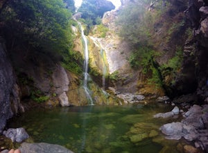
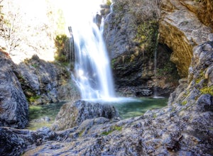
Salmon Creek Falls
5.00.29 mi / 102 ft gainThe trailhead to Salmon Creek Falls is located along a pullout just 45 miles south of Pfieffer Burns State Park on the Highway 1. The falls are only about .25 miles from the trailhead, perfect for a quick visit if you are already driving through Big Sur. Though the Salmon Creek Trail continues on...Read more -
Big Sur, California
Salmon Creek Trail to Spruce & Estrella Camps
4.56.07 mi / 1919 ft gainFeel free to hike Salmon Creek Trail at your own pace – you can choose to turn back at any point, or at the Spruce (2 miles in) or Estrella (3.25 miles in) sites. The trail leads to open vistas of the coast, giving stunning views of the cliffs and ocean. Around 2 miles in, follow the fork to the...Read more -
San Luis Obispo, California
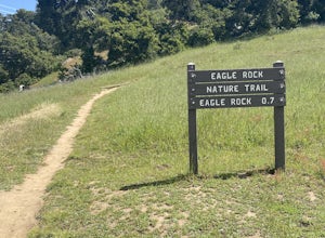
Eagle Rock Nature Trail
4.01.66 mi / 430 ft gainEagle Rock Nature Trail is an out-and-back trail where you may see beautiful wildflowers located near San Luis Obispo, California.Read more -
Monterey County, California
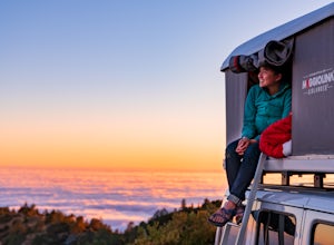
Camp at San Martin Top
San Martin Top is a magical spot overlooking the coast in Big Sur. Accessible via a rutted, windy dirt road, it’s remote enough to guarantee some privacy though you’ll see fellow adventurous souls on surrounding ridges. Take care on the drive up, then set up camp overlooking the ocean or rolling ...Read more -
San Luis Obispo, California
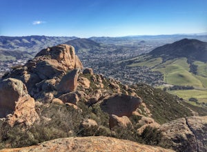
Bishop's Peak Trail
4.83.17 mi / 928 ft gainBishop's Peak is one of the most frequented hikes of the San Luis Obispo Area. With a 950ft elevation gain in an estimated 3 mile trek, the summit's peak rests at 1,559 feet. The hike is both demanding and rewarding - the panoramic views at the top of the nearby volcanic morros and San Luis Obisp...Read more -
San Luis Obispo, California
Mountain Bike Cuesta Ridge
5.07 mi / -1600 ft gainStart at the parking lot directly off of Highway 101, head up TV tower Road for 2.8 Miles and a 900' climb from 1500' to 2400'. The trail is an old fire road that has degraded over the years and is full of potholes. Starting October 2015, the road has been closed to vehicles as its being repaved ...Read more -
Big Sur, California
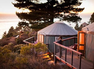
Luxurious Camping at Treebones Resort
5.0If you’ve always wanted to experience Big Sur, but sleeping on the ground isn’t really your thing, Treebones might be exactly what you’re looking for. Nestled along Big Sur’s beautiful coastline, Treebones Resort offers expansive views and easy access to everything the area has to offer. With a t...Read more -
Big Sur, California
Explore San Carpoforo Creek
4.0Just south of Ragged Point, San Carpoforo Creek is an open beach that is fun to explore. There is a quick hike from the highway to the beach. During heavy rain years, the creek will be flowing deeper, so you might need to do some swimming. There are waves occasionally here with a couple of surfe...Read more -
San Luis Obispo, California
Bowden Ranch Trail
4.03.34 mi / 1286 ft gainThis short but intense hike on the north east side of San Luis Obispo, offers an amazing view of the town. This hike is roughly 3 miles with 1300 ft of elevation gain. It provides a great cardio workout! It is also a very popular spot to hike but is less crowded than Bishop Peak. It's a dog frie...Read more -
San Luis Obispo, California
Point San Luis Lighthouse via Pecho Coast Trail
3.4 mi / 879 ft gainThis guided roundtrip hike to Point San Luis Lighthouse has one of the best views of the central coast coastline. You will get a chance to see the Avila Beach, Avila Pier, Call Poly Pier, and Harford Pier from a high point. The trail crosses through a land owned by PG&E; therefore, the hike...Read more -
Big Sur, California
Hike down to Jade Cove
2.00.3 mi / 65 ft gainThe entrance to jade cove is off the side of the road on Hwy 1. There is lots of side parking available. You go down a short unmarked trail and keep left. You'll find yourself at the top of a cliff/mountain side that uses 2 ropes to get down. The first rope is short and not super difficult. ...Read more -
Big Sur, California
Sand Dollar Beach
4.80.35 mi / 82 ft gainHead into Big Sur and get a campsite at Plaskett Creek. You can either make a reservation through recreation.gov or show up and hope to luck out on one of the first-come, first-serve campsites. The campground is much more crowded during the prime summer months, so if you want to get better surf ...Read more -
San Luis Obispo, California
Bike or Run the Bob Jones Trail
5 miThe Bob Jones Trail provides a variety of activities -- running, walking, biking, skateboarding/rollerblading, and some exploring by the creek. You can choose where you would like to start, across the street from the Central Coast Aquarium off Avila Beach Dr. or from the parking lot off Ontario R...Read more -
San Luis Obispo, California
Ontario Ridge to Shell Beach Bluff Trail Loop
4.02.79 mi / 679 ft gainOntario Ridge to Shell Beach Bluff Trail Loop is a loop trail where you may see beautiful wildflowers located near Avila Beach, California.Read more -
San Luis Obispo, California
Catch the Sunset at the Avila Sea Caves
4.0When I attended Cal Poly San Luis Obispo, I would come out to this place to watch the sunset. It was my favorite spot to sit on a rock and take in the beautiful scenery as the sun went down. You don't really have to hike to get a nice view, you can park the car and walk out to the rock cliffs and...Read more

