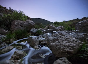
Borrego Springs, California
Looking for the best chillin in Borrego Springs? We've got you covered with the top trails, trips, hiking, backpacking, camping and more around Borrego Springs. The detailed guides, photos, and reviews are all submitted by the Outbound community.
Top Chillin Spots in and near Borrego Springs
-
Palm Springs, California
Climb at the Tramway of Mount San Jacinto
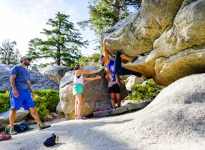
John Muir once wrote, "The view from San Jacinto is the most sublime spectacle to be found anywhere on this earth!" So it's no surprise that this is a sought after destination for hikers and climbers alike. Named after the fact that most climbers use the Palm Springs Aerial Tramway to reach this...Read more -
Banning, California
Lake Fulmor Loop Trail
5.00.53 mi / 89 ft gainLake Fulmor is a small lake in the San Jacinto Wilderness near Idyllwild, CA. The trail loops around the lake offering spectacular views and is good for all skill levels. There are picnic tables, grills, and a small dock where you can peer out over the lake or cast a line. To fish in Lake Fulm...Read more -
Calipatria, California
Explore the Mud Volcanoes of the Salton Sea
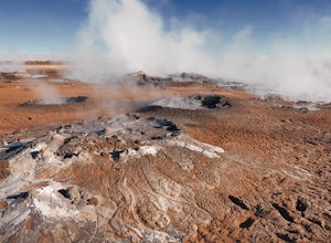
5.04 miIt should be noted that extreme caution should be practiced when going to the mud volcanoes. While the photographs above appear close, they were taken on a zoom lens from a safe distance. The ground here is soft and misleading. Collapses can occur, where you could be fatally scalded by the boili...Read more -
Escondido, California
Lake Hodges Overlook
4.66.73 mi / 1407 ft gainElfin Forest is one of the most beautiful and unique trails in all of San Diego, CA. The parking is free as well as the overflow parking area. There is an Interpretive Center located in the staging area where you can speak to park rangers, learn about the wildlife and trail locations. The parking...Read more -
Campo, California
Photograph the Mexican Border on the PCT Southern Terminus
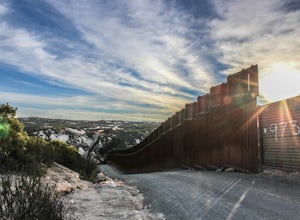
4.5From San Diego head East on Hwy 8 for roughly 60 miles to Buckman Springs Road (Exit 51). Take a right on Buckman Springs road an drive South for 10 miles. Turn right on CA-94 W (Campo Rd) and drive for 1.5 miles. After crossing the railroad tracks turn left on Forrest Gate Road. Take this road f...Read more -
Twentynine Palms, California
Explore Cottonwood Spring
Just east of the Cottonwood Visitor Center. This scenic spot provides access to cottonwood spring. The spring is a short walk down from the parking lot, and was formed from earthquakes! It was a popular spot for natives and settlers to gather water back in the day. As you approach the springs you...Read more -
Twentynine Palms, California
Camp at Cottonwood Campground in Joshua Tree NP
The Cottonwood Campground is roughly 40 minutes south of the main attractions in Joshua Tree on Pinyon Canyon Rd and is located right next to the visitor center The biggest advantage of this site is that it is less popular than many of the other sites in Joshua Tree. It also has potable water and...Read more -
Twentynine Palms, California
Hike the Mastadon Peak Loop
5.02.3 mi / 331 ft gainThe trail is typically used for hiking, nature trips, and trail running. There are lots of opportunities to see desert plants and flowers. On clear days, you can see the Salton Sea. There is an old mine to explore from the outside, as the entrance has been sealed. If you plan on going to the top...Read more -
San Diego, California
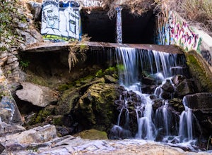
Explore Chambers Hidden Dam and Waterfall
3.20.5 miOnce you get off on Poway road, turn right onto Sabre Springs Parkway. Take your immediate left onto Creekbridge Road and park right there on the hill. Walk straight down towards the black gate and go down the hill. Turn right on the trail and walk down 1/4 mile to the dam, and another 500 yards ...Read more -
Santee, California
Cowles Mountain via Big Rock Trail
4.04.86 mi / 1207 ft gainStarting somewhat near sea-level, Cowles Mountain via the Big Rock Trail climbs about 1000 ft in elevation. This trail is about 5 miles total, out and back. Arrive at Big Rock park which has good parking. At the park you will walk to the left of the tennis courts past the limits (the fence) of...Read more -
Desert Hot Springs, California
Catch a Sunset at Keys View in Joshua Tree NP
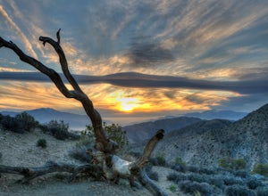
5.0This is a great place to watch the sunset, perched on the crest of the Little San Bernardino Mountains, provides panoramic views of the Coachella Valley and is well worth the 20-minute drive from Park Boulevard down Keys View Road. The views reach as far south as Salton Sea and on some clear days...Read more -
Santee, California
Cowles Mountain via Big Rock Road
4.54.32 mi / 1109 ft gainStart by plugging 8125 Arlette St, Santee, CA into your GPS. This takes you to Big Rock Park, a convenient parking spot for the Cowles Hike. From here you want to walk through the park, and around the right side of the tennis court. This will take you to the fenced entrance to the hike. Head sout...Read more -
Jamul, California
Hike the Hollenbeck Canyon Trail
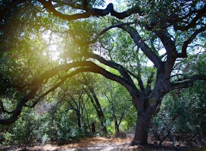
4.6 mi / 626 ft gainThe trail is wide and well maintained. The first mile of the trail is well shaded by oak trees. You'll see stunning rocky peaks and rolling green hills as the trail continues. There are three creek crossings to be aware of. Cleveland National Forest is dog friendly, but bring a leash! Hunting is ...Read more -
San Diego, California
Los Penasquitos Canyon Loop
3.36.77 mi / 131 ft gainLos Penasquitos Canyon Loop After about a five minute hike on the trail you will start to enter into Los Penasquitos Canyon. Every section of the trail is different, one minute you are walking next to a stream with trees arching over the trail and another minute you are walking through an open f...Read more

