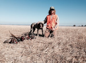
Bootjack Campground, California
Bootjack Campground in California offers some of the top trails for outdoor adventures. The must-visit Bootjack Trail is a moderate 4.8-mile loop that offers scenic views of redwood and oak trees, a variety of bird species, and the occasional deer sighting. The trail is well-maintained and includes a series of wooden steps and bridges. Another highlight is the nearby Cascade Falls, a stunning waterfall that can be reached via a short detour from the main trail. For those interested in fishing, the nearby Pine Lake is stocked with trout and is a popular spot for anglers. The best trails and outdoor activities at Bootjack Campground offer a mix of natural beauty and active fun.
Top Spots in and near Bootjack Campground
-
San Francisco, California
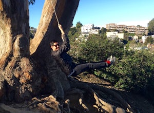
Swing at Billy Goat Hill
3.5Billy Goat Hill Park is located in the Glen Park neighborhood of San Francisco. The park has street parking at the top of the park on Beacon Street or at the base of the park on Ladley Street. Getting to the swing is only a short walk up or down the stairs that run through the middle of the park....Read more -
San Francisco, California
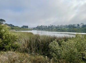
Lake Merced Loop
4.74.53 mi / 180 ft gainLake Merced Loop is a loop trail in the southwestern part of San Francisco. This trail is used for running and walking. You'll see plenty of people getting exercise or taking their dog for a stroll. There are also benches and tables around the loop. The lake itself is fresh water and is used for...Read more -
Novato, California
Mount Burdell Open Space Loop
4.87 mi / 1234 ft gainStart at the wide gravel parking lot. You will find the start of the San Andreas Fire Road on the south side leading up the mountain. The San Andreas Fire Road heads up the southern slope before joining the Middle Burdell Fire Road and then very quickly the Deer Camp Fire Road. Keep your eyes p...Read more -
San Francisco, California
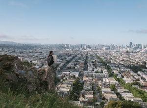
Bernal Heights Park
4.70.95 mi / 128 ft gainBernal Heights Park is an excellent week night adventure for those who need an escape from the city. Sit atop this small, grassy peak in peace and look out over the San Francisco skyline. Park on the street bordering the park and follow a pathway that leads up to the top. You will be instantly g...Read more -
San Francisco, California
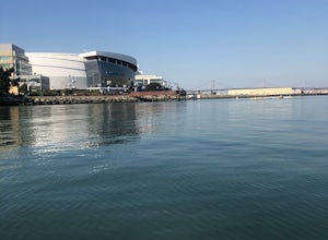
Paddle at Crane Cove
5.0Crane Cove is a beautiful waterfront park with access for paddle boards and kayaks. This area is protected from the wind (it will be less choppy here than in the middle of the bay). If you decide to paddle up to mission bay or down towards Islais Creek you'll most likely face more currents and w...Read more -
Richmond, California
Hike the Wildcat Canyon Loop
4.010.5 mi / 2300 ft gainStarting off on Wildcat Creek Trail, the trail is wide and rolling. After about 4 miles make a left on Jewel Trail, then onto Sylvan Trail. Another left puts you on Wildcat Peak Trail. Be sure to check your map, as many trails intersect here. Wildcat Peak Trail runs into Nimitz Way, at which poin...Read more -
Point Reyes Station, California
Sky Trail Loop
5.09.55 mi / 1818 ft gainSky Trail in Point Reyes National Seashore is a dramatic, mostly single-track trail that runs along the main spine of the Inverness Ridge and across highest mountains in Point Reyes, looming above the Olema Valley and Highway 1 which mark the San Andreas Fault rift zone and the dividing line betw...Read more -
Point Reyes Station, California
Sky Campground via Sky Trail
2.66 mi / 495 ft gainEntering Point Reyes National Seashore from Bear Valley Road the Sky Trailhead is a 4.9 mile drive. Camping in Sky Camp requires a Camping Permit. Once at the Sky Trailhead parking lot. The Sky Trailhead will be on the left side pulling in. The hike is not very strenuous and not all that lo...Read more -
San Francisco, California
McLaren Park: Philosopher's Way Loop
5.02.25 mi / 315 ft gainBeyond McLaren's family friendly playgrounds and picnic areas, there are miles of trail to explore. The Philosopher's trail is a well-marked loop (notice the stone markings along the trail with arrows etched into them). There are several parking lots available where you can jump onto the loop. No...Read more -
Point Reyes Station, California
Coast Campground via Laguna Trailhead
4.34.02 mi / 633 ft gainThis campground is the closest you can get to staying overnight on Pt. Reyes coastline if you're backpacking in. Once you get there, enjoy the view! The easiest way to get to the camp is from the slightly uphill hike along the Laguna Trail and the Firelane Trail. The trailhead for the Laguna Tra...Read more -
Point Reyes Station, California
Hike the Laguna Trail & Coast Trail Loop
5.05.2 mi / 300 ft gainLeave your car on a side of the road. When navigating there, put "HI Hostel Point Reyes" in your navigation - you park literally on the other side of the road, opposite to the hostel. Go to the west and soon you'll find the start of Coast Trail with a tsunami warning sign. During first 1.8 mile y...Read more -
Daly City, California
San Bruno Mountain
4.03.63 mi / 781 ft gainSan Bruno Mountain is a fun, mellow hike that climbs easily on a well-graded path to the ridge line, and then drops back to the trailhead. Along the way, the trail runs along a creek, ascends through chaparral, and provides excellent views of downtown San Francisco, the East Bay hills, and the Sa...Read more -
San Francisco, California
Bayview Hill Loop
4.01.24 mi / 184 ft gainBayview Hill Loop is a loop trail that starts with a paved uphill climb and views of the bay facing toward the East Bay located in the Bayview neighborhood of San Francisco, California.Read more -
Inverness, California
Limantour Beach
4.85.33 mi / 66 ft gainThe entire drive to Pt. Reyes is picturesque, but once you make it to Limantour, you and your dog can both get out and enjoy it! This area, between Drake's Bay and an estuary, allows you to spend time relaxing or head out for a run (keep the dog on leash). If you're lucky you might either get a c...Read more -
Daly City, California
Mussel Rock Loop
4.01.95 mi / 322 ft gainMussel rock, a three-story, 50 million year old rock that has been carried some 500 miles northwest from Southern California, is where the San Andreas fault meets the Pacific Ocean. It's also an excellent spot to drink some wine and catch a sunset. From San Francisco, take Highway 1 south towar...Read more -
Petaluma, California
Upland Game Bird Hunting/ Clay Shooting
I’m sure all you hunters and are well aware that there are few, if any, hunting opportunities in San Francisco or Marin County. However, many of you don’t know that an epic hunting club exists just an hour North of San Francisco. At the Black Point Game Bird Club, you can hunt ring-necked pheasan...Read more

