Top Spots in and near Big Basin Redwoods State Park
-
Berkeley, California
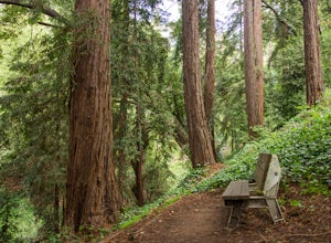
Park along the street in front of Codornices Park in Berkeley. Follow the stream to the left of the playground. Take the path up the hill to the right (don't head over the bridge on the left). Keep walking up multiple concrete stairs. After the first flight of stairs you'll see a path on the left...
Read more
-
Berkeley, California
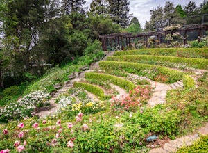
I'm always surprised at how few people know of this beautiful garden. I'm often alone when I visit, which allows for perfect serenity. Visit in early spring for maximum blooms.
Park on Euclid Ave, which is where you'll find the entrance to the amphitheater (you can't miss the giant sign). Spend ...
Read more
-
Lafayette, California
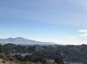
Lafayette Reservoir is perfect for canoeing, mountain biking, trail running, and hiking. The Reservoir trail system is also used for nature walks and birding. The loop has several high points that have amazing views. The trails become very muddy after wet weather - so tread with caution.
Th...
Read more
-
Danville, California
5.0
7.8 mi
/ 2299 ft gain
Although steep in sections, this trail is a wonderful workout and hikers are more than rewarded for their efforts. The Rock City Trail is a direct route to the summit of Mount Diablo, and the park is an ecological treasure dear to the hearts of Bay Area residents. The best views are on clear days...
Read more
-
Tiburon, California
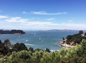
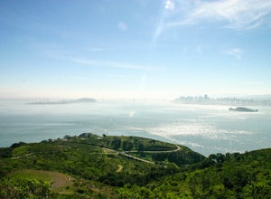
Angel Island Perimeter Loop is a loop trail around the circumference of the island in the San Francisco Bay. The island is located near Tiburon, California with views of downtown San Francisco, Alcatraz, the Golden Gate Bridge, Oakland, Sausalito, and TIburon as you traverse around the island.
...
Read more
-
Tiburon, California
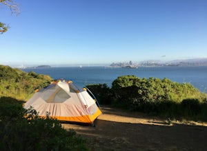
Thousands of years ago, this island was a fishing and hunting ground for the Miwok Native Americans. It has also been an outpost for the U.S. Army and a cattle ranch. Now, it’s one of the closest places to escape from the hustle of San Francisco and set up camp. Camping on the island requires ba...
Read more
-
Belvedere Tiburon, California
4.5
4.92 mi
/ 1178 ft gain
Unless you own a boat or a kayak, this adventure requires a ride on the Blue and Gold Ferry from Pier 41 in San Francisco. But let’s be honest, that’s actually half the fun. Who doesn’t love a ferry ride?
Angel Island State Park is the largest island in the Bay, and recommend the 6-mile loop aro...
Read more
-
Danville, California
This hike starts at the Rock City area of Mount Diablo State Park. Begin at the Madrone Canyon Trail, hiking southeast towards the Devils Slide trail. Along this section of the hike, the trail dips into a wooded canyon and follows the path of a small creek. To best experience the beauty of the cr...
Read more
-
Walnut Creek, California
Sugarloaf Open Space Loop is an almost 2-mile loop for hiking, running and walking. This trail is relatively easy and takes under one hour to hike. This loop is dog friendly.
Read more
-
Berkeley, California
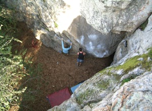
Indian Rock is one of the most popular outdoor bouldering spots in Berkeley. With over 80 problems, there's plenty of routes for beginners to the most advanced climbers. After parking in the surrounding neighborhood, it's an easy walk into the park.
Aside from enjoying the challenge of new routes...
Read more
-
Berkeley, California
Lake Anza makes for a great warm weather swimming hole. The parking area is close to the beach along with the trail, which will take you around the lake. The beach gets plenty of sun and is fairly wind protected, which makes for a relaxing day. Bring some picnic food out to the lake and snag your...
Read more
-
Salinas, California
Just a short drive from downtown Monterey you will find yourself amongst the rugged yet serene hills ofToro Park. For a $2 admission fee you will have access to 20+ miles of trails that climb through canyons and run along ridgelines to peaks with views of the ocean in the distance.
While the map ...
Read more
-
Berkeley, California
4.5
4.28 mi
/ 1007 ft gain
The trail is dog and horse friendly, and many trail loops make Tilden Regional Park fun for families and those of any skill level. The Seaview and Big Springs Trail loop is typically used by avid hikers, trail runners, or mountain bikers. The first half of the trail is exposed to the sun and rock...
Read more
-
Livermore, California
4.5
4.38 mi
/ 620 ft gain
This regional preserve is perfect for day hikes. There are also designated campsites and even a backpack campsite. Horses and dogs are welcome in the preserve.
There are many different clearly marked trails that one can choose from. A good 4.5 mile loop is to start at the Park Residence entrance...
Read more
-
Mill Valley, California
The Tennessee Valley trail is leisurely 3.6 mile roundtrip hike that turns around at Tennessee Valley Cove. Along the way, you’ll hike past shrublands, wetlands, and a lake before you get to a cool little secluded beach that many people picnic at.
This is probably the easiest to access, and most...
Read more
-
Mill Valley, California
5.0
6.15 mi
/ 1001 ft gain
Starting just before the Tennessee Valley parking lot, head out from the Miwok Trailhead. This Mill Valley hike offers incredible views of the San Francisco Bay, the Pacific Ocean (fog permitting of course!), and on occasion, wildlife. Unfortunately, this trail is not dog-friendly.
Keep in mind...
Read more

