Belmont, California
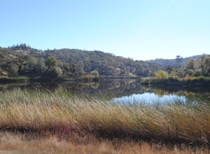
Belmont, California is a top destination for outdoor adventures, offering some of the best trails and outdoor activities. One must-visit trail is the Water Dog Lake Park Trail, a moderate difficulty trail that spans 3.8 miles. Along this scenic route, hikers can enjoy views of the beautiful Water Dog Lake and encounter unique rock formations. If you're up for a challenge, the Sugarloaf Mountain Trail is a 2.8-mile trail that boasts panoramic views from the summit. For those interested in bird watching, the Crystal Springs Reservoir offers a rich array of bird species. Near Belmont, the Pulgas Ridge Open Space Preserve is another great spot for hiking and wildlife viewing. These outdoor attractions in and near Belmont are sure to satisfy anyone seeking adventure and natural beauty.
Top Spots in and near Belmont
-
Novato, California
Schwindt, Indian Valley, and Waterfall Trail Loop
3.51 mi / 594 ft gainSchwindt, Indian Valley, and Waterfall Trail Loop is a loop trail that takes you by a waterfall located near Novato, California.Read more -
Santa Cruz, California
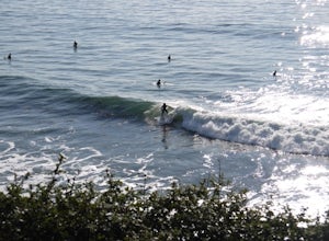
Surf the Hook
4.0The hook is a surf spot found on the east side of Santa Cruz, located along East Cliff drive. If you keep driving past Pleasure Point, you'll get to it. It's a right hand point break that is usually smaller in size than Pleasure Point. It's a very crowded spot due to the easy access parking lo...Read more -
Santa Cruz, California
Surf Pleasure Point
4.0Pleasure Point is located on the east side of Santa Cruz, California. It is a right hand point break that breaks year round. It is a popular surf spot for many people that live in the San Francisco Bay Area. There are 3 different peaks that break at Pleasure Point. Sewers, which is the furthest ...Read more -
Lagunitas, California
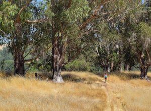
Bolinas Ridge Loop
10.27 mi / 1568 ft gainNestled in the Samuel P. Taylor State Park this ten miler was a perfect escape from the chaos of the city. Hikers are able to pay a $10.00 park entry fee that includes plenty of parking spaces and restrooms before you hit the trail. The hike starts along the Cross Marin Trail, a path popular to ...Read more -
Lagunitas, California
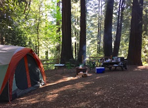
Redwoods Camping at Samuel P Taylor
These West Marin campsites are often overlooked. It does get busy during the summer, but take the rest of the year to explore this state park. The main campground boasts more than 50 campsites with restrooms, hot pay showers, and piped drinking water. A few spaces can accommodate trailers, but t...Read more -
Novato, California
North Levee Trail
3.78 mi / 157 ft gainNorth Levee Trail is a loop trail where you may see wildflowers located near Novato, California.Read more -
Petaluma, California
Upland Game Bird Hunting/ Clay Shooting
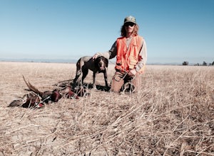
I’m sure all you hunters and are well aware that there are few, if any, hunting opportunities in San Francisco or Marin County. However, many of you don’t know that an epic hunting club exists just an hour North of San Francisco. At the Black Point Game Bird Club, you can hunt ring-necked pheasan...Read more -
Novato, California
Mount Burdell Open Space Loop
4.87 mi / 1234 ft gainStart at the wide gravel parking lot. You will find the start of the San Andreas Fire Road on the south side leading up the mountain. The San Andreas Fire Road heads up the southern slope before joining the Middle Burdell Fire Road and then very quickly the Deer Camp Fire Road. Keep your eyes p...Read more -
Point Reyes Station, California
Bear Valley to Coast Camp Loop
5.016.18 mi / 2818 ft gainPermit and Trail Camp Info To stay overnight in Point Reyes, you must stay at one of the Trail Camps. Camping anywhere else in the park is not allowed. Permits for the Trail Camps can be booked up to 6 months in advance. If you are looking to go on a weekend, then you'll want to start loo...Read more -
Morgan Hill, California
Backpack to Coit Lake
5.026 miThis trail can be started from Coe Headquarters or Hunting Hollow Trailhead. The trail from Coe HQ is 2 miles longer, almost all elevation but provides beautiful views of the surrounding mountains. These directions will be starting from Coe HQ.Follow the loop around the parking area to the backpa...Read more -
Morgan Hill, California
Backpack to Mississippi Lake
5.026.4 mi / 3600 ft gainIf you're tired of trying and failing to get reservations for backcountry camping around the bay area, then Henry Coe State Park is the perfect place to visit. No reservations need to be made prior to the trip. All you need to do is get to the HQ on the morning of your trip, get your permits and ...Read more -
Nicasio, California
Hike and Fish at Nicasio Reservoir
5.03 mi / 300 ft gainNicasio is a quaint town just inland of the more popular coastal town of Point Reyes. It's most known for it's wine country, rolling hills, and the home of Skywalker Ranch, George Lucas's getaway home. Most visitors of this area either pass right on through for Point Reyes or use it's scenic road...Read more -
Point Reyes Station, California
Sky Trail Loop
5.09.55 mi / 1818 ft gainSky Trail in Point Reyes National Seashore is a dramatic, mostly single-track trail that runs along the main spine of the Inverness Ridge and across highest mountains in Point Reyes, looming above the Olema Valley and Highway 1 which mark the San Andreas Fault rift zone and the dividing line betw...Read more -
Point Reyes Station, California
Sky Campground via Sky Trail
2.66 mi / 495 ft gainEntering Point Reyes National Seashore from Bear Valley Road the Sky Trailhead is a 4.9 mile drive. Camping in Sky Camp requires a Camping Permit. Once at the Sky Trailhead parking lot. The Sky Trailhead will be on the left side pulling in. The hike is not very strenuous and not all that lo...Read more -
Point Reyes Station, California
Coast Campground via Laguna Trailhead
4.34.02 mi / 633 ft gainThis campground is the closest you can get to staying overnight on Pt. Reyes coastline if you're backpacking in. Once you get there, enjoy the view! The easiest way to get to the camp is from the slightly uphill hike along the Laguna Trail and the Firelane Trail. The trailhead for the Laguna Tra...Read more -
Point Reyes Station, California
Hike the Laguna Trail & Coast Trail Loop
5.05.2 mi / 300 ft gainLeave your car on a side of the road. When navigating there, put "HI Hostel Point Reyes" in your navigation - you park literally on the other side of the road, opposite to the hostel. Go to the west and soon you'll find the start of Coast Trail with a tsunami warning sign. During first 1.8 mile y...Read more


