Belmont, California
Looking for the best hiking in Belmont? We've got you covered with the top trails, trips, hiking, backpacking, camping and more around Belmont. The detailed guides, photos, and reviews are all submitted by the Outbound community.
Top Hiking Spots in and near Belmont
-
Fairfax, California
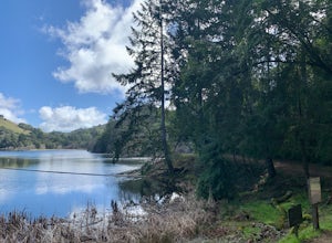
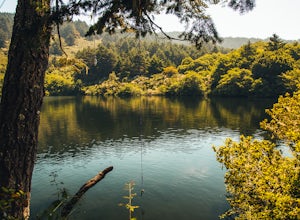
Lake Lagunitas
4.01.6 mi / 176 ft gainLocated near Fairfax, California, this trail is relatively flat and provides peaceful views of the lake as you pass over small creeks and groves of redwoods. It's good for all skill levels and is accessible year-round. It's a great trail for families and beginner mountain bikers.It can be a littl...Read more -
Stinson Beach, California
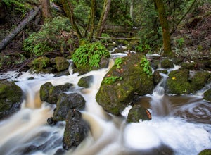
Cataract Falls
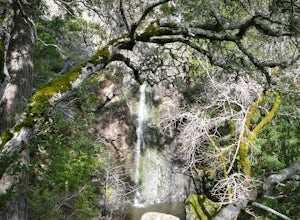
4.22.81 mi / 1184 ft gainThe Bay Area is home to many beautiful waterfalls, but Cataract Falls located about an hour north of San Francisco is one of the most stunning. Be sure to head out on this hike after a recent rain. Cataract Falls is a picturesque waterfall located in the Mt. Tamalpais Watershed near Stinson Be...Read more -
Felton, California
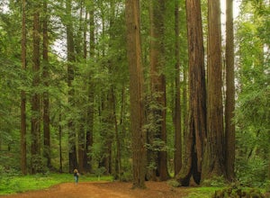
Redwood Grove Loop
4.00.93 mi / 144 ft gainHenry Cowell Redwoods State Park is located just a few miles north of the city of Santa Cruz, along Highway 9. The park is home to an array of hiking and biking trails, but the crown jewel of the park is the Redwood Grove Loop Trail, which is only a 1/4 mile in from the park's entrance. Many peo...Read more -
Felton, California
Observation Deck Loop in Henry Cowell Redwoods SP
4.35.3 mi / 869 ft gainThe trail starts at the Henry Cowell Redwoods State Park Visitors Center. Grab a map in the center, as your hike has you turning onto a few different trails to get to the observation deck. Starting at the Redwood Grove Loop Trail, follow the trail until it connects with the Pipeline Road Trail ...Read more -
San Rafael, California
China Camp Loop
4.09.23 mi / 1716 ft gainPark at the lot in the China Camp State Park. Hop onto the Bay View trail to gain to begin the loop trail. Switchbacks take you up to a long and easy path passing through shaded and open areas. Enjoy the grasslands speckled with oak trees and coyote brush. You can see the San Rafael bay and bridg...Read more -
Santa Cruz County, California
Camp at Henry Cowell Redwoods Campground
4.8/ 665 ft gainNestled in the Santa Cruz Mountains, Henry Cowell Redwoods State Park is a great weekend option for Bay Area residents. With approximately 30 miles of hiking trails, the incredible Garden of Eden swimming hole, and proximity to Santa Cruz - this campground is not to be missed! On sunny days, view...Read more -
Fairfax, California
Carson Falls
4.03.75 mi / 863 ft gainAre you tired of crowds on your hikes? First, shame on you for getting up so late and moving so slowly. Did you really need Philz before you got on the trail? Ok, now that you’ve been thoroughly chastised, let’s start planning a hike to the less-frequented Carson Falls. Like any of the falls in ...Read more -
Santa Cruz, California
Hike the Rincon Fire Trail
5.01 mi / 300 ft gainThe Rincon Fire Trail Starts at a small dirt parking lot next to CA-9 and traverses down the mountain to the San Lorenzo River Connecting with the Pipeline Trail. The trail can be a simple one of a mile out and back or up to 5 miles depending on your preference. The elevation will change by about...Read more -
San Rafael, California
Terra Linda Sleepy Hollow Ridge Trail
5.05.85 mi / 1089 ft gainThis San Rafael neighborhood trail is quite popular, but there is plenty of room for everyone and the parking is easy. After you park at the trailhead, you walk (or bike) up a relatively short and steep path that takes you to the beginning of the trail. This hike takes you along a scenic ridge ...Read more -
Antioch, California
Hike the Old Homestead Loop
5.06.5 miThis is a fun day hike that takes you through the beautiful hills of the Black Diamond Mines Regional Preserve and a bit of the Contra Loma Recreational Area as well. You can hike here year round, but I suggest going in the spring time when the hills are covered in soft, green grass and the wild ...Read more -
Bolinas, California
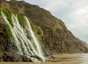
Alamere Falls via Palomarin Trailhead
4.513.54 mi / 1614 ft gainAlamere Falls is the tallest waterfall in the bay area. It is known as a tide fall because it empties directly into the Pacific Ocean. This is extremely unique because there are only 34 tide falls in the world and two in California, the other being McWay Falls in Big Sur. Enjoy stunning views of...Read more -
Bolinas, California
Point Reyes' Wildcat Camp via Coast Trail
5.011.19 mi / 1926 ft gainIn order to make this trip possible, go to recreation.gov and make a reservation for Wildcat Camp (available year-round). On your way to the trailhead, make sure to stop by the Bear Valley Visitor Center to grab your camping permit. For more information, visit: http://www.nps.gov/pore/planyourvis...Read more -
Bolinas, California
Bass Lake via Palomarin Trailhead
4.26.11 miFollow the Coast Trail from Palomarin Trailhead to Bass Lake. It's a fairly easy ~2.5-3 miles to the Lake. As soon as you pass the lake, on the left you will see a narrow unmarked dirt trail. Take this trail and you'll get to a nice clearing with easy lake access (this will be a great spot for lu...Read more -
Bolinas, California
Glen Camp Loop via the Palomarin Trailhead
4.715.72 mi / 3091 ft gainDay 1 Before heading to the trailhead, make sure to stop by the Bear Valley Visitor Center to pick up your permit. To stay overnight in Point Reyes, you must stay at one of the trail camps. Camping anywhere else in the park is not allowed. Permits for the trail camps can be booked up to 6 mo...Read more -
Bolinas, California
Backpack to Coast Camp in Point Reyes via Palomarin Trailhead
20.5 mi / 2705 ft gainSpanning from just north of the small town of Bolinas (about an hour north of San Francisco) across Inverness ridge and to the top of Tomales Point, Point Reyes National Seashore is as stunning park featuring breathtaking ocean views and solitude among the grassy hillsides and forested ridges. Th...Read more -
Vallejo, California
Camp at Mare Island Shoreline Heritage Preserve
1 mi / 20 ft gainThis old Naval Base is now home to, well, almost nothing. As a weekend volunteer trip, myself and about 50 others got a little dirty creating 3 new campsites for you and your friends!During the day, the island has hikers exploring everywhere, but the preserve closes upon sunset and it's just you ...Read more

