Atascadero, California
Looking for the best hiking in Atascadero? We've got you covered with the top trails, trips, hiking, backpacking, camping and more around Atascadero. The detailed guides, photos, and reviews are all submitted by the Outbound community.
Top Hiking Spots in and near Atascadero
-
Arroyo Grande, California
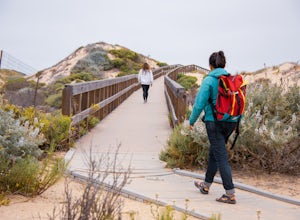
Explore the Guadalupe-Nipomo Dunes
The Guadalupe-Nipomo Dunes and nearby Lake Oso Flaco are home to many endangered and threatened species of plants and animals. A beautiful, short boardwalk takes you from the parking lot, over Lake Oso Flaco, and through the dunes before arriving at the ocean. Enjoy the local wildlife and abundan...Read more -
San Simeon, California
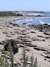
Elephant Seal Vista Point
5.0Elephant Seal Vista Point is a favorite place to see the elephant seals. If you’re in the area and have the opportunity, it's a must see. During the Spring, the adult elephant seals and the baby seals are out. Nearby are easy, clearly marked, walking paths, along the cliffs edge. Dogs are not all...Read more -
San Simeon, California
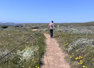
Elephant Seal Vista Point Trail
5.05.27 mi / 184 ft gainElephant Seal Vista Point Trail is an out-and-back trail that provides a good opportunity to view wildlife located near San Simeon, California.Read more -
Big Sur, California
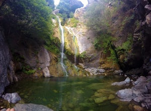
Salmon Creek Falls
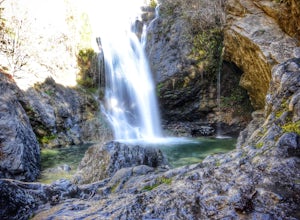
5.00.29 mi / 102 ft gainThe trailhead to Salmon Creek Falls is located along a pullout just 45 miles south of Pfieffer Burns State Park on the Highway 1. The falls are only about .25 miles from the trailhead, perfect for a quick visit if you are already driving through Big Sur. Though the Salmon Creek Trail continues on...Read more -
Big Sur, California
Salmon Creek Trail to Spruce & Estrella Camps
4.56.07 mi / 1919 ft gainFeel free to hike Salmon Creek Trail at your own pace – you can choose to turn back at any point, or at the Spruce (2 miles in) or Estrella (3.25 miles in) sites. The trail leads to open vistas of the coast, giving stunning views of the cliffs and ocean. Around 2 miles in, follow the fork to the...Read more -
Orcutt, California
Hike or Trail Run the Rice Ranch Trail
4.03.2 mi / 400 ft gainHike, mountain bike, or trail run the Rice Ranch Trail in Orcutt, CA. This park is relatively small, but a great place for a hike or run. I did a 3 mile loop and could easily have added on a couple more miles. Hike up to water towers at the top and enjoy views overlooking Santa Maria Valley and o...Read more -
Santa Maria, California
Trail Run, Hike, or Mountain Bike Los Flores Ranch Park
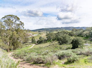
5 mi / 700 ft gainI'm a sucker for a good ridgeline trail, and Los Flores Ranch Park has lots of them. For a solid 5ish mile loop with about 600 ft of elevation gain, take the Manzanita Trail to the Ridge Top Trail for sweeping views of the valley, vineyards, and out to the ocean on a clear day. The Solomon Trail ...Read more -
Santa Margarita, California
Photograph Wildflowers at Carrizo Plain National Monument
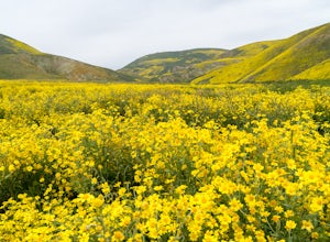
5.0Driving in from Hwy 58 East, you will be passing through a grapevine, and through some hills. Once you hit the Seven Mile Road, you will start to see fields of yellow flowers all around you - this is where the adventure starts. Just continue to drive along the road until you find a great spot to ...Read more

