Arcadia, California
Arcadia, California offers some of the best trails and outdoor activities for those seeking scenic outdoor adventures. The Eaton Canyon Trail, a must-visit, is a moderate-level hiking trail known for its waterfall and the beautiful Eaton Canyon River. Another top trail is the Mount Wilson Trail, featuring a stunning view of the San Gabriel Valley and an observatory at the peak. For those interested in bird watching, the Arcadia Wilderness Park is a great spot with its diverse bird species. The Los Angeles County Arboretum and Botanic Garden, located in Arcadia, is a fantastic place to enjoy a leisurely walk amongst a variety of plant species. So, pack your hiking boots and get ready to explore the best of Arcadia's outdoor attractions.
Top Spots in and near Arcadia
-
Los Angeles, California
Stoney Point Park Loop
4.00.73 mi / 141 ft gainOnce you've parked along Topanga Canyon Blvd, make your way down the street and start the trail off near the steel gate, close to the horse stables. As you make your way in, you will notice some rock climbers practicing on the lower elevation rocks. Make your way around this rocky park, counter-...Read more -
Los Angeles, California
Hike up Chatsworth Park North
1 miFrom the parking lot, make your way through the park until you reach the bottom of a hill filled with huge rocks and boulders. It is very hard to miss.From here, you can pick any trail you wish. They will all lead up to the top. There's a lot of rock scrambling involved, as well as boulder hoppin...Read more -
Topanga, California
Calabasas Peak Motorway
7.23 mi / 1565 ft gainGetting There You can, from Los Angeles, go one of three ways: take I-405 to US-101 and head west, or from downtown, take US-101 the whole way, OR, get on I-10 from the Westside or east of there and take that until it becomes PCH, then take that to Topanga Canyon (turn left onto Old Topanga Cany...Read more -
Topanga, California
Red Rock Canyon to Calabasas Peak
4.04.53 mi / 1004 ft gainWhen you get to the parking lot be sure to pay the $5 parking fee. You will need to place this in the provided envelope and drop it in the iron ranger. Start the hike by following the fire road behind the gate. About a couple of yards in, you will see a trail on your left which leads to a ghoul...Read more -
Rancho Palos Verdes, California
Terranea Beach Sea Cave
4.31.63 mi / 210 ft gainHead to the Pelican Cove parking lot where there’s plenty of free parking right at the trailhead. From the parking lot, take the Terranea Beach Trail and you will see views of the Point Vicente Lighthouse down the coast to your right. Continue on the trail through the luxury Terranea Resort whic...Read more -
Rancho Palos Verdes, California
Pelican Cove
0.38 mi / 95 ft gainGetting There Coming from San Pedro, make a U-turn at the Hawthorne Boulevard stoplight onto Palos Verdes Drive South. From here, you can access the parking lot for Pelican Cove, where you'll get a 120° view of the ocean. It might be tempting to take in the sunset from the car, but you should def...Read more -
Palmdale, California
California Aqueduct Trail
7.67 mi / 213 ft gainCalifornia Aqueduct Trail is an out-and-back trail that takes you past scenic surroundings located near Palmdale, California.Read more -
Calabasas, California
Hike and Rock Climb at Saddle Peak
5.0This is one of my favorite hikes in the Los Angeles area. Super easy, yet beautiful and a perfect place to get away from the city.Parking for the trailhead is where the three roads intersect. The parking area is a long strip of dirt, there will most likely be cars there when you arrive already th...Read more -
Los Angeles, California
Cave of Munits
4.51.53 mi / 299 ft gainAre you looking for a hike that offers trail running, scenic views, hiking, and CAVE exploring? This short, but exciting trail leads you on a short 0.8 mile hike to the Cave of Munits. When starting at the main trailhead, El Scorpion Park, take the wide paved dirt road all the way till you get to...Read more -
Ventura County, California
Hike the Upper Las Virgenes Canyon Open Space Preserve Trail
8.6 mi / 1851 ft gainThe most popular point of entry is through the Victory Trailhead, which has ample parking. You can park on the street or you can pay $3 to park at the trailhead parking lot. You can also enter at the Upper Las Virgenes Canyon Trailhead at the northern end of Las Virgenes Canyon Road in Calabasas....Read more -
Newport Beach, California
Newport Beach Back Bay Trail
4.010.62 mi / 499 ft gainThe Newport Beach Back Bay Trail features beautiful wildflowers and is open for use year round. Very minimal elevation gain makes this hike food for all skill levels, but be mindful of the distance. Dogs are allowed on the trail but must be kept on leash. Cooling sea breezes make this one of th...Read more -
Stevenson Ranch, California
Mentryville: Pico Canyon Trail
7.07 mi / 1388 ft gainMentryville: Pico Canyon Trail is an out-and-back trail that takes you past scenic surroundings located near Stevenson Ranch, California.Read more -
Newport Beach, California
Newport Pier
4.9Newport Pier is located just south of Huntington Beach at the center of the Balboa Peninsula. Balboa Pier, the more crowded pier of Newport Beach, is nearby to the south. Thanks to the awesome weather of Southern California, there’s no reason this beach can’t be enjoyed all year long, which means...Read more -
Malibu, California
Surf Malibu Point
3.0Malibu point is an iconic surf spot located in Malibu, California. It's a very popular summer time spot due to the exposure to south swells. The majority of people longboard this surf spot. It's a very iconic wave with lots of history! The wave itself is a long right-hand point break that is r...Read more -
Malibu, California
Photograph the Iconic Malibu Pier
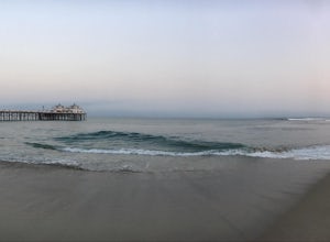
3.2Less than a mile South from the small town center, Malibu Pier stretches out into the Pacific. The Pier has been in Malibu since 1905 and though much of Malibu has been built up around it, it has remained quite similar to when it was first constructed. You can either pay for parking right at the ...Read more -
Silverado, California
Bedford Peak Trail
5.06.78 mi / 1972 ft gainThe Bedford Peak Trail in Silverado, California is a challenging hike that offers a variety of natural features. The trail spans 6.78 miles round trip and has an elevation gain of 1,972 feet. It is rated as difficult due to its steep inclines and rocky terrain. The trail begins in a dense oak w...Read more

