Angelus Oaks, California
Looking for the best running in Angelus Oaks? We've got you covered with the top trails, trips, hiking, backpacking, camping and more around Angelus Oaks. The detailed guides, photos, and reviews are all submitted by the Outbound community.
Top Running Spots in and near Angelus Oaks
-
Hemet, California
Hike South Fork Trail
5.4 mi / 1056 ft gainBegin by following the unsigned but visible trail on the south side of the turnout. You climb steadily through bushes and past granite boulders. At half a mile, you pass over to the western slope of the hill where the trail bends southeast, providing your first look of the river valley far below....Read more -
Palm Springs, California
South Lykken Trail to Simonetta Kennett Viewpoint
3.66.45 mi / 1654 ft gainThe South Lykken Trail is the south half of the 9.5-mile Carl Lykken Trail, which weaves along a series of mountain ridges above downtown Palm Springs. Dogs are not permitted on this trail. This section of the trail runs 3.2 miles one-way. You will gain just over 1600ft of elevation at the high...Read more -
Palm Springs, California
South Carl Lykken Trail - North Section
3.42 mi / 1076 ft gainSouth Carl Lykken Trail - North Section is an out-and-back trail that takes you by a waterfall located near Palm Springs, California.Read more -
Palm Springs, California
Araby and Berns Trail Loop
4.76 mi / 1293 ft gainAraby and Berns Trail Loop is a loop trail that takes you past scenic surroundings located near Palm Springs, California.Read more -
Palm Springs, California
Andreas Canyon
5.01.03 mi / 154 ft gainAndreas Canyon in Indian Canyons is located very close to Palm Springs in the Agua Caliente band of Cahuilla Indians Reservation. It is one of the few places with abundant shade and running fresh water in an otherwise dry desert landscape. Enjoy a longer hike to a waterfall (Seven Falls) or stay ...Read more -
Palm Springs, California
Indian Potrero Loop Trail
8.67 mi / 1247 ft gainIndian Potrero Loop Trail is a strenuous loop trail located near Palm Springs, California.Read more -
Palm Springs, California
Indian Canyon West Fork Trail
5.3 mi / 1545 ft gainIndian Canyon West Fork Trail is a strenuous out-and-back trail located near Palm Springs, California.Read more -
Riverside County, California
Hike the Covington Crest Trail
4.2 mi / 200 ft gainAccessing Covington Flats in Joshua Tree National Park requires a high ground-clearance overland vehicle. In the summer months a standard car might make it to the parking lot after the 7.5 mile off-road drive, but should always be prepared for soft sand. Bring spare water and emergency tools inca...Read more -
Corona, California
Skyline Drive Trail
3.09.07 mi / 1946 ft gainThis trail is shared by hikers, mountain bikers and trail runners. Rock climbers can find areas to boulder off the trail. Bring lots of extra water as this trail is rather dusty and can get very hot. This is a good training hike for those looking to do some backpacking. The trail is open year-r...Read more -
Claremont, California
Claremont Wilderness Loop
4.85.03 mi / 1020 ft gainDrive to the top of Mills Ave in Claremont. There is a main parking area to the left and overflow parking a block south on the right. It costs $3 to park for 4hrs. As the name implies, the Wilderness Loop is a loop that connects to other trails in the Claremont Hills Wilderness. You can choose t...Read more -
Llano, California
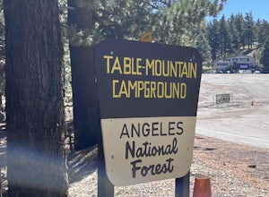
Table Mountain Campground
Table Mountain Campground is a hilly campground that offers ADA-accessible sites, pit toilets, fire rings, picnic tables, BB! grill, water, and parking spaces for a two-car limit. Rules are strictly enforced, which is great, so we can enjoy nature and not someone’s party/music. Book your campgro...Read more -
Silverado, California
Bedford Peak Trail
5.06.78 mi / 1972 ft gainThe Bedford Peak Trail in Silverado, California is a challenging hike that offers a variety of natural features. The trail spans 6.78 miles round trip and has an elevation gain of 1,972 feet. It is rated as difficult due to its steep inclines and rocky terrain. The trail begins in a dense oak w...Read more -
Desert Hot Springs, California
Pushwalla Palms Loop
4.33 mi / 741 ft gainPushwalla Palms Loop is a loop trail where you may see wildflowers located near Thousand Palms, California.Read more -
Lake Elsinore, California
Hike Bear Canyon Trail to Sitton Peak
6.4 mi / 2200 ft gainA MUST hike for any orange country resident! The hike starts of off Ortega HWY 74 at the Bear Canyon Trail head on the same side of the road as the Ortega oaks candy store. Its recommended you park in the lot across the street from the trail head (tip:there is a working water spicket in the parki...Read more -
La Verne, California
Marshall Canyon Trail
4.05.99 mi / 722 ft gainFor this adventure you can choose to start in a multiple of places; for the easiest parking use Oak Mesa Park located next to Oak Mesa Elementary School. From the parking lot cross the soccer field towards the bridge on the north east end of the school. Once across the bridge follow Los Robles ea...Read more -
Aguanga, California
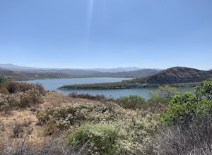
Vail Lake Loop
4.07.25 mi / 922 ft gainVail Lake Loop is a loop trail that takes you by a lake located near Temecula, California.Read more


