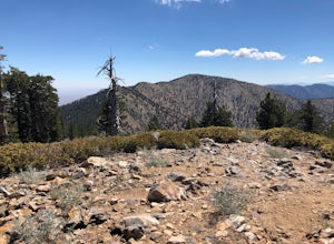
Anaheim, California
Anaheim, California offers some of the best trails and outdoor activities for those seeking scenic outdoor adventures. One of the top must-visit spots is the Oak Canyon Nature Center. This 58-acre natural park is nestled in the Anaheim Hills, featuring four miles of hiking trails through oak woodland and coastal sage scrub, leading to a year-round stream. You'll see a variety of birds and local wildlife, making it a great spot for bird watching. Another highlight is the Santa Ana River Trail, a multi-use trail that runs alongside the Santa Ana River, offering stunning views and opportunities for biking and horseback riding. The trail is flat and easy, making it accessible for all fitness levels. For a more challenging hike, head to the Anaheim Hills Trail, known for its steep inclines and panoramic views over the city.
Top Spots in and near Anaheim
-
Santa Monica, California
Santa Monica Pier, Boardwalk, and Beach Trail
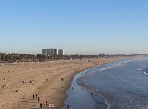
4.03.33 mi / 20 ft gainThe Santa Monica Pier, Boardwalk, and Beach Trail in Santa Monica, California, offers a unique blend of coastal and urban hiking. The trail is a flat, paved 3.33-mile loop that is suitable for all skill levels. It starts at the Santa Monica Pier, a historic landmark known for its Ferris wheel and...Read more -
Pearblossom, California
Mt. Waterman
5.05.87 mi / 1499 ft gainMt. Waterman is accessed along Highway 2 in the Angeles National Forest. Heading east from La Canada look for mileage marker 58.0 (34 miles from La Canada) just past the closed ski resort. Park at one of the large paved turnouts on your left. Display an Adventure Pass ($5 at Ranger Station or Big...Read more -
Pearblossom, California
Cooper Canyon Trail Camp
5.37 mi / 1214 ft gainThere's a small parking lot just below Cloudburst Summit on the way to Mount Waterman. Start your adventure there. I'd be hard-pressed to say it's more than 15 yards from the sign for the summit (7018' AMSL). There's a fire road, if you're newer to altitude and don't know how to read a map (or e...Read more -
Azusa, California
Little Jimmy Trail Camp
4.33.36 mi / 607 ft gainTake Hwy 2 out of La Canada north along Angeles Crest Highway. Follow this for quite some time enjoying the fine views in all directions. After traveling through two consecutive tunnels continue to the Islip Saddle parking lot (on left). There will be a vault toilet & a picnic table. Display ...Read more -
Los Angeles County, California
Mt. Williamson via Islip Saddle
4.16 mi / 1519 ft gainThe trailhead is immediately off of Angeles Crest Highway CA-2 at Islip Saddle. It's just a touch over 2 miles to reach the summit, through which you'll be hiking among the pine tree forest practically the entire way up (part of this trail doubles as the Pacific Crest Trail). The summit is larg...Read more -
Riverside, California
Hike Two Trees Trail
2.5 mi / 977 ft gainParking is free at the trailhead, but there is only room for approximately five cars. The trailhead is on the edge of a neighborhood, so you can park there if needed. From the parking lot, head west, and immediately veer right and across the bridge. If you go left at the first fork, you can stay ...Read more -
Los Angeles, California
Verdugo's North Ridge Trail
12.7 mi / 2684 ft gainThe Verdugo Mountain Range is a small, rugged range spanning across the northeast end of the San Fernando Valley from Sun Valley to Glendale. With close to 50 miles of graded and well-maintained trails, the Verdugos are surprisingly underutilized and make a great place for someone looking to esca...Read more -
Los Angeles, California
Verdugo Mountain Traverse
5.012.13 mi / 0 ft gainThe Verdugo Mountain Range is a small, rugged range spanning across the northeast end of the San Fernando Valley from Sun Valley to Glendale. With close to 50 miles of graded and well-maintained trails, the Verdugos are surprisingly underutilized and make a great place for someone looking to esca...Read more -
Lytle Creek, California
Old CC Spur Trail via Big Tree Cucamonga Rd
5.11 mi / 1138 ft gainOld CC Spur Trail via Big Tree Cucamonga Rd is an out-and-back trail that takes you by a waterfall located near Fontana, California.Read more -
Santa Monica, California
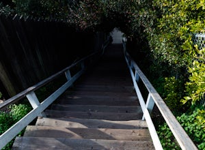
Run the Santa Monica Wooden Stairs
4.0The wooden Santa Monica Stairs are a great way to get in some intense leg burning cardio. There are around 120 steps that are steeper then the Santa Monica Concrete Stairs, which can provide a deep burn on the intended muscles!This place has been a hot spot in the Santa Monica fitness scene for s...Read more -
Santa Monica, California
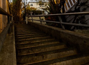
Run the Santa Monica Concrete Stairs
3.00.1 mi / 111 ft gainThe concrete Santa Monica Stairs are a great way to get in some intense leg burning cardio. There are around 170 steps that are wider and easier than the Santa Monica wooden staircase.This place has been a hot spot in the Santa Monica fitness scene for some time so it is also a good place for mee...Read more -
Santa Monica, California
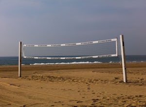
Beach Volleyball at Will Rogers State Beach
5.0At PCH and West Channel there is a tunnel that goes underneath the highway leading you directly onto the beach. In the tunnel take a left up the stairs onto the bike path. Head south 250 feet and you will hit the first set of courts but be aware you will need lines for these courts! If you want c...Read more -
Los Angeles, California
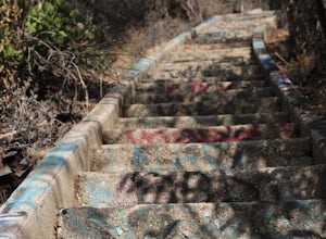
Murphy's Ranch
4.83.21 mi / 679 ft gainThis three-mile out-and-back hike begins at the beginning of a very nice neighborhood in Santa Monica. You will be trekking on a dirt road for about 1.5 miles until you reach some stairs that will be visible on your left-hand side. You will need to descend down those (what seem to be never-ending...Read more -
Dawson Saddle, California
Hike to Throop Peak, Mt. Hawkins, and Mt. Burnham
8 mi / 2000 ft gainThe trailhead, or pair of trailheads actually, is at a location on the Angeles Crest Highway (CA-2) called Dawson's Saddle. There are a couple of parking areas along the side of the highway, and each of the pair of trailheads begins at either end of this parking area. The trailheads aren't mark...Read more -
1501 Will Rogers State Park Road, California
Backbone Trail via Will Rogers State Park
5.03.02 mi / 656 ft gainYou'll make your way up Will Rogers State Park Road, located just minutes from Santa Monica, Brentwood, Westwood, Malibu, Palisades, and much of west Los Angeles. Once on the road, head all the way to the top and you'll dead end into the parking lot. Always worth supporting State Parks with the p...Read more -
Los Angeles, California
Inspiration Point Loop Trail
2.36 mi / 486 ft gainThe Inspiration Point 2.3 mile loop hike in Will Rogers State Park is a family-friendly hike or after-work run near Los Angeles, California. It’s a great dirt trail for all skill levels and features scenic views and beautifully budding wildflowers. You’ll get to escape the city and take in the br...Read more

