Anaheim, California
Looking for the best hiking in Anaheim? We've got you covered with the top trails, trips, hiking, backpacking, camping and more around Anaheim. The detailed guides, photos, and reviews are all submitted by the Outbound community.
Top Hiking Spots in and near Anaheim
-
Rancho Palos Verdes, California
Terranea Beach Sea Cave
4.31.63 mi / 210 ft gainHead to the Pelican Cove parking lot where there’s plenty of free parking right at the trailhead. From the parking lot, take the Terranea Beach Trail and you will see views of the Point Vicente Lighthouse down the coast to your right. Continue on the trail through the luxury Terranea Resort whic...Read more -
Rancho Palos Verdes, California
Pelican Cove
0.38 mi / 95 ft gainGetting There Coming from San Pedro, make a U-turn at the Hawthorne Boulevard stoplight onto Palos Verdes Drive South. From here, you can access the parking lot for Pelican Cove, where you'll get a 120° view of the ocean. It might be tempting to take in the sunset from the car, but you should def...Read more -
Los Angeles, California
Kenneth Hahn Recreation Area Loop
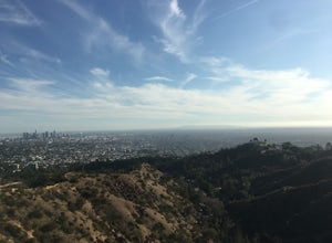
2.85 mi / 328 ft gainThe Kenneth Hahn Recreation Area is just outside of downtown LA, a perfect location for hiking, trail running, and biking. The trail loops up to the top of a hill, where hikers get sweeping views of LA. Dogs are allowed, but must be kept on leash. This is also a great location for trail running...Read more -
La Verne, California
Bridge to Nowhere via East Fork Trail
4.49.65 mi / 1798 ft gainThe trail on this 10-mile hike is predominately slow and steady, but can be a little rocky, so be prepared to scramble. When you’re fording the river, the water level can range from knee to chest high, especially in the wet months. A good pair of waterproof hiking boots is helpful, but water shoe...Read more -
Los Angeles, California
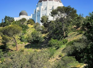
Ferndell to the West Observatory Loop Trail to Griffith Observatory
4.52.63 mi / 587 ft gainThe Ferndell to Griffith Observatory trail in Los Angeles, California is a moderate difficulty, 2.63-mile loop trail. The trail starts at Ferndell Nature Museum, a small museum with a garden and picnic area. The trail then ascends through a shaded canyon, with a small stream running alongside. ...Read more -
Los Angeles, California
Griffith Park Old Zoo Loop
4.02.52 mi / 666 ft gainThe Griffith Park Old Zoo Loop is a 2.52-mile moderately trafficked loop trail located in Griffith Park, Los Angeles. Due to its length and minimal elevation gain of ~670 feet, the hike is open to all skill levels. The trail is primarily used for walking, hiking, and trail running, The Griffith P...Read more -
Los Angeles, California
Mount Hollywood via the Fern Canyon Trail
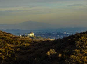
5.05.02 mi / 1581 ft gainAt 1,625 feet Mt Hollywood is the second highest point in Griffith Park and provides picturesque views of the Hollywood Sign, Griffith Park Observatory, Downtown Los Angeles and the San Gabriel Mountains. The hike to the Mt Hollywood Summit begins on the northeast side of Griffith Park near the ...Read more -
Altadena, California
Millard Falls
3.01.27 mi / 289 ft gainTo get to the trail, park at the Millard Campground Trailhead parking lot, where you'll find plenty of parking. Follow the trail that leads away from the lot and past the Millard Campground. If necessary, you'll find bathrooms at the campground. Follow signs for Millard Falls as the trail veers r...Read more -
Los Angeles, California
West Trail Loop
4.31.85 mi / 463 ft gainThe trail starts near Dell Picnic area, near the Trails Cafe. On this wide fire road, you can choose to run or hike, but don't expect to have the trail to yourself, especially if you're heading out on the weekend. With that said, you can time your run or hike around sunset and get amazing views b...Read more -
Los Angeles, California
Mount Hollywood Trail
5.02.49 mi / 505 ft gainMount Hollywood Trail is a loop with scenic views of Griffith Park located in Los Angeles, California. There are multiple ways to reach the summit of Mount Hollywood, including via Mount Hollywood via Fern Canyon Trail (5-mile loop) starting near the merry-go-round. This route is one of the most ...Read more -
Los Angeles County, California
San Gabriel Peak
4.02.79 mi / 1040 ft gainAt 6,000 feet, San Gabriel Peak gives you one of the best views of the Los Angeles basin on the front range of the San Gabriel Mountains National Monument. As you pass through Muller Tunnel, the trail will be littered with rocks and boulders. A little over 100 feet in, the road will fork in thre...Read more -
Los Angeles County, California
Idlehour Trail
4.014.89 mi / 4665 ft gainIdlehour Trail located near Mount Wilson, California, is an out-and-back trail that is strenuous and can take 8-10 hours if done all at once. There are opportunities to camp off the trail, making this a backpacking trail in the Angeles National Forest as well. To access the Idlehour Campground ...Read more -
Glendale, California
Mt. Thom and Tongva Peak
6.06 mi / 1480 ft gainMount Thom and Tongva Peak are accessed by using the 6.2 mile out and back trail, Las Flores Motorway located in the north part of Glendale, CA. Roadside parking is not allowed near the trailhead, you will need to park in the nearby residential area along Sunshine Drive about 0.15 miles away from...Read more -
Los Angeles, California
Glendale Peak via Henry's Trail
4.02.07 mi / 915 ft gainGlendale Peak is often passed over by people hiking to Mt. Hollywood, and while it is not as high as its neighbor summit, it boasts arguably better views that you will enjoy all to yourself. While not really a full hiking trail and more of a small detour, Henry's Trail is worth the small uphill c...Read more -
Claremont, California
Stoddard Peak Trail
4.05.93 mi / 1129 ft gainOn the way to Mount Baldy and within the trail system of the San Gabriel mountain range is the Stoddard Peak Trail. The Stoddard Peak Trail, which is basically the old Barrett-Stoddard fire road, goes through the Stoddard Canyon into Stoddard Flat, and then eventually leads to Stoddard Peak. The ...Read more -
Claremont, California
Stoddard Canyon Falls (Baldy Slide Waterfall)
0.74 mi / 174 ft gainLocated near the Angeles National Forest, it's a short hike, approx. 0.75 miles roundtrip and just about anybody can go. To get there, input the intersection of Mt. Baldy Rd. and Barrett Stoddard Truck Trail into your GPS. This will bring you to a small dirt parking lot. The trailhead starts a...Read more


