Alhambra, California
Looking for the best hiking in Alhambra? We've got you covered with the top trails, trips, hiking, backpacking, camping and more around Alhambra. The detailed guides, photos, and reviews are all submitted by the Outbound community.
Top Hiking Spots in and near Alhambra
-
Los Angeles, California
Sunset Hike in Ascot Hills
3.5Ascot Hills Park is a great hidden gem located a few miles east of Los Angeles. There is a parking lot with plenty of parking but the gates close at sunset, which is a great time to go, so if you plan on staying later, park outside the gates where there is ample street parking. Depending on the s...Read more -
Los Angeles, California
City View and Walnut Forest Trails Loop
4.02.59 mi / 568 ft gainThe City View and Walnut Forest Trails in Ernest E. Debs Regional Park are just outside of downtown Los Angeles, and are perfect for all abilities. The trails are most commonly used by dog walkers, trail runners, mountain bikers and families. The top of the hike features a unique pond. Dogs are a...Read more -
Pasadena, California
Arroyo Terrace Trail
5.01.54 mi / 194 ft gainArroyo Terrace Trail is a loop trail that takes you by a river located near Pasadena, California.Read more -
Altadena, California
Eaton Canyon to Idlehour Trail Camp
4.510.99 mi / 3291 ft gainIdlehour is nestled deep in the Angeles National Forest, so it feels like you're in the heart of some untapped wilderness instead of six miles away from a bustling metropolis. The trail camp is accessible by foot through a variety of locations, but the most popular route is through Eaton Canyon, ...Read more -
Pasadena, California
Eaton Canyon Falls via Eaton Canyon Trailhead
4.23.54 mi / 528 ft gainThe hidden forty-foot-tall Eaton Canyon Falls fills an amphitheater at the top of Eaton Canyon Trail, tumbling into a wide pool that you can rest alongside or wade in. Normally the water is waist deep, but during this recent trip, we found the water only to stop at our ankles as it tends to fluct...Read more -
Los Angeles, California
Secret Swing in Elysian Park
4.20.16 mi / 360 ft gainFor the most direct directions to the swing, plug in "Swing on top of Elysian Park" into google maps, which will take you directly to the trailhead. If you want to do it the more old fashion way, the swing is on top of a hill at the intersection of Angels Point Drive and Park Row Drive in Elysian...Read more -
Los Angeles, California
Elysian Park
4.01.88 mi / 282 ft gainThe trail at Elysian Park in Los Angeles, California, is a moderate difficulty hike that spans approximately 1.88 miles. The trail is well-marked and offers a variety of terrain, including dirt paths and paved roads. The trail is known for its panoramic views of the city, including the iconic Dod...Read more -
Altadena, California
San Gabriel via Sam Merrill and Mount Lowe Trails
17.55 mi / 5614 ft gainSan Gabriel via Sam Merrill and Mount Lowe Trails is a loop trail where you may see beautiful wildflowers located near Altadena, California.Read more -
Altadena, California
Thalehaha Falls
1.71 mi / 679 ft gainThe trails starts in a foothill neighborhood of Altadena CA at the corner of Pleasantridge Dr. and Rubio Vista Rd. This is one of the better entries into the Angeles National Forest because it is one of the lesser known. Find a place to park on the street and head out on the trail into Rubio Cany...Read more -
Altadena, California
Echo Mountain and Inspiration Point Loop
4.110.16 mi / 3369 ft gainThe trail switchbacks up the mountain before reaching the first historic marker, in 3 miles. These are the remains of the Mount Lowe Railroad, which brought customers to Echo Mountain Resort, also in ruins, nearby. Explore the historic sites, then head up Castle Canyon Trail. A steep climb will ...Read more -
Whittier, California
Sycamore Canyon Trail in Turnbull Canyon
2.03.47 mi / 627 ft gainThe Sycamore Canyon Park Trailhead can be found at the end of the dirt parking lot off Workman Mill Road. The entrance is off a small road which is pretty easy to miss, but there is a sign off the main road. Soon after you start on the trail, the path opens up onto a larger dirt road for vehicle ...Read more -
Los Angeles, California
Secret Stairs Astro Loop
2.34.21 mi / 600 ft gainI learned about these remnants of Los Angeles history, just a few months ago. When I found myself in L.A. this past month, I decided to find some of these stairs, and find out what they’re all about. Back in the 1920’s these stairs were created for pedestrians to have direct routes to the trans...Read more -
Los Angeles, California
Vista Hermosa Natural Park
4.20.58 mi / 36 ft gainVista Hermosa Natural Park is part of the Santa Monica Mountains Conservancy and the Mountains Recreation and Conservation Authority. Located in the western gateway to Downtown Los Angeles, it’s very easy to drive by this hidden gem if you’re not looking for it. This park is the perfect mix of ur...Read more -
Los Angeles, California
Silver Lake Reservoir Trail
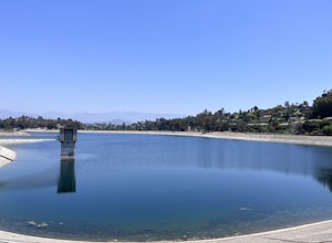
3.02.18 mi / 79 ft gainSilver Lake Reservoir Trail is a loop trail that takes you by a lake located in the Silver Lake neighborhood of Los Angeles, California. This urban escape is used by people running, walking, and birding. The trail is stroller-friendly, so you may see parents along the trail with their younger fam...Read more -
Altadena, California
Millard Falls
3.01.27 mi / 289 ft gainTo get to the trail, park at the Millard Campground Trailhead parking lot, where you'll find plenty of parking. Follow the trail that leads away from the lot and past the Millard Campground. If necessary, you'll find bathrooms at the campground. Follow signs for Millard Falls as the trail veers r...Read more -
Glendale, California
Mt. Thom and Tongva Peak
6.06 mi / 1480 ft gainMount Thom and Tongva Peak are accessed by using the 6.2 mile out and back trail, Las Flores Motorway located in the north part of Glendale, CA. Roadside parking is not allowed near the trailhead, you will need to park in the nearby residential area along Sunshine Drive about 0.15 miles away from...Read more


