Aguanga, California
Looking for the best photography in Aguanga? We've got you covered with the top trails, trips, hiking, backpacking, camping and more around Aguanga. The detailed guides, photos, and reviews are all submitted by the Outbound community.
Top Photography Spots in and near Aguanga
-
Escondido, California
Bernardo Mountain Summit Trail
5.07.15 mi / 1060 ft gainBernardo Mountain is located on the Coast to Crest Trail in San Dieguito River Park. The 7.15-mile out-and-back trail to the 1060 ft. summit starts on the east side of I-15. It's a relatively easy hike all the way to the top. It picks up a little once you make it to the Summit Trail junction, wh...Read more -
Borrego Springs, California
Hike the Panorama Overlook in Anza Borrego Desert State Park
1.6 mi / 636 ft gainThis is an out and back 1.6 mile round trip with 636 feet of elevation gain. The top has excellent views of Anza Borrego. It is close to the visitor center.Read more -
Escondido, California
Lake Hodges Overlook
4.66.73 mi / 1407 ft gainElfin Forest is one of the most beautiful and unique trails in all of San Diego, CA. The parking is free as well as the overflow parking area. There is an Interpretive Center located in the staging area where you can speak to park rangers, learn about the wildlife and trail locations. The parking...Read more -
Borrego Springs, California
Hike to Maidenhair Falls via Hellhole Canyon in Anza Borrego Desert State Park
5.1 mi / 974 ft gainThis 5.1 mile hike begins near the visitor center of Anza Borrego Desert State Park and gains 974 feet of elevation while climbing up a canyon to a small waterfall. It is an interesting hike as you can see the plant life change as you get closer to the waterfall. There are parts where the trail g...Read more -
San Diego, California
Battle Mountain's Cross
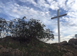
5.00.45 mi / 256 ft gainThis is a quick and easy hike for everyday explorers desiring a 20-minute sweat-inducing power walk leading to incredible views of urban development, Iron Mountain, Mt. Woodson, Mule Hill, and The 15. Come enjoy the views while sitting under the beautiful 20ft cross you've been admiring from the ...Read more -
Borrego Springs, California
Anza Borrego Metal Sculptures
4.6Here's a map I made that marks where most of the sculptures are (here). First, you enter the park and drive through the little city of Borrego Springs. There will be a roundabout you can't miss, so you know you're on the right path. There is nowhere to park to get to the sculptures specifically,...Read more -
Ramona, California
Mount Woodson's East Approach
3.03.96 mi / 1385 ft gainMount Woodson is a well-known hiking trail in San Diego County. It is known for its breathtaking views and the famous potato chip rock. The Trail on the east side of the Mountain is fairly steep but is about half the distance of the trail on the west side of the mountain. To get to the trail on ...Read more -
San Diego County, California
Camp On the Abandoned Santa Margarita Lookout Helipad
4.3Starting in Murrieta, CA you don't have to venture far to enjoy a beautiful view and less light polluted skies.From Murrieta on the I-15 freeway you're going to want to take the Clinton Kieth Road exit and head west. If you're low on gas make sure to fill up at the 7 Eleven on the left corner. Th...Read more -
Carlsbad, California
Hike and Fish at Lake Calavera
4.06.24 miLake Calavera Preserve is located in Carlsbad, CA and is home to one of North America's smallest volcanoes. It is the end peak of each trail and is what's known as a "volcanic plug" (cool hardened lava). The northern face of Mount Calavera is that of columnar joints- columns of molded lava. Geolo...Read more -
Palm Springs, California
Climb at the Tramway of Mount San Jacinto
John Muir once wrote, "The view from San Jacinto is the most sublime spectacle to be found anywhere on this earth!" So it's no surprise that this is a sought after destination for hikers and climbers alike. Named after the fact that most climbers use the Palm Springs Aerial Tramway to reach this...Read more -
Palm Springs, California
Scramble Cornell Peak
3.5 mi / 1000 ft gainEntering Mt San Jacinto State Park via the Palm Springs Aerial Tram is one of the easiest ways to get into the wilderness area. Purchase your ticket and ride to the station where you'll be able to walk out the backdoor and onto the trail. In order to get to Cornell, your route finding skills wil...Read more -
Poway, California
Mount Woodson and Potato Chip Rock
4.66.45 mi / 900 ft gainMt. Woodson is located in Poway's most eastern region and is one of San Diego's most popular and most iconic hiking trails. Known for its grand photo opportunistic "Potato Chip Rock", Mt. Woodson is a 7.5mi out-and-back trail with amazing vistas, convenient rest stops and breathtaking views. The...Read more -
Ramona, California
Cedar Creek Falls
4.85.52 mi / 1024 ft gainThe trail to Cedar Falls starts out at a hill in a residential area and ends in an unexpected spot where there is a beautiful waterfall complete with a swimming hole. Surrounded by 75-foot-high cliffs, a magnificent waterfall splashes into a pool known as the Devil’s Punch Bowl. Hikers have been ...Read more -
Ramona, California
Iron Mountain Peak Trail
4.15.67 mi / 1030 ft gainIron Mountain is the longest wilderness trail in Poway, CA. The parking lot is free and provides bathroom and water fountain amenities. The distance from the parking area to the summit is approximately 3.2 miles. Beginning with a wide smooth trail, slowly transitioning into semi-technical incline...Read more -
Santa Ysabel, California
Three Sisters Falls
4.93.42 mi / 906 ft gainThree Sisters Falls is by far the best hike, for the most reward, that I've gone on in the close vicinity of San Diego. Only a short hour and a half drive from downtown San Diego, the hike offers all the draws of a National Park: remote wilderness, strenuous hiking, scenic mountain views, and ama...Read more -
Poway, California
Catch a Sunset at Twin Peaks Mountain
2 miStart by parking at Silverset Park. You will see the trail head for Twin Peaks just behind the park. Park outside of the park if you think you'll be staying past sunset, as the park gates close at dark! Once you spot the trail head, veer left to the path heading up towards the peaks. You will eve...Read more

