Aguanga, California
Looking for the best hiking in Aguanga? We've got you covered with the top trails, trips, hiking, backpacking, camping and more around Aguanga. The detailed guides, photos, and reviews are all submitted by the Outbound community.
Top Hiking Spots in and near Aguanga
-
San Diego, California
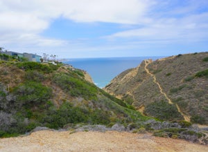
Black's Beach via the Ho Chi Minh Trail
4.30.61 mi / 259 ft gainFinding the actual trail is 80% of the adventure. Once you turn down La Jolla Farms Road you will follow it for about 3/4 of a mile and there won't be anything too apparent that you are there, except a few cars parked along the street. Make sure to plug in the directions from the map so you know ...Read more -
San Diego, California
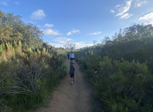
Visitor Center Loop Trail
5.01.46 mi / 148 ft gainThe Visitor Center Loop Trail is a 1.4 mile hike in San Diego that features river views and allows dogs.The Visitor Center Loop Trail is a well maintained, quick hike with shady spots scattered along the path and open year-round. This trail is great for kids and dog owners. There is a great netwo...Read more -
San Diego, California
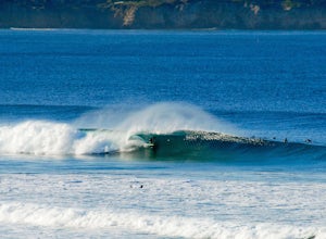
Surfing at Black's Beach via the Main Gate
5.01 mi / 650 ft gainWith arguably some of San Diego’s best waves, Black’s Beach can be found in the vicinity of the University of California San Diego campus, at the southern end of Torrey Pines State Beach and north of La Jolla Shores. Stately eight-figure mansions now line the bluffs where pastures and the Black f...Read more -
San Diego, California
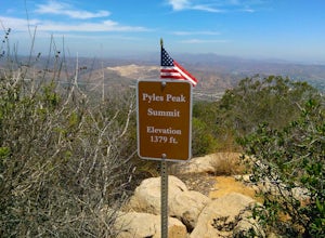
Pyles Peak
5.06.03 mi / 1706 ft gainMost people who live in San Diego have heard of, if not hiked, Cowles Mountain. At 1591 ft., Cowles is the highest peak in the city of San Diego. It's a hugely popular destination for day hikers and trail runners looking to get in a little trail time and take in the 360 degree views the summit h...Read more -
Riverside, California
Hike Two Trees Trail
2.5 mi / 977 ft gainParking is free at the trailhead, but there is only room for approximately five cars. The trailhead is on the edge of a neighborhood, so you can park there if needed. From the parking lot, head west, and immediately veer right and across the bridge. If you go left at the first fork, you can stay ...Read more -
Morongo Valley, California
Big Morongo Canyon Trail
11.65 mi / 1401 ft gainBig Morongo Canyon Trail is a loop trail where you may see wildflowers located near Morongo Valley, California.Read more -
Redlands, California
Run the Carriage Trail
3.52.5 mi / 300 ft gainThere is room to park just off San Timoteo Road. On the other side of the trail is more parking off Alessandro. You can park your car on either side and start your run/walk/bike ride. This is a nice little "get away" trail to take a break from suburbia.Read more -
Borrego Springs, California
Hike the Calcite Mine Trail in the Anza-Borrego Desert
4 mi / 830 ft gainOpen from March until October - but I would not particularly recommend this hike in the summer months, unless you started in the wee almost dark hours. This is the desert and it gets hot early and quickly.This is a former calcite mine with slot canyons, great rock formations and some shady areas ...Read more -
Silverado, California
Bedford Peak Trail
5.06.78 mi / 1972 ft gainThe Bedford Peak Trail in Silverado, California is a challenging hike that offers a variety of natural features. The trail spans 6.78 miles round trip and has an elevation gain of 1,972 feet. It is rated as difficult due to its steep inclines and rocky terrain. The trail begins in a dense oak w...Read more -
Trabuco Canyon, California
The Luge: Santiago Truck Trail Loop
5.07.46 mi / 1371 ft gainThe Luge: Santiago Truck Trail Loop is a loop trail that takes you through a nice forest located near Lake Forest, California.Read more -
Julian, California
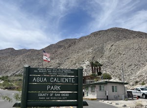
Agua Caliente Hot Spring
5.01.53 mi / 164 ft gainAgua Caliente Hot Spring is an out-and-back trail that takes you by a hot springs located near Julian, California.Read more -
Mount Laguna, California
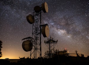
Night Shoot at Mt. Laguna USAF Station
This is a great stop when passing through the Anza Borrego Desert. The drive is very scenic, and passes through Sunrise Highway. Once you turn off the road, it's a very short drive up the hill where you will find a large spot to leave your car. There is a service gate that you can't drive through...Read more -
Silverado, California
Harding Falls Trail
5.05.96 mi / 1378 ft gainThe lot provides free parking, with plenty of spaces available throughout the day. The first few miles feature a descent into the canyon on a defined trail out in the open. The way back up is a decent incline in the sun! Be prepared, because even though 6+ miles may not seem too hard, this h...Read more -
Laguna Niguel, California
Colinas Ridge Trail
2.01 mi / 131 ft gainFirst, you'll be parking in the parking lot for the dog park. It's free parking and there are roughly 40 spaces, so there is plenty of parking. I've never seen more than 20 cars here at any one time. Once parked you'll find the trail head/ start on the northwest side of the lot (opposite the dog ...Read more -
San Diego, California
La Jolla Coast Walk Trail
5.02.32 mi / 295 ft gainLa Jolla Coast Walk is a beautiful coastline trail, but is a bit of a heavily trafficked tourist trail. The hike can be started and ended at 3 separate locations. The trail is easily accessible with a small parking lot and tons of restaurants nearby. The trail begins near another popular touris...Read more -
Mount Laguna, California
Red Trail Roost and Agua Dulce Trail Loop
4.04.63 mi / 591 ft gainRed Trail Roost and Agua Dulce Trail Loop is a loop trail where you may see wildflowers located near Julian, California.Read more

