San Carlos, Arizona
Top Spots in and near San Carlos
-
Tonto Basin, Arizona
Hike to Brown's Peak
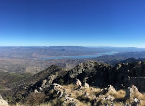
5.06 mi / 1957 ft gainStarting at the trailhead you will begin hiking through oak trees and forest. At numerous times throughout the hike Roosevelt Lake can be seen to the northwest. Approximately 3 miles into your hike you will reach a small campsite in the saddle of the mountain. This is your turnaround point if you...Read more -
Superior, Arizona
Hike Picketpost Mountain
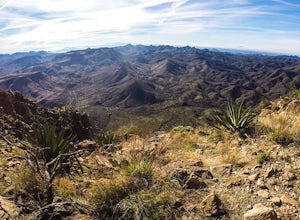
4.74.4 mi / 2200 ft gainFrom the parking lot you will start out on the Arizona Trail until you reach the turn off to begin your accent up the mountain. This part of the trail isn't well maintained, and is a scramble, so be ready to use those hands. The trail is marked with cairns though and there is enough traffic tha...Read more -
Rogers Trough Trailhead, Arizona
Hike Rogers Canyon Trail
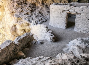
5.08 mi / 1108 ft gainThe Superstition Wilderness is a vast rugged landscape where you can find the cultural remains of ancient Hohokam, Salado, Apache, and Yavapais tribes. Rogers Canyon Trail takes you to one of the most impressive and best preserved archaeological sites this region has to offer. These Salado ruin...Read more -
Waddell, Arizona
Hike Goat Camp Trail
16 miThis is one of the less traveled trails in White Tank Mountain Regional Park. If you're looking for a solid day hike in the west valley, try this one. It isn't a loop, but it ultimately connects with some of the other long trails so if you're up for a long hike, you have options. This starts f...Read more -
Waddell, Arizona
Hike to Waterfall Canyon
4.02 mi / 200 ft gainSo to fully enjoy the theme of this hike, make sure to try and go right after a rain. But also know that since this is a pretty easy hike, you will won't be the only one there. This is also a great hike/ waterfall to do with someone that is new to desert hiking, since it is relatively easy and th...Read more -
Waddell, Arizona
Hike Mesquite Canyon Trail
13 mi / 1394 ft gainThis is a great place to begin your hike in the White Tank Mountains. From the Ramada Way area, the trail begins to lead steadily into a small canyon. As you get further up, the trail will begin get more steep. After a short time it leads up to the first saddle and wraps around a ridge and bec...Read more -
Buckeye, Arizona
Hike Valley Vista from Turnbuckle Trail
5.02 miThe Valley Vista trail is a short hike in Skyline Regional Park, located in the southern region of the White Tank Mountains west of Phoenix. From the top you'll have a great view of the Estrella Mountain Range and the southwest valley. For the most direct route, take the Turnbuckle trail. This...Read more -
Roosevelt, Arizona
Camp At Burnt Corral Campground On Apache Lake
5.0Located in the Superstition Wilderness about 65 miles northeast of Phoenix, AZ, Apache Lake is one of the most popular recreational lakes in Arizona because it has something for everyone: hiking, boating, fishing, water skiing, camping, swimming, and more! The Burnt Corral Campground is located o...Read more -
Morristown, Arizona
Hike the Wild Burro Trail
4 mi / 112 ft gainHike along the shoreline of beautiful Lake Pleasant. This 4.0 mile out-and-back trail is worth its weight in beautiful views. The path is well maintained and perfect for beginner hikers who enjoy leisurely hikes while looking for wild burros. The Wild Burro trail starts with a small descent from ...Read more -
Morristown, Arizona
Hike the Pipeline Canyon Trail
4.84 mi / -220 ft gainStarting at a little below 2,000 feet this hike takes about two hours out and back over a two-mile stretch. There is a parking lot with bathrooms at either end.For those with small members of your hiking party and two vehicles you could easily leave a car at either end of the trail. There are als...Read more -
Morristown, Arizona
Explore Lake Pleasant, AZ
5.0Located just 30 minutes from the outskirts of Phoenix, AZ lies a 10,000 acre desert oasis known as Pleasant Lake Regional Park. This expansive body of water serves as a great opportunity to beat the heat of the central Arizona sun, while taking in the beauty of the vivid blue waters and surroundi...Read more -
Morristown, Arizona
Yavapai Point Trail
5.03.08 mi / 525 ft gainYavapai Point Trail is an out-and-back trail that takes you by a lake located near New River, Arizona.Read more -
Roosevelt, Arizona
Visit Tonto National Monument
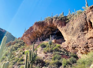
3.71.5 mi / 305 ft gainExplore two remarkably preserved American Indian cliff dwellings that date back to the 13th century. Set within a shelter bluff on the side of steep cliffs, the Upper and Lower Cliff Dwellings are well protected, and have great views of the surrounding Sonoran Desert. If you get to the park early...Read more -
Buckeye, Arizona
Camp in Sonora Desert National Monument
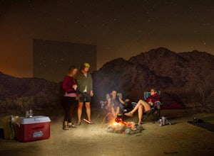
3.0Here you will find free camping on BLM land in the Sonora Desert National Monument (BLM page link). It's easy access from AZ 85. We took BLM road 8000, north of Gila Bend, into washy, sand roads and found easy dispersed camping within 20 minutes of the highway. There was no water here, and less c...Read more

