Peoria, Arizona
Top Spots in and near Peoria
-
Maricopa County, Arizona
Second Water To Boulder Canyon Camp
9.12 mi / 951 ft gainSecond Water To Boulder Canyon Camp is an out-and-back trail where you may see beautiful wildflowers located near Tortilla Flat, Arizona.Read more -
Apache Junction, Arizona
White Rock Springs Camp Loop via First Water Trailhead
4.724.18 mi / 3635 ft gainThe Superstition Wilderness is a stunning 160,200 acre area outside Apache Junction, AZ, with over 170 miles of (variously maintained) trail networks. There are any number of trips you can design to fit your time and skill level. This adventure offers a three day/ two night backpacking trip cover...Read more -
Apache Junction, Arizona
Hike Battleship Mountain
5.011.5 mi / 443 ft gainBattleship Mountain is nestled within the Superstition Mountains, surrounded by dramatic peaks and desert landscapes. The hike itself is beautiful, and the views once on top of Battleship Mountain are exceptional. The diversity and uniqueness of geological formations in the mountains surrounding ...Read more -
Apache Junction, Arizona
Hike the Dutchman's Second Canyon Loop
5.016 miTo get to the trail head, drive past Lost Dutchman State Park on the 88 and then take the dirt road (on your right) with arrows leading you to First Water Trail Head. There is an outhouse at the trailhead, so I suggest visiting it before you begin this hike. I also started this hike about an ho...Read more -
Apache Junction, Arizona
Hike Black Mesa Loop
4.59 miFrom First Water Trailhead, a short walk east brings you to the junction of the Dutchman trail and the Second Water trail. If you follow the Dutchman trail to the right you'll be heading southeast for a while, catching glimpses of Weaver's Needle in the distance. You can complete the loop going...Read more -
Apache Junction, Arizona
Hike the Boulder Canyon Trail
4.010 mi / 1500 ft gainParking for the trailhead is actually in the same lot as the marina. There is a restaurant, campground, and restrooms all in the vicinity of the parking lot. The actual trailhead is on the other side of the street opposite the parking lot entrance road. The hike begins an uphill climb. In a c...Read more -
Apache Junction, Arizona
Kayak Canyon Lake Reservoir
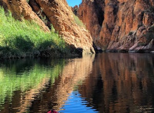
4.5Canyon Lake is located in a National Recreation Area. It was created by the damming of the Salt River, in Arizona, specifically by the Morman Flat Dam. The lake sits at an elevation of 1,660' and has a mean depth of 130', and an area of 1.484 mi². We launched our kayaks from the boat launch area ...Read more -
Gold Canyon, Arizona
Hieroglyphic Trail
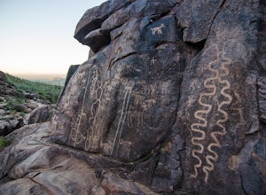
5.02.9 mi / 614 ft gainThis hike is a great beginner hike for those who want to experience the beauty of the Superstitions. I suggest going early in the morning because this trail gets very crowded later in the day (especially on weekends). To get to the trailhead from US60, turn north onto Kings Ranch Road where you ...Read more -
Gold Canyon, Arizona
Peak 5057 via Hieroglyphic Trail
5.07.45 mi / 3045 ft gainTo get to the trailhead from US60, turn north onto Kings Ranch Road where you will begin the winding path through the neighborhoods. From Kings Ranch Road, turn east on Baseline Ave, north on Mohican Road, west on Valley View Drive, north on Whitetail Road, and east on Cloudview Ave until it com...Read more -
Cordes Lakes, Arizona
Crown King OHV Trail
4.024.85 mi / 3497 ft gainCrown King OHV Trail is a point-to-point trail that takes you past scenic surroundings located near Mayer, Arizona.Read more

