New Zealand
Looking for the best hiking in New Zealand? We've got you covered with the top trails, trips, hiking, backpacking, camping and more around New Zealand. The detailed guides, photos, and reviews are all submitted by the Outbound community.
Top Hiking Spots in and near New Zealand
-
Half Moon Bay, New Zealand
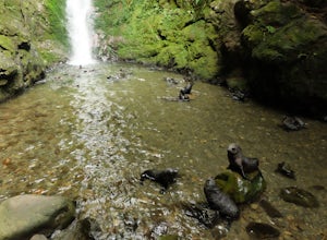
Explore Ohau Waterfall
0.2 mi / 0 ft gainPrepare yourself for the cutest walk you will ever go on! This short trail follows a stream filled with playful, furry, seal babies! Over a hundred seal pups come to Ohau Stream and Waterfall every winter. They come here to hone the skills they will need on their own in the wild while their mothe...Read more -
Westland National Park, New Zealand
Hike to Robert's Point (Franz Josef Glacier)
5.07.6 mi / 1640.4 ft gainThis trail is one of my favorite in New Zeanand. It wasn't so much 'built' as it was 'discovered'. The trail follows natural erosion and clean exposed flows of glacier carved granite walkways.You will enjoy thick, green rainforest, the reflective water of Pete's Pond, and a few long swinging brid...Read more -
Kaikoura, New Zealand
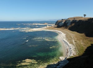
Hike the Kaikoura Peninsula
4.3 mi / 196.9 ft gainFrom the Point Kean carpark head south up the paved walkway until you reach the Clifftop Walk. This trail will take you past East Head and Atia Point before it becomes the South Bay Lookout Walk. When you reach car park at trail's end turn back the way you came and descend the stairs near East He...Read more -
Dunedin, New Zealand
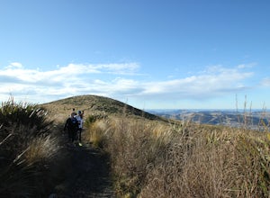
Hike the Pineapple Track
From the car park, follow the trail as it begins to go uphill. The slope is fairly gradual at first. Once you enter the trees it begins to get steeper and continues to climb until you are above tree line. You then begin to get views of the city and the harbor, along with mountains in the far dist...Read more -
Westland National Park, New Zealand
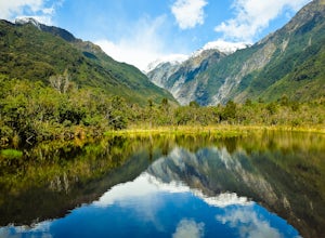
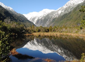
Explore Peter's Pool
From the carpark for Franz Josef Glacier, Peter's Pool is signposted to the left near the toilets. The walk takes you through a fern and beech forest, eventually dropping you in front of the gorgeous and reflective Peter's Pool. Snap a few photos and then return the way you came or continue along...Read more -
Mount Aspiring National Park, New Zealand
Valley of the Trolls
1.9 mi / 1312.3 ft gainThe Valley of The Trolls can be accessed from the head of Lake Harris, off the Routeburn track. The trail in the valley is a lot tougher going than the well maintained Routeburn track. The valley floor will quickly become a swampy bog after a rain. Getting to the trail is easily done about 300 ...Read more -
Hanmer Springs, New Zealand
Hike the Waterfall Track
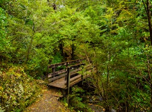
4.02.5 mi / 1500 ft gainRelatively short day hike that involves a few stairs and bridge crossing brings you to a cool spot called Dog Stream Waterfall at the end of the Waterfall Track. While the waterfall itself is cool, the hike itself is pretty great. Steady climb up to the 41 meter waterfall, offering some great vie...Read more -
Queenstown, New Zealand
Ben Lomond Track via Skyline Road
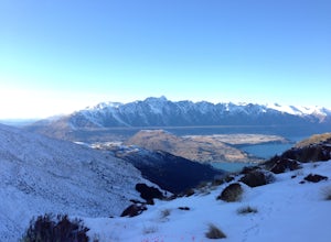
5.025.88 mi / 3107 ft gainIn the summer, Ben Lomond is an easy rated track flooded with tourists. In the winter, the hike gets a complete makeover by the soft blankets of snow, especially closer to the peak. Although the snow makes the route significantly more challenging, the views afforded are phenomenal and the trail i...Read more -
Cattle Flat, New Zealand
Hike the Minaret Burn Track
8.7 miThe Minaret Burn Track starts at the end of West Wanaka Road at Homestead Bay, which many tourists (and locals!) unknowingly drive past on their way to Treble Cone, Diamond Lake and/or the Rob Roy glacier. The start of the track is signposted and trail times to Colquhouns Beach (2-3 hrs; 7km) and...Read more -
Mount Aspiring National Park, New Zealand
Hike Brewster Track to Mt. Armstrong
5.05.6 mi / 5577.4 ft gainAfter a short walk from the Fantail Falls parking lot, the trail crosses the river to reach the beginning of the track. It's unlikely you'll avoid getting your feet wet.The track heads up through the steep and rooted slopes until you break treeline after several thousand feet of elevation gain. N...Read more -
Mount Aspiring National Park, New Zealand
Backpack MacPherson Creek to Lake Barra
5.07.5 mi / 5249.3 ft gainIf you’re ready for an advanced challenge to suit any adventurous spirit and have the skills to navigate complicated terrain then the narrow MacPherson Creek drainage on the fringes of Mount Aspiring National Park may grab your interest. Diving in from the MacPherson Creek bridge on the Haast Roa...Read more -
Anakoha, New Zealand
Summit Mt. Stokes
2.9 mi / 2044 ft gainThe real adventure is driving to the start of this track. While driving along the Queen Charlotte Drive, the little town called Linkwater has the access road the Mahau and Keneperu Sounds via the Keneperu Road. Warning: There is no petrol along the Keneperu Road, so if you are running low, I woul...Read more -
Westland National Park, New Zealand
Hike to the Summit of Mount Fox above Fox Glacier
5 mi / 3430 ft gainThe trail starts 3 km south of Fox Glacier Township. Take the Haast Highway until Thirsty Culvert, which has a small parking lot on the right side of the road. Start early in the morning to miss the almost daily afternoon fog. The trail climbs relentlessly through a lush rain forest. The route is...Read more -
Hanmer Springs, New Zealand
Hike the Forest Journey
2 miThis track is located just outside of Hanmer springs, and is the perfect afternoon or morning walk. Don't plan on this taking a whole day as the longest loop takes an about 90 minutes, if you are taking your time and enjoying it all. There are clear signs that guide you on this amble through the ...Read more -
Nelson Lakes National Park, New Zealand
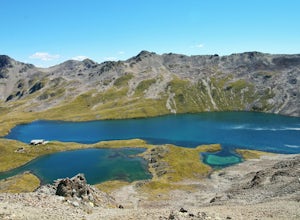
Backpack to Lake Angelus Alpine Hut
7.6 mi / 3987 ft gainFrom the Mt. Robert car park, take the Pinchgut Track up to the Bushline shelter (approx. 1 hr 30 mins). This beginning portion of the track is steep, with numerous switchbacks that will have you questioning whether you really need everything in your pack. The panoramic views of Lake Rotoiti are ...Read more -
Mount Cook National Park, New Zealand
Climb Mt. Ollivier
5.07 mi / 3436 ft gainStart on the track from the White Horse Hill campground. Follow the track up almost 2,000 steps until you reach Sealy Tarns. From here the track continues steeply up the mountain until you reach the ridge. Continue over the ridge until reaching the hut. From here continue up the ridge to the summ...Read more

