Old Folks Flat
Book this listing through our partner Recreation Gov
About Old Folks Flat
Overview
Old Folks Flat Campground is nestled in beautiful Huntington Canyon along the Huntington Canyon National Scenic Byway on Utah Highway 31. It sits at an elevation of 8,600 feet. Many recreational activities are available, including hiking, biking and fishing.Recreation
Popular activities include fishing, hunting, hiking, mountain biking, horseback riding, rock climbing and scenic driving. Nearby Huntington Creek is a Blue Ribbon fishery, offering high-quality fishing for brown, cutthroat and rainbow trout.The 4-mile Left Fork of the Huntington National Recreation Trail is nearby and open to hikers and horseback riders. The 10-mile Fish Creek Trail, for hiking, biking and horseback riding, is also close by.
Facilities
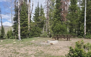
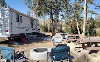
This campground is primarily devoted to group sites, but eight single-family campsites are also available. The five group sites can accommodate up to 20, 50 or 60 people and multiple vehicles in adjacent parking areas.Sites are equipped with tables and and a campfire rings with grills. The facility has recently been upgraded with flush toilets and drinking water spigots, but electricity and garbage collection service is not available. Roads and parking spurs within the campground are gravel.
Natural Features
Large spruce trees and aspens cover the campground, offering partial shade. The canyon area has numerous lakes and streams, vibrant summer wildflowers, colorful fall foliage and abundant wildlife.Nearby Attractions
The Huntington Canyon National Scenic Byway is part of the 86-mile Energy Loop. It offers stunning mountain and lake views as it tops 10,000 feet in elevation.The historic Stuart Guard Station Visitor Center is nearby, offering a glimpse of the 1930s life of a ranger and his family who once lived there. Exhibits of Civilian Conservation Corps projects and original equipment are also on display. Area information is available there as well.
Old Folks Flat Reviews
Have you stayed here? Be the first to leave a review!
Top Spots in or near Huntington
Bouldering in Joe's Valley, UT
Orangeville, Utah
5.0
The bouldering in Joe's Valley has been a hot spot for climbers from all around the world. Discovered by Utah climbers decades ago it has turned into a mecca for anyone who loves sandstone bouldering. The texture of the rock is very grippy and after a long day can leave you with little skin left on your fingers. Plan on having some of your best bouldering days here.The Valley consists of 3 p...
Climb at Maple Canyon
Fountain Green, UtahRegardless on whether you're northbound / southbound, jump on I-15 and take exit 225 in Nephi. Head east. Continue on this road (100 N) for 14 miles. Then, turn right on 400 S and after a 1/2 mile turn left onto West Side Road. This road will take you along a bunch of farmlands. After about 6 miles, turn right on Freedom road. Keep to your right, and you'll end up at the mouth of the canyon a f...
Maple Canyon Arch Loop
Fountain Green, Utah
2.78 mi
/ 1332 ft gain
If you’re a rock climber, you probably know all about Maple Canyon. It’s unique conglomerate walls attract climbers from all over the world. It’s a Mecca of sorts. The beautiful canyon contains some outstanding hiking as well and this adventure will give you a taste of the entire canyon.
The trailhead is located just south of Mount Nebo and is about a 1.5 hour drive from Salt Lake City. Exit I...
Andrew's Ridge to Mt. Nebo (South Peak)
Nephi, Utah
8.67 mi
/ 5400 ft gain
Andrew's Ridge to Mt. Nebo (South Peak) is an out-and-back trail where you may see wildflowers located near Nephi, Utah.
Visit the Flooded Thistle Ghost Town
18899-19003 U.S. Highway 89, Utah
3.0
Thistle, Utah was a small community located in Spanish Fork Canyon, founded in 1883. It flourished for a time as a ranching community and eventually became a major stop on the rail line that ran through it. This all changed in 1983 when a massive landslide dammed the Spanish Fork River and flooded the town. Now there are only a few structures remaining, and most can be seen from the road. Most ...
Mount Nebo via North Rim Trail
Payson, Utah
4.5
8.6 mi
/ 2897 ft gain
Mount Nebo is the tallest of all the mountains in the Wasatch, and also one of the easiest to hike, due to the fact that the trail begins at an elevation of ~9300 ft. The parking area for the trailhead is along a short dirt road, which is precisely marked on the location map.
The trail itself is easy to follow. The dirt road leading to the trailhead is called Mona Pole Rd. The trail leaves the...
Camping and Lodging in Huntington
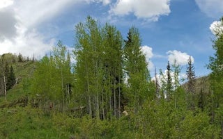
Huntington, Utah
Bridges Campground
Overview
Bridges Campground is located in beautiful Huntington Canyon, along the Huntington Canyon National Scenic Byway on Utah Highway ...
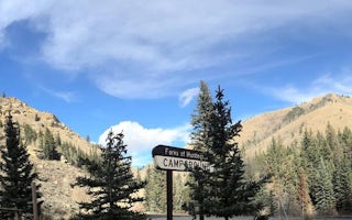
Huntington, Utah
Forks Of Huntington
Overview
Forks of Huntington Campground is located in beautiful Huntington Canyon, along the Huntington Canyon National Scenic Byway on U...
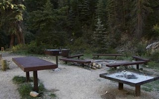
Huntington, Utah
Big Rock Group
Overview
Big Rock Group Campground is located in beautiful Huntington Canyon, along the Huntington Canyon National Scenic Byway on Utah H...
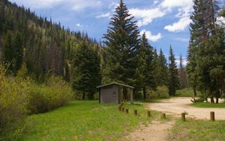
Huntington, Utah
Chute Group
Overview
Chute Group Campground is located in beautiful Huntington Canyon, along the Huntington Canyon National Scenic Byway on Utah High...
Mount Pleasant, Utah
Miller Flat Reservoir Campground
Overview
Miller Flat Reservoir Campground is located one mile south of Miller Flat Reservoir at 8,500 feet elevation, approximately five ...
Mount Pleasant, Utah
Lake Canyon Rec Area
Overview
Lake Canyon Recreation Area can be found along Utah's scenic Energy Loop, on top of the Wasatch Plateau. It is located just off ...
Unfortunately, we don't have up-to date pricing data for this listing, but you can check pricing through Recreation Gov.
Book NowAdd your business today to reach The Outbound's audience of adventurous travelers.
Community
© 2024 The Outbound Collective - Terms of Use - Privacy Policy


