Hat Creek
Book this listing through our partner Recreation Gov
About Hat Creek
Overview
Hat Creek is one of six campgrounds available in the Hat Creek Recreation Area, home to some of the area's best trout fishing. Scenic hiking trails and an active volcanic area can easily be accessed from the facility.Recreation
Hat Creek is popular for its trophy trout fishing. The cold waters of the creek allow for a refreshing play on hot summer days. Other popular activities in the area include wildlife viewing, hunting, backpacking, hiking and caving.A variety of day hikes are available in the area, including the Spatter Cones Nature Trail, which is located just across the highway from the campground. The 1.5-mile loop trail provides hikers with a unique opportunity to explore craters, cones and crevices, as well as other geologic features left by the Hat Creek Lava Flow.
Nearby, visitors can take a self-guided tour of Subway Cave. The trail is less than a half-mile long and explores the underground world of a lava tube. Visitors are encouraged to bring flashlights for hiking through the cave.
Facilities
Hat Creek offers three group campsites that can accommodate up to 50 people each. Individual sites are also available on a first-come, first-served basis.Picnic tables and campfire rings with grills are provided, as are accessible flush and vault toilets, utility sinks and drinking water. The RV dump-station is located 1.5 miles north of the campground behind the Old Station Visitors Center.
Natural Features
The campground is situated next to Hat Creek in a mixed conifer forest at an elevation of about 4,390 feet. Pine needles, grasses and volcanic rocks cover the forest floor. Sites are widely spaced for privacy.Nearby Attractions
The campground is located about a mile west of the town of Old Station, and 12 miles east of the northwest entrance to Lassen Volcanic National Park, where active, hissing fumaroles and boiling mud pots are continually shaping the landscape.The Pacific Crest National Scenic Trail can be accessed near the Spatter Cones Nature Trailhead.
Hat Creek Reviews
Have you stayed here? Be the first to leave a review!
Top Spots in or near Old Station
Subway Cave Lava Tubes
Old Station, California
5.0
0.65 mi
/ 33 ft gain
The Subway Cave Lava Tube is located at Old Station in the Lassen National Forest. About 26 miles south of Burney, CA. If coming from the North, it is on Highway 89 (Volcanic Legacy Scenic Byway) on your left right before Highway 44. If coming from Redding, about 60 miles away, you would enter the park on Highway 44 and head North. The Subway Cave Lava Tube will be on your right, right after th...
Hike to Snag Lake via the Cinder Cone
Old Station, California
12.5 mi
/ 2000 ft gain
Start from the Butte Lake trailhead, off Highway 44 at the north end of Lassen Volcanic National Park. From the parking lot walk past the little boat launch and the trailhead is obvious in front of you. Be mentally prepared to be walking in loose sand for most of this trip (and bring ankle or knee braces if you have a weak joint). You'll walk along the edge of the intimidating black "fantastic...
Hike to Cinder Cone
Old Station, California
5.0
4 mi
/ 846 ft gain
Cinder Cone Trail For 1.2 miles, the trail gently slopes up through a forest. The Fantastic Lava Beds form a wall to your left. The Fantastic Lava Beds were formed by several eruptions of lava from Cinder Cone. The trail is mostly cinder erupted from Cinder Cone. Walking on cinder is similar to walking on sand.The trail then exits the forest and opens up into a field of cinder. Cinder Cone (6,9...
Magee Peak & Crater Peak
Shasta County, California
7.19 mi
/ 2887 ft gain
The trail to Magee Peak and Crater Peak makes for a fairly strenuous hike (mostly due to altitude). This USFS out-and-back trail has incredible views of the major peaks in the Northern California & Southern Oregon.
Take in a spectacular close-up of Lassen NP and great views of Shasta, Castle Craigs, the Trinity Alps, Yolla Ballys, and Mt. McLaughlin. The USFS hike is technically to Magee ...
Devastated Area Interpretive Trail
Shasta County, California
2.0
0.5 mi
/ 16 ft gain
Devastated Area Interpretive Trail is a loop trail that is good for all skill levels located near Old Station, California.
Manzanita Lake Loop
Shingletown, California
4.0
1.88 mi
/ 121 ft gain
Manzanita Lake Loop Trail is a loop trail that takes you by a lake located near Old Station, California.
Camping and Lodging in Old Station
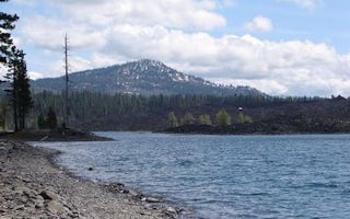
Old Station, California
Butte Lake Group
Overview
Butte Lake Group Campground (elevation 6,100 feet) is located in the northeastern section of Lassen Volcanic National Park in no...
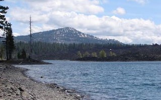
Old Station, California
Butte Lake
Overview
Butte Lake Campground (elevation 6,100 feet) is located in the northeastern section of Lassen Volcanic National Park in northern...
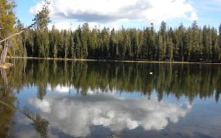
Volcanic Legacy Scenic Byway
Summit Lake South
Overview
Summit Lake South Campground (elevation 6,700 ft.) is conveniently located on the main road of Lassen Volcanic National Park. Th...
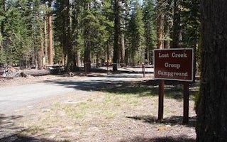
Volcanic Legacy Scenic Byway
Lost Creek Group
Overview
Lost Creek Group Campground (elevation 5,700 ft.) is approximately five miles south of Manzanita Lake, and close to the Lost Cr...
Volcanic Legacy Scenic Byway
Summit Lake North
Overview
Summit Lake North Campground (elevation 6,700 ft.) is conveniently located on the main road of Lassen Volcanic National Park. Th...
Unnamed Road
Manzanita Lake Camping Cabins
Overview
Manzanita Lake Camping Cabins offer convenience and comfort in a scenic setting of the Lassen Volcanic National Park. They are w...
Unfortunately, we don't have up-to date pricing data for this listing, but you can check pricing through Recreation Gov.
Book NowAdd your business today to reach The Outbound's audience of adventurous travelers.
Community
© 2024 The Outbound Collective - Terms of Use - Privacy Policy


