Cutthroat
Book this listing through our partner Recreation Gov
About Cutthroat
Overview
Cutthroat Campground lies at an elevation of 9,000 feet in the White Mountains of eastern Arizona. It sits on the shoreline of Big Lake and affords visitors many recreational opportunities in a quiet, scenic setting. Popular activities include trout fishing and hiking.Recreation
Named after a species of trout, Cutthroat is adjacent to 450-acre Big Lake, one of Arizona's top fishing lakes. The lake is known for its trout fishing, with rainbow, cutthroat, brook and Apache being the most sought-after species. The recreation area is also popular for hiking, mountain biking, birding and wildlife viewing.Facilities
Sites for tent camping only are scattered throughout this small facility and spaced a good distance apart. Some are directly on the waterfront. The basic amenities of restrooms, picnic tables and drinking water are provided, and anglers and boaters have the convenience of a boat ramp. An RV dump station is one mile away.Natural Features
The campground is located in a very scenic area, forested with ponderosa pine, spruce, Douglas fir, and aspen trees, which provide ample shade. Summer temperatures are pleasant and cool, a nice respite from the heat of lower deserts. Visitors should come prepared for cool nighttime temperatures and occasional summer rain storms.Nearby Attractions
Visitors can explore endless vistas and take part in many outdoor activities in the surrounding Apache-Sitgreaves National Forest, which encompasses 2 million acres of magnificent mountain country in east-central Arizona and New Mexico.Cutthroat Reviews
Have you stayed here? Be the first to leave a review!
Top Spots in or near Greer
Hike the Thompson Trail
Apache County, Arizona
5.0
6 mi
/ 250 ft gain
As you travel down Forest Road 116, approximately 200 yards before the trailhead, you will see the remains of the old Thompson Cattle Ranch - hence, Thompson Trail #629. The trail begins atop an old railroad grade, a reminder of the very successful logging days that went on for many years. The railroad, which ran from Maverick (ghost town) to Holbrook was owned by Southwest Lumber Mill. Today...
Backpack East Baldy Trail #95
Greer, Arizona
13 mi
/ 1900 ft gain
From the trailhead you start your hike with views over the East Fork of the Little Colorado River as it winds through grassy meadows filled with summer wildflowers. About 1.5 miles in the trail heads into the forest, on your left before you enter the forest is a nice primitive campsite where we stayed the night. Entering in the forest you will climb a steep 800 ft gain over the next half mile t...
Hike the West Baldy Trail
Greer, Arizona
4.5
14 mi
/ 2000 ft gain
The West Baldy Trail is one of the most beautiful (and popular) hikes in Arizona. It is reminiscent of many alpine hikes you might find scattered across Colorado. The trail follows the Little Colorado River most of the way and the sound of trickling water complements the gorgeous mountains and grasslands. Even if you’re not completing the full 7-mile hike, there are many places along the first ...
Hike the Government Springs Trail
Greer, Arizona
6.25 mi
/ 68 ft gain
To find Government Springs Trailhead, follow State Route 260 to State Route 373 (the Greer Turnoff), turn right and follow State Route 373 to FR 575 until it ends. At the end of the road is a small parking lot with restroom facilities. The trail starts at the north end of the parking lot.This beautiful and sometimes rocky trail parallels the Little Colorado River and eventually connects with th...
Pacheta Falls
Whiteriver, Arizona
5.0
2.37 mi
/ 187 ft gain
Pacheta Falls is spectacular and worth the several hour drive over washboard roads and you explore the high country of Arizona. You will be on the White Mountain Apache Reservation, so please take note:
You need to purchase a Special Use PermitNo swimming allowed4x4 with additional clearance recommendedThis is very rugged country. Finding the falls can be difficult and the terrain hazardous. ...
Hike to Escudilla Mountain Lookout Tower
Nutrioso, Arizona
6 mi
/ 1300 ft gain
Already starting off at elevation (about 9,560 feet above sea level), you first travel through a large stand of aspen trees during the beginning third of the trail.Depending on the season, the aspen can provide pleasant cover in summer, miraculous colors in fall and eerie creaking as the wind flows through their naked branches in spring and winter. You'll rarely come across many (if any) other ...
Camping and Lodging in Greer
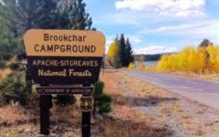
Greer, Arizona
Brookchar
Overview
Brookchar Campground is tucked on the banks of Big Lake in the White Mountains of eastern Arizona. The campground is a small, te...
Greer, Arizona
Winn
Overview
Winn Campground is situated near the Mt. Baldy trailheads and the East and West Forks of the Little Colorado River, making it an...
Greer, Arizona
Benny Creek Group Area
Overview
Benny Creek Campground offers group camping in the remote and scenic White Mountains of Arizona. A perfect outdoor retreat for s...
Greer, Arizona
Hoyer
Overview
Hoyer Campground is situated among the ponderosa pine forests of eastern Arizona, and is one of the most popular campgrounds in ...
Alpine, Arizona
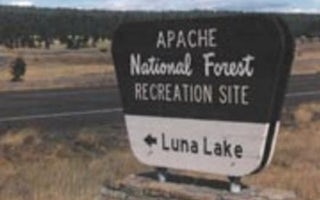
Luna Lake
Overview
Luna Lake Campground is a pleasant vacation site with open forest, lush meadows, a lake with great fishing, first rate mountain ...
Apache County, Arizona
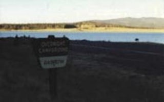
Rainbow (Az)
Overview
Rainbow is the largest campground in the Big Lake Recreation Area in eastern Arizona. Because of its proximity to the lake, size...
Unfortunately, we don't have up-to date pricing data for this listing, but you can check pricing through Recreation Gov.
Book NowAdd your business today to reach The Outbound's audience of adventurous travelers.
Community
© 2024 The Outbound Collective - Terms of Use - Privacy Policy


