Bridal Veil Group Area And Picnic Ground
Book this listing through our partner Recreation Gov
About Bridal Veil Group Area And Picnic Ground
Overview
This site remains closed due to storm damage. No reopening date has been set at this time. Bridal Veil Group Campsite and Picnic Area is located on the South Fork of the American River. It offers picnicking sites, a group overnight area, beautiful swimming holes, and close access to fishing.Recreation
This site provides two large swimming holes in the river that are popular with the local residents. Fishing is also a popular activity, mainly rainbow and brown trout.Facilities
Bridal Veil Group Area is on a hill overlooking the river and day use area. The group area includes lot-style parking with 7 parking stalls, 5 tent pads, 8 picnic tables, 6 serving tables, and a large group fire ring. Group campsite users may use the day use areas with no additional fees. None of the facility is accessible. There is no water available on site. The facility has a host on site from mid-May through mid-October.Natural Features
Sitting at an elevation of 3,200 feet, Bridal Veil group campsite provides easy access to the American River. A Mediterranean climate extends over most of this forest, creating warm, dry summers, and cold, wet winters. Vegetation is mixed conifers with riparian vegetation along the river.Nearby Attractions
Visitors enjoy scenic drives along Highway 50 and surrounding forest roads. The site is within a half hour drive of both Jenkinson Lake and Crystal Basin. It is 10 minutes from the stores and restaurants of Pollock Pines and 5 minutes from Bridal Veil Falls. South Lake Tahoe is a 45 minute drive.Bridal Veil Group Area And Picnic Ground Reviews
Have you stayed here? Be the first to leave a review!
Top Spots in or near Pollock Pines
Jenkinson Lake Loop Trail at Sly Park
Pollock Pines, California
4.0
8.19 mi
/ 640 ft gain
The Jenkinson Lake Loop Trail runs along Jenkinson Lake, making for an easy, shaded, and well-marked hike that the entire family can enjoy. The full loop is over eight miles, but can be easily modified into a shorter trip, as well.
Along the way, you will see a variety of activities along the lake (fishing, kayaking, canoeing, etc.), as well as come across some great areas for swimming, sight-...
Camp at Ice House Reservoir
El Dorado County, California
4.0
1 mi
/ 1 ft gain
Desolation Wilderness is just west of Lake Tahoe, a part of Eldorado National Forest. It's a very popular backpacking destination as the PCT and Tahoe Rim Trail both run through the area. There are what seems to be endless amounts of mountain lakes, creeks, and rivers that run through this area which make it one of the more beautiful regions in California. Camping at Ice House Reservoir is a pe...
Hike to Bassi Falls
Kyburz, California
4.6
1.22 mi
/ 194 ft gain
109' tall Bassi Falls is located in the Crystal Basin area of the El Dorado National Forest. These gorgeous falls at peak Springtime flow crash over enormous boulders and the water sheets over huge, flat slabs of granite. It is located off a rural, pot-holed dirt road (high clearance vehicles recommended) . Afternoon is a preferable time to photograph here, since the light will be hitting the...
Hike Pyramid Peak
Kyburz, California
5.0
Although it stands only slightly higher than its neighbors, Pyramid Peak nonetheless dominates the Crystal Range atop which it sits. Great views from the summit make this a must-do.The Route: The route is fairly straightforward to Lake Sylvia (see map). Simply follow the well-defined Lyons Creek trail up Lyons Creek, until you reach Lake Sylvia (about 4.6 miles). Over this distance, you've...
Desolation's Primitive Western Edge through Rockbound Pass Loop
Kyburz, California
4.4
26.28 mi
/ 5151 ft gain
This 26 mile loop meanders through some of the most primitive trails in Desolation Wilderness. Starting from Wrights Lake, the route proceeds over Rockbound Pass, loops around several lakes, and returns to Wrights Lake. Not many hikers venture past the steep and rocky Rockbound Pass to enter this part of the wilderness which makes for a truly desolate experience. Along with passing tens of name...
Rock Climb the Cosumnes River Gorge
Placerville, California
5.0
Consumes River Gorge is a good climbing spot that is relativity close to Sacramento, California. it is located just outside of Placerville, California, making it a must-stop climbing spot for any Sacramento or Eldorado county local. The climbing spot boasts granite climbing areas with over a hundred different routes.Park your car along Bucks Bar Road and hike down the trail that starts at the g...
Camping and Lodging in Pollock Pines
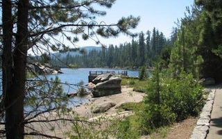
Pacific House, California
Gerle Creek
Overview
Gerle Creek Campground is nestled on the banks of the Gerle Creek Fork among a lush forest of hardwoods. The area provides lots ...
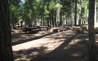
Pollock Pines, California
South Fork Group (Ca)
Overview
South Fork is the largest group campground in the Crystal Basin Recreation Area, nestled in the vast expanse of the Eldorado Nat...
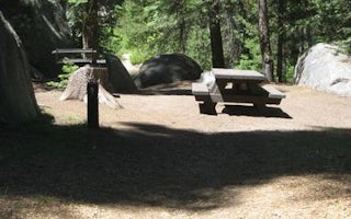
Pollock Pines, California
Silver Creek Group Campground
Overview
Silver Creek, located in the Crystal Basin area, offers a fun atmosphere with beautiful scenery for group gatherings. The Ice Ho...
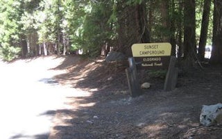
Kyburz, California
Sunset Union Valley
Overview
Sunset Campground is situated on the shores of Union Valley Reservoir, among the towering cedar and ponderosa pines of Eldorado ...
Kyburz, California
Fashoda
Overview
Fashoda Campground, located on a peninsula of the eastern side of Union Valley Reservoir, is an incredibly scenic place to camp....
Grizzly Flats, California
Capps Crossing
Overview
Capps Crossing is located on the North Fork of the Cosumnes River. The campground is located in a forested area and is well sha...
Unfortunately, we don't have up-to date pricing data for this listing, but you can check pricing through Recreation Gov.
Book NowAdd your business today to reach The Outbound's audience of adventurous travelers.
Community
© 2024 The Outbound Collective - Terms of Use - Privacy Policy


