Kelley LeExplorer
Wilderness therapy field instructor; loving people, nature, and the Creator of it all.
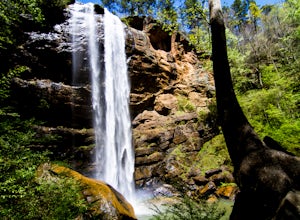
Explore Toccoa Falls
Toccoa, Georgia
3.6
0.2 mi
Park at the welcome center of Toccoa College.The trailhead is behind the welcome center, starting at the gates to the right of the center. The trail takes you along a creek on a gravel trail. After a short distance, you will reach Toccoa Falls, where the water pours off the rocks from over 180 feet high in a free-fall to a pool below.There are also beautiful butterflies that are often flying ar...
Take a Dive at the Forty Foot
Dublin, IrelandBack in the day, the Forty Foot used to be a nude bathing place for men only. Over time, it became a popular place to swim and cliff jump. The locals have an annual Christmas Day swim here, where brave swimmers take a plunge into the waters in Santa clothing and other festive clad. Others find it as a great hangover cure after a long night at a local pub. Even when I was there, a guy shouted "I...
Hike to the Roswell Mill Ruins via Vickery Creek Trail
Roswell, Georgia
4.4
3.46 mi
/ 374 ft gain
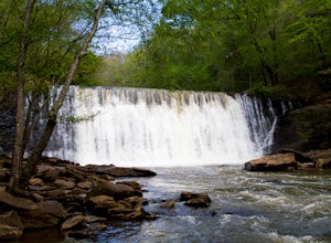
From Riverside Road, the Vickery Creek Trail takes you alongside the creek, then to an intersection where you will turn right. Switch onto Outer Loop Trail at the next intersection, and keep an eye out for marked junctions going forward.
The trail will take you to the Roswell Mill waterfall, then to a covered bridge 3 miles in, before reaching the ruins of the mill, itself. There is a nice wat...
Hike the Cliff Path Loop
Howth, Ireland
4.8
3.7 mi
/ 426.5 ft gain
Starting from the Dart train station in town, follow the green arrows along the promenade that lines the harbour. These arrows are on lamp posts, fairly small, along with other colored arrows for other trails. It can be difficult to first spot them, but if you follow along the harbour, in a meadow there is a large map detailing the different trails on the peninsula. There is also a stand with b...
Drive through Scenic Castle Valley
Moab, Utah
5.0
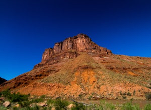
Going west on Highway 128 towards Moab, take a left onto La Sal Loop Road. And you're there! To get back to Highway 128, simply turn back on the same road. You can also take a right onto Porcupine Ranch Road, meeting at La Sal Loop Road again, eventually reaching Highway 128.During this drive, you'll catch views of free range cattle and Castleton Tower. You can also see distant mountain ranges ...
Camp at Big Bend Campground
Moab, Utah
5.0
This campground has three different campsites. All the sites are made for larger groups, so there has to be a minimum number of people to reserve a site. Site A is the largest, with the maximum capacity of 40 people. Site B fits 20 people and site C fits about 30 people. All the sites are non-electric. Sites A & B are by the Colorado River with views of Big Bend. Site C is across the street...
Hike the Cascade Springs Trail
Atlanta, Georgia
5.0
1.9 mi
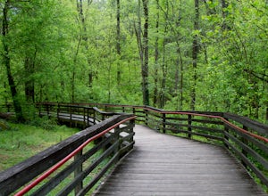
A quick and local getaway from the hustle and bustle of Atlanta city life, Cascade Springs Nature Preserve offers over 100 acres of forested trails that lead to Utoy Creek and Cascade Falls.The trail starts at the parking area and leads to a boardwalk where old historical structures stand alongside the path. At the end of the boardwalk sits a stone structure surrounded and covered by moss. From...
Hike to St. Kevin's Monastic Site
Wicklow, Ireland
5.0
1.9 mi
/ 459.3 ft gain
Park at the Upper Lake car park. The parking fee is 4 Euro.Start at the trailhead and follow the Green Road Walk. Along the trail, you'll walk through wetlands on boardwalks as well as forested areas. At the beginning of the trail by the car park, there are views of Glendalough Upper Lake. You'll be hiking around the Glendalough Lower Lake as well. During your hike, make sure you follow the sig...
Panther Creek Falls
Clarkesville, Georgia
3.7
7.27 mi
/ 659 ft gain
Park at the Panther Creek Recreation Area. The fee to park here is $4. There is extra parking alongside the road if the parking lot is full.
The trail begins opposite the parking area, noted by a wooden sign. The trail gains elevation here and there with several drop-offs secured by cable cord fences.
At 3.5 miles, you will reach Panther Creek Falls where the water flows into a large pool. He...
High Falls Loop
Jackson, Georgia
4.2
1.08 mi
/ 194 ft gain
Parking areas are on the opposite side of the road where the trailhead is located and the fee is $5. If paying for parking isn't in your agenda, there is a gas station down the road on the same side as the trailhead where free parking is occasionally available.
The trail begins off High Falls road, indicated by a sign. At the beginning, the trail descends along several wooden stairs. There are...
Hike from Bray to Greystones
Bray, Ireland
5.0
3.7 mi
/ 328.1 ft gain
From Dublin, you can get to Bray via Dart train. Once you arrive in Bray, walk towards the sea along the Bray promenade. Continue along the promenade going south. You'll walk along the beach for a few minutes before reaching the blazed trail. Essentially, you'll follow this trail until you reach the town of Greystones. Along the trail, there are side routes that take you down to secluded beache...
Hike the Wilderness Preserve Trail
Port Saint Joe, Florida
5.0
14 mi
Parking is open and free for all designated spots within the state park.At the end of the parking area, there is a gate with a large brown sign. This sign reads "St. Joseph Peninsula State Park / Wilderness Preserve Access." This is where the trail begins.The trail is easy to follow with yellow markers as guides. Along this main trail, there are several smaller trails. The smaller trails on the...
Hike to Martin Creek Falls
Clayton, Georgia
5.0
0.6 mi
There are two different ways to get to this waterfall.The easiest way is through a trail in the Warwoman Wildlife Management Area. To get to this trail head, drive east on Warwoman Road from Clayton, GA. At approximately 3.5 miles, take a left onto Finney Creek Road (FS 152). You will see a sign that marks the wildlife management area. Continue past the checking station and about 0.5 miles, the...
Hike the Battlefield and Mountain Loop
Marietta, Georgia
5.0
10.24 mi
/ 1355 ft gain
From the visitor center, start on the Kenneshaw Mountain Trail, which takes you up a series of switchbacks to the summit of Kennesaw Mountain (600' elevation gain). Take in the views of Atlanta from the top, then continue on the trail as it descends, then starts up Little Kennesaw Mountain.
At 2.5 miles you will reach the site of Confederate trenches at Pigeon Hill. In a little over a mile, ta...
Community
© 2024 The Outbound Collective - Terms of Use - Privacy Policy

