
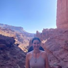
Hike to Lost Lake
Gunnison County, Colorado
Details
Distance
2.4 miles
Elevation Gain
600 ft
Route Type
Out-and-Back
Description
Added by Billy DiMirra
Lost Lake is a lesser known spot off of Cottonwood Pass, that sends you through some forested areas and meadows, that eventually lead to an alpine lake.
This Trail starts at about 11,200 feet right before the top of cottonwood pass. The trailhead starts at the LAST pull-off before you reach the top of the pass, so if you reach the top, you've gone too far. The hike isn't a super difficult one, but you will go through numerous streams and flooded meadows (depending on the time of year). The view from the top looks straight down the valley and from the top of the lake you can see Pikes Peak in the distance on a clear day.
Download Outbound mobile app
Find adventures and camping on the go, share photos, use GPX tracks, and download maps for offline use.
Get the appFeatures
Hike to Lost Lake Reviews

Hike through various terrains, wild animal scat all over. The scent of pine in some areas is just fantastic. Great family hike.
5.0
This hike was beautiful start to finish! Wide open green hills and plenty of wildflowers. We saw a huge amount of columbines at peak wildflower season! The lake is gorgeous and there is plenty of room to spread out, plus some camping spots if you wanted to backpack in.
5.0

The views are insane the whole way. It's nice for a quick hike and anyone can do it. It goes up and down a little bit, but it really isn't bad. Beautiful hike.
5.0

We are trying this out this weekend but I found on the Buena Vista chamber of commerce website an 18mile drive to get to a trail to the lake. =) http://www.buenavistacolorado.org/hiking/ Lost Lake For a relaxing day with breathtaking mountain views, explore Lost Lake, located less than 30 minutes from downtown Buena Vista. This hike is terrific for visitors who aren’t used to Colorado’s altitude or for families with young ones. One of our favorite times to go is in July and August when the wildflowers are in full bloom. At an easy pace, this route typically takes about 30 to 45 minutes one-way. Bring your fishing pole to catch some 6-16″ native cutthroats. Difficulty: Easy to Moderate Distance: 2.6 miles round trip Elevation: 11,195 ft. Elevation Gain: 680 ft. Directions: From the stoplight in downtown Buena Vista at the intersection of U.S. 24 and Main Street, head west on Main Street/CR 306 and travel for 18.1 miles. You’ll be going in the same direction as Cottonwood Pass. The trailhead will be on your left, and a small parking section is located on the right side of the road; keep your eyes peeled because the trailhead can be easily missed.
1.0
Let's just say this short hike does not disappoint! Perfect for families with children if you're looking for a lesser known and lesser crowded hike. if you use the coordinates provided here you most certainly can find it. There is no "trailhead" sign so don't go looking for that. There is a pulloff right near where the trail starts so just trust what Billy and the Outbound has provided. The lake at the end is as stunning as it is in the pics. A little elevation gain but most anyone can do it. The beauty is that not very many people even know about it! We ended up at the lake with one other small group who was leaving and then had the whole thing to ourselves. The lake is a stunning emerald green with a cool rocky island in the middle of it. Great place to backpack if you're looking for a very manageable one. Thanks for sharing Billy as my family loved it!
5.0
Leave No Trace
Always practice Leave No Trace ethics on your adventures and follow local regulations. Please explore responsibly!
Nearby

Take in the Views on Cottonwood Pass

Ptarmigan Lake near Buena Vista

Summit Mt. Yale

Backpacking to Kroenke Lake

Photograph Cottonwood Lake, CO

Hike Mt. Harvard
Discover
Community
Mobile Apps

© 2026 The Outbound Collective - Terms of Use - Privacy Policy