Yale, British Columbia
Top Spots in and near Yale
-
Maple Ridge, British Columbia
Hike to Lower Falls in Golden Ears Provincial Park
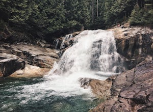
5.03.5 miLower Falls is found within Golden Ears Provincial Park in British Columbia. Easily accessible from the Gold Creek Parking lot, it is a relatively flat trail snaking along Gold Creek itself. It can be done as an out & back trail, or you can make it a loop by using the connector trail located ...Read more -
Maple Ridge, British Columbia
Hike Evans Peak in Golden Ears Provincial Park
4.0Start on the West Canyon Trail and then take a left up the View Point Trail. Along the View Point trail you’ll cross a creek. There’s a beautiful waterfall and natural hammock (a log) which is great for a quick snack spot or photo.A few hundred meters past the creek, 1.5km from the start of the...Read more -
Maple Ridge, British Columbia
Summit Golden Ears
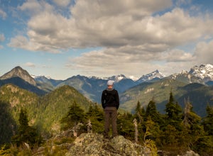
4.514.9 mi / 5039.4 ft gainDay 1 Starting from the Golden Ears parking lot, your journey begins up a relatively small incline passing two bridges and entering the forest. Continue through the forest passing small cliffs and revealing some views of what you are going to climb the next day. Your estimated time it should take...Read more -
Maple Ridge, British Columbia
Hike to Alder Flats in Golden Ears Provincial Park
4.06.8 mi / 918.6 ft gainIf you're looking for a challenge and hope to get into the mountains this is a great adventure to set out on.Be prepared: Water, a lot of time, and with an understanding of the elevation gain will be important. This hike to the viewpoint of Alder Flats (overlooking the ears) takes around 2 hours ...Read more -
Maple Ridge, British Columbia
Hike the East-West Canyon Loop
8.1 mi / 1640.4 ft gainPark your car in the Gold Creek Parking lot ( at the end of the dirt road), and look for a yellow gate at the far end of the parking lot. This will be the East Canyon trail.The first part of the trail winds through the forest and you emerge on an old logging road. Follow this road along with the ...Read more -
Maple Ridge, British Columbia
Hiking Golden Ears Trail
14.9 mi / 4921.3 ft gainGolden Ears is well known to those in the Lower Mainland. After staring at the jagged 'ears' from all angle, I finally got to see them up close and in-person. The West Canyon Trail is a gentle 5.5 kilometers on a well groomed path, lined with deciduous trees making it a perfect place to watch the...Read more -
Maple Ridge, British Columbia
Camp in Golden Ears Provincial Park
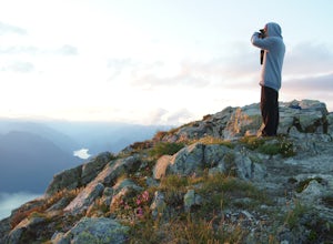
11.2 mi / 3937 ft gainBackcountry permits are required to camp on Panorama Ridge ($5) and can be paid online.The trailhead is located at the West Canyon Parking lot. The trail starts out on a relatively flat old logging road. The trail slowly gains elevation over three kilometers taking you through thick green forest ...Read more -
Deming, Washington
Catch a Sunrise at Picture Lake
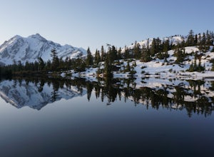
4.7Set your eyes on one of the most photographic mountain landscapes in North America. You can drive up early for the sunrise, but really any time of day will be a treat.In the spring, make sure to come when the lake isn't frozen over so you can get the full reflection of Mt. Shuksan on the water. T...Read more -
Deming, Washington
Winter Backpack to Artist Point
4 mi / 1000 ft gainYou do need a Northwest Forest Pass to park in the lot overnight. You can buy a day use E-pass online here (pick Mount Baker-Snoqualmie National Forest from the drop down menu) and print it out and it's ready to use. Or you can buy the annual pass here.The adventure to Artist Point begins in the ...Read more -
Deming, Washington
Snowshoe to Huntoon Point
5.06 mi / 1200 ft gainThis strenuous but rewarding hike takes you first to Austin Pass, where there is a great view of Mount Shuksan. Look out for skiers and snowboarders heading the opposite direction as you start out.The second major push heads further up to Kulshan Ridge, leading first to Artist Point, then Huntoon...Read more -
Deming, Washington
Winter Backpack in the Mt. Baker Backcountry
6 mi / 1500 ft gainArrive at the upper ski resort parking lot (approx. 4300 feet elev.) and snowshoe, skin, or split board up. Make your way toward Artist Point and eventually Huntoon Point, gaining approximately 1500 feet of elevation over approximately 3 miles (one way). Past Huntoon Point, there are several grea...Read more -
Deming, Washington
Backcountry Skiing Near Mt. Baker
5.0Park at Heather Meadows parking lot at Mount Baker Ski Resort and follow the Blueberry cat-track, which is actually a paved road in the summer, leading south up for 2 miles passing Austin Pass and continuing southwest on to Artist Point, gaining 1200 ft in elevation. From there, dig out your snow...Read more -
Deming, Washington
Winter Backpack to Lake Anne Ridge
14 mi / 2000 ft gainArrive at the upper ski resort parking lot (approx. 4300 feet elev.) and snowshoe, skin, or split board up. Make your way toward Artist Point and halt at Austin Pass, gaining approximately 1200 feet of elevation over approximately 2 miles (one way). From Austin Pass, turn left (south) to take the...Read more -
Deming, Washington
Chain Lakes Loop
4.08.35 mi / 2005 ft gainDriving Directions: Travel east on Mt. Baker Highway 542 to the road's end and the Mount Baker Ski area. Follow the signs to the upper parking lot and the Bagley Lakes/Chain Lakes trailhead. The trail can also be accessed from Austin Pass and Artist Point. Trail: From the Bagley Lakes trail...Read more

