Shawnigan Lake, British Columbia
Top Spots in and near Shawnigan Lake
-
Port Renfrew, British Columbia
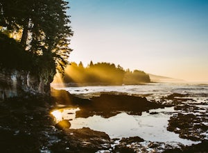
This is a gorgeous beach with so much going on. It's a quick walk from the parking lot (about .8 miles), or you can do the entire Botanical Beach Loop which is 3.5km. Go at low tide for amazing tidal pools and exploring caves if the tide is at its lowest. You can beach hop and climb up to some...
Read more
-
Olga, Washington
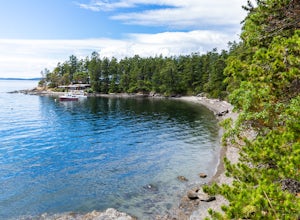
The nine primitive campsites and one Cascadia Marine Trail campsite of Obstruction Pass State Park are the only first come, first serve campsites available on Orcas Island. The campsites themselves overlook a fantastic (and accessible beach) and Obstruction Pass itself.
There are four composting ...
Read more
-
Olga, Washington
Obstruction Pass State Park is something of a hidden gem on Orcas Island given that its nearby neighbor, Moran State Park, gets most of the tourist attention. What this means is that you can find solitude and quiet, *and* make a visit to the only publicly owned beach on the island.
There are seve...
Read more
-
Blakely Island, Washington
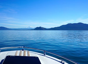
From Washington Park in Anacortes, Washington we launched our 19' Beachcraft with a deep hull into Puget Sound on a beautiful blue sky morning. The weather and water was favorable for an overnight adventure to Blakely Island!
We made our way across Rosario Straight and toward James Island (20 mi...
Read more
-
Port Angeles, Washington
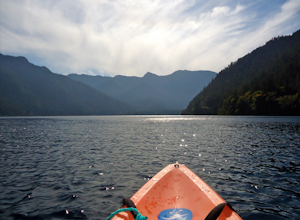
From the Log Cabin Resort located on the east shore of Lake Crescent, rent a kayak and spend the day on the water! My husband and I rented a kayak on our honeymoon for a day and explored half of the lake staying close to the east shore.You can see the bridge for the Spruce Railroad trail on the ...
Read more
-
Port Angeles, Washington
3.0
11.36 mi
/ 1138 ft gain
This versatile trail can adapt to your needs. It's can be an out-and-back hike, so you can make it as long as you like. If you do full distance, you are looking at an 8 mile day... OR, if you have two cars, you can park a car at either end of the trail and make it a 4 mile one-way hike.
This des...
Read more
-
-
Lopez Island, Washington
4.0
1.59 mi
/ 453 ft gain
The Watmough Bay Trail on Lopez Island, Washington, is a moderate-level hiking trail that stretches for approximately 1.59 miles. The trail is known for its unique natural features, including a prominent cliff face, a pebble beach, and a protected bay. The trail is relatively flat, making it acce...
Read more
-
Sequim, Washington
Park at a the north side of the Dungeness Spit Recreation Area, in the Refuge parking lot. There is a kiosk at the Refuge where you can pay an entrance fee ($3) and check the Tide Table. Only attempt the hike at low tide or the sand spit becomes narrow and you have to climb over logs.Follow the R...
Read more
-
Blakely Island, Washington
If you're looking for a weekend camping getaway to a small San Juan Island and you have a boat of substantial size or experience sea kayaking, this is the adventure for you!Launch your boat from Washington Park in Anacortes and cruise or sea kayak across Rosario Straight to James Island. There i...
Read more
-
Nanaimo, British Columbia
4.8
2.69 mi
/ 558 ft gain
The falls cascades off of a sheet of rock that is filled with Ammonite fossils, thus the name Ammonite Falls!
The trailhead is very distinct and has a parking lot close to the start of the trail. From the Nanaimo Parkway (#19) head onto Jingle Pot Road. Follow that for a few kilometres and turn ...
Read more
-
Nanaimo, British Columbia
You can easily put Sugarloaf Mountain Park into your GPS when in Nanaimo, but lets, just say you have an old school map. First make your way from the Island Highway onto Departure Bay Rd. Just before you get to Hammond Bay Rd turn onto Little John Way and take your first left, then take your firs...
Read more
-
Nanaimo, British Columbia
Firstly, use google maps to take you to Stephenson Rd in Nanaimo. About a mile down, the road forks, follow the left road (It says no exit, but the road just ends at a property so you will need to turn around to get back out). Continue down the road another half mile or so and you will see a smal...
Read more
-
Youbou, British Columbia
Heather Mountain is a moderate well marked out and back hike through managed forest land.
The hike brings a wonderful feeling of solitude as there are no towns or buildings visible even with distant views in all directions. It is also quite lightly tracked: we saw no other hikers on the entire r...
Read more
-
Port Angeles, Washington
4.7
3.91 mi
/ 2251 ft gain
The trailhead is located right next to the Storm King ranger station adjacent to Lake Crescent right off Hwy 101 just past Port Angeles if heading West.
It shares the same trail as, and breaks off left from the Marymere Falls trail (also worth seeing) about a quarter mile in (look for signage). ...
Read more

