Port Alberni, British Columbia
Top Spots in and near Port Alberni
-
Alberni-Clayoquot A, British Columbia
Far on the west coast of Vancouver Island, accessed only by a harrowing dirt road, is a wild and rugged coast begging to be explored. Bamfield is about a 3 hour drive from Nanaimo, half of which is on the gnarliest (and most active) logging road I've ever been on - and I grew up driving on loggin...
Read more
-
Nanaimo, British Columbia
4.8
2.69 mi
/ 558 ft gain
The falls cascades off of a sheet of rock that is filled with Ammonite fossils, thus the name Ammonite Falls!
The trailhead is very distinct and has a parking lot close to the start of the trail. From the Nanaimo Parkway (#19) head onto Jingle Pot Road. Follow that for a few kilometres and turn ...
Read more
-
Nanaimo, British Columbia
You can easily put Sugarloaf Mountain Park into your GPS when in Nanaimo, but lets, just say you have an old school map. First make your way from the Island Highway onto Departure Bay Rd. Just before you get to Hammond Bay Rd turn onto Little John Way and take your first left, then take your firs...
Read more
-
Nanaimo, British Columbia
Firstly, use google maps to take you to Stephenson Rd in Nanaimo. About a mile down, the road forks, follow the left road (It says no exit, but the road just ends at a property so you will need to turn around to get back out). Continue down the road another half mile or so and you will see a smal...
Read more
-
Ucluelet, British Columbia
Drive south west on Coast Guard drive to the parking lot for the wild coast trail to your left (where the pin is). Park in the parking lot, and head to the trailhead where the big sign board is. We completed the lower loop in approximately one hour, but you can continue up the coast all the way i...
Read more
-
Ucluelet, British Columbia
The Willowbrae trailhead is not marked along the Tofino Ucluelet highway and the turnoff is easy to miss. Driving from Tofino look for Willowbrae Road on the right hand side, 2 kilometers past the Port Alberni junction. From Ucluelet this road is on the left, 5 kilometers from town. Drive up...
Read more
-
Comox-Strathcona D, British Columbia
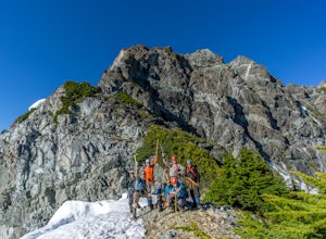
Mt Septimus lies deep within the beautiful and untouched Strathcona Park on Vancouver Island. The route takes you high into the alpine where you will cross glacial fed lakes amongst large peaks and thick forest. To climb Mt Septimus the route you will be taking is the X-Gully route, a steep snow ...
Read more
-
Comox-Strathcona D, British Columbia
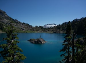
The hike to Cream Lake starts at the trailhead for the Bedwell Lake trail, which you can find directions to here.From Bedwell Lake the trail to Cream Lake heads Eastward from the campground (past the outhouse), and begins climbing steadily. Shortly you will reach a waterfall with the trail climb...
Read more
-
Comox-Strathcona D, British Columbia
5.0
7.5 mi
/ 2132.5 ft gain
Driving: From Campbell River, take Highway 28 West to the bridge over Upper Campbell Lake/Buttle Lake. Do not cross the bridge, but take the road down the East side of Buttle Lake. Follow Buttle Lake road south to Jim Mitchell Lake road which is on the left just after the Thelwood Creek Bridge. ...
Read more
-
Comox-Strathcona D, British Columbia
These beautiful falls are just a short and easy 500 metre stroll from the parking lot, making this one of the more family-friendly hikes in the area. Located at the end of the trail are the 75 metre cascading falls and spectacular views of Buttle Lake.Located approximately 1 1/2 hours north of th...
Read more
-
Comox-Strathcona D, British Columbia
With a name like Flower Ridge, who wouldn't want to add this hike to their bucket list?The Flower Ridge trailhead is located approximately 26kms down the Buttle Lake Parkway, towards Westmin Mine, in Strathcona Provincial Park. A classic Island alpine approach, you will be more than warmed up af...
Read more
-
Comox-Strathcona C, British Columbia
If you are looking for a beautiful, stress-free campground nestled in the mountains far from the city but within a morning's drive and a day's walking distance, suitable for the whole family and offers tons of activities, Circlet Lake is the right choice for you. It features an alpine lake that i...
Read more
-
Comox-Strathcona C, British Columbia
5.0
5.32 mi
/ 607 ft gain
The trail head starts at the Raven Lodge parking lot on Nordic Drive. Once at the trail head, follow the trail and turn right on the Hellen Mackenzie/ Battleship Lake trail loop. This boardwalk/ dirt trail will take you around beautiful meadows filled with blueberries (in the fall season), stream...
Read more
-
Comox-Strathcona C, British Columbia
5.0
12.4 mi
/ 2854.3 ft gain
Travelling through pristine sub-alpine terrain, and past endless crystal clear lakes, the trail to the lookout is loaded with awesome scenery. The icing on the cake is reaching the Canyon and enjoying lunch at the lookout, complete with Whiskey Jacks and 180 degree mountain and valley views. If...
Read more
-
Comox-Strathcona C, British Columbia
5.0
1.54 mi
/ 131 ft gain
Strathcona is the oldest provincial park in British Columbia and on their centennial year to celebrate, they built a 2km "every-body" accessible loop trail. It is wheelchair and stroller friendly, with boardwalks and large gravelled trails.
If you are looking for a quick hike with a taste of th...
Read more
-
Comox-Strathcona C, British Columbia
5.0
19.9 mi
/ 3280.8 ft gain
Mount Albert Edward is hard to miss. If you have ever driven up to Mount Washington you will remember the unique profile of this mountain to the west of Raven Lodge. Its long, drawn out scree ridge ends dramatically in a ski jump style peak before falling off into the abyss below. The Grinch hims...
Read more

