Bowen Island, British Columbia
Looking for the best chillin in Bowen Island? We've got you covered with the top trails, trips, hiking, backpacking, camping and more around Bowen Island. The detailed guides, photos, and reviews are all submitted by the Outbound community.
Top Chillin Spots in and near Bowen Island
-
Nanaimo, British Columbia
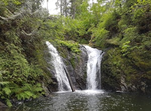
Hike to Ammonite Falls
4.82.69 mi / 558 ft gainThe falls cascades off of a sheet of rock that is filled with Ammonite fossils, thus the name Ammonite Falls! The trailhead is very distinct and has a parking lot close to the start of the trail. From the Nanaimo Parkway (#19) head onto Jingle Pot Road. Follow that for a few kilometres and turn ...Read more -
Squamish-Lillooet D, British Columbia
Hike to Crooked Falls
4.04 mi / 1400 ft gainThe trail to Crooked Falls starts at the Sigurd Creek Trail. The coordinates are: N49.910556, W-123.322817. It is a scenic dive just past the Squamish city center and the Squamish River. Once at the trail head you'll walk across a bridge over Sigurd Creek and follow the logging road for a couple...Read more -
Surrey, British Columbia
Stroll through Redwood Park in Surrey, BC
3.01.2 miRedwood Park is large beautiful forested park in South Surrey. The park is a legacy of one of Surrey's early pioneer's, David Brown, who in 1893 gave the property to his twin sons, David and Peter. The Brown twins spent much of their life traveling the world collecting the seeds and saplings of e...Read more -
Maple Ridge, British Columbia
Stroll along the Spirea Nature Trail
3.01.5 mi / 0 ft gainAn hour outside of downtown Vancouver lies the beautiful 150,000 acre Provincial Park of Golden Ears. The park has a myriad of hikes and adventures all with varying degrees of difficulty. The Spirea Nature Trail likely clocks in as one easiest amongst the dozens within the park. However, don’t le...Read more -
Maple Ridge, British Columbia
Camp in Golden Ears Provincial Park
11.2 mi / 3937 ft gainBackcountry permits are required to camp on Panorama Ridge ($5) and can be paid online.The trailhead is located at the West Canyon Parking lot. The trail starts out on a relatively flat old logging road. The trail slowly gains elevation over three kilometers taking you through thick green forest ...Read more -
Maple Ridge, British Columbia
Summit Golden Ears
4.514.9 mi / 5039.4 ft gainDay 1 Starting from the Golden Ears parking lot, your journey begins up a relatively small incline passing two bridges and entering the forest. Continue through the forest passing small cliffs and revealing some views of what you are going to climb the next day. Your estimated time it should take...Read more -
Maple Ridge, British Columbia
Hike to Lower Falls in Golden Ears Provincial Park
5.03.5 miLower Falls is found within Golden Ears Provincial Park in British Columbia. Easily accessible from the Gold Creek Parking lot, it is a relatively flat trail snaking along Gold Creek itself. It can be done as an out & back trail, or you can make it a loop by using the connector trail located ...Read more -
Maple Ridge, British Columbia
Hiking Upper Gold Creek Falls
4.5Once you arrive in Golden Ears Park, follow the road to the end and look for signs to the Gold Creek Day Area. The road will turn to gravel, and after you cross a small, one-line bridge, you will reach the parking lot.After you have parked, head north past the yellow gate, marked East Canyon Trai...Read more -
Nanoose Bay, British Columbia
Hike to Bonnell Creek Falls
5.01.9 miThis trail isn't much to look at but it's all about the destination here as you will stumble upon scenic waterfalls nestled in the quiet Nanoose Bay area. Turn off the highway next onto Sea Blush Drive next to the Arlington Pub in Nanoose BC. Take your first right onto Sundew Place. Start your wa...Read more -
Whistler, British Columbia
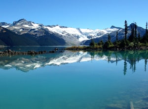
Hike and Camp at Garibaldi Lake
4.6Garibaldi Lake is a huge basin of beautiful turquoise water measuring almost 10 square kilometers (2460 acres), and located at nearly 5000ft above sea level. The lake is over 800 feet deep, filled with pristine glacial water. You’ll be surrounded by big snowy mountains, which remain bright white ...Read more -
Whistler, British Columbia
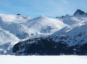
Explore Garibaldi Park on Snowshoes
Exploring Garibaldi Park by snowshoe is an experience you'll never forget. There is nothing like being in a forest wilderness in the stillness of winter. There are lots of places to snowshoe in the Whistler area, but here are two of the most exciting (yes, snowshoeing can be exciting!) Cheakamus ...Read more -
Parksville, British Columbia
Catch a Sunset from Little Mountain Lookout
3.51 mi / 0 ft gainAmazing lookout just outside of Parksville, British Columbia. From Parksville, drive towards Coombs and turn left off of Bellevue Rd. Then take the left onto Little Mountain Road and drive to the top parking lot. You can park at the bottom of the hill and run up the steep incline in case your car...Read more -
Parksville, British Columbia
Explore Lasqueti Island
15.5 mi / 754.6 ft gainLasqueti Island is a beautiful island that covers about 75 square kilometres. It is one of the drier islands in the strait, and has some of the warmest waters too. The shores are dotted with arbutus trees, and feral sheep run wild through the woods. The lack of car ferry and direct utilities kee...Read more -
Cowichan Bay, British Columbia
Photograph Cowichan Bay
There is a reason the town of Cowichan Bay is a popular destination for visitors and locals alike. The town boasts stunning views across the bay, of the Cowichan River estuary, the beautiful marina, and has a variety of restaurants, a candy shop and bakery. Start off by grabbing a bite to eat at ...Read more -
Errington, British Columbia
Hike to BC's Englishman River Falls
1.9 miSituated amid a quiet forest of both old and new growth Douglas firs, cedar, hemlock, and maple, the Englishman River Falls consist of two waterfalls which cascade into a deep canyon beneath a secluded bridge. Perfect for intermediate hikers, day-trippers, photographers and curious tourists, this...Read more -
Whistler, British Columbia
Hike to Helm Lake
4.012.4 mi / 3000 ft gainHelm Lake is a sparkly body of water tucked into one of the most scenic alpine meadows around. The lake sits on a lava field, just under the Black Tusk, with the unique volcanic remains of Cinder Cone and Helm Peak on the opposite side of the meadow.The big draw for this hike is that it's far les...Read more

