
Backpack Cape Pillar
Fortescue, Tasmania
Details
Distance
18 miles
Route Type
Loop
Description
Added by Katie Kessel
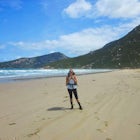
A stunning walk varying between forests and cliffsides, ending at a lookout of Cape Pillar and the famous lighthouse.
This hike has recently been newly built with a spectacular wooden boardwalk winding in and out of the forest and along the cliffs. As with other hikes in Australia, please make sure to book your campsite prior to heading out!
The Three Capes Track, a newly built four-day hike starting in Port Arthur, has recently been opened and includes portions of this older hike, though we have not yet done it.
Please note that the water sources are not necessarily dependable, so make sure to bring lots of water. Water sources include tanks at the campsite, Retakunna Creek (which you cross on your way to the campsite) and finally at Lunchtime Creek, which you will cross after setting up camp and heading back on to the Cape Pillar Track as indicated below.
Lastly, make sure, if you decide to alter the walk, to abide by the direction of the walk, which disallows walkers from walking in a southerly direction on the last section of the track from Mount Fortescue to Cape Huay.
The first day of the hike is the longest, at 22km. From the carpark at Fortescue Bay, head back down the road the way you came for around 200m until you reach the trail on the left side of the road.The track is well marked. Continue along the track, winding across grasslands and forests, until you reach a junction. This junction is made up of the Three Capes Track coming in from the right, which joins up on the Cape Pillar Track, and a track that continues to Mt Fortescue to the left. Continue straight along the track from here.
Not long after the first junction, you'll reach another where you have the option to head to the left, where the Wughalee Falls Campsite sits. At this point, we set up camp and continued on to Cape Pillar. The campsite here provides tent platforms, toilets, and rainwater tanks.
As you start back on the Cape Pillar Track, it will first make its way down to Lunchtime Creek, where you can refill your water. From the creek the track heads back uphill over rocky outcrops for about 300m until it flattens out and you can enjoy a bit of a view of the ocean to your right. Given bushes up here are relatively sparse and allows for fantastic views for most of the track on both sides. The cliffs are high, allowing you to see out quite far. The walking track winds south, allowing more spectacular views of the ocean and the lighthouse at the end of the cape.
Once you reach the end of the cape, admire the views then head back to camp, looking out for the track heading to your right.
On your second day, you'll have the opportunity to hike on the newly completed track that leads you over Mt Fortescue to Cape Huay and back to the carpark. This is an easy day of around 7 kms. From your campsite, head north towards Mt Fortescue. Once you summit, the track will descend and follow the cliffs until you reach the tip of Cape Huay. Finally, the track heads west, ending at the carpark.
Download Outbound mobile app
Find adventures and camping on the go, share photos, use GPX tracks, and download maps for offline use.
Get the appFeatures
Backpack Cape Pillar Reviews
Such an amazing place to visit and not far away from Hobart.
5.0
Leave No Trace
Always practice Leave No Trace ethics on your adventures and follow local regulations. Please explore responsibly!
Nearby

Photograph the Tasman Peninsula by Boat

Hike to the Three Capes

Hike Tasman National Park to Fortescue Bay via Tasman Trail

Camp near the Tessellated Pavement in Eaglehawk Neck

Lenah Valley Circuit

Visit the Bruny Island Lighthouse
Discover
Community
Mobile Apps

© 2026 The Outbound Collective - Terms of Use - Privacy Policy