Explore Sugar Pine Reservoir
4.3
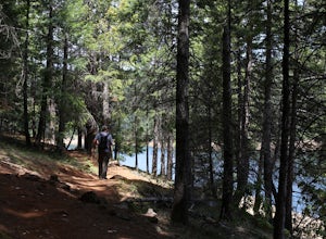
Just a few miles north of Foresthill, Sugar Pine is a lesser known reservoir found in Placer County that is surprisingly unpopulated for how much the park provides. A swim suit, some friends, and some good music can be all it takes to have a good ...
Hike to the Natural Bridge Falls
5.0
2 mi
/ 300 ft gain
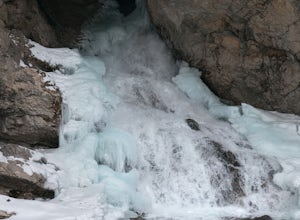
Although this recreation area is at minimum 30 minutes out from any town, the road leading to the location is amazing and allows for some sweet views. Once you arrive, there will be a relatively small, paved place to park as well as bathrooms. Rig...
Explore The Solo Tree
3.0
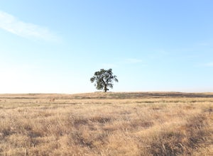
Disclaimer: This tree is on private property. If you choose to proceed, please check in with the property owner and proceed respectfully.The Solo Tree (often referred to as #thatrosevillesolotree on Instagram) has become a very popular photography...
Views of Cedar Breaks National Monument
The National Monument has very clearly marked roads, spacious parking, and easy access to anything you might need or want to see. At the parking lot, there is a sign to the left of the bathrooms, pointing you to a trail with a breath-taking view.W...
Scramble to Lake Aloha Lookout
Although Lake Aloha is in area of tourism, the way to get to this lookout invloves much more than just driving. And when some of my friends and I started planning this backpacking trip, we did not have climbing this peak in mind. We actually had n...
Morning Exploration at Trinity Lake
My grandparents have lived in the area (Trinity Center) for quite a while now, so I'm up at the lake quite often. This lake has always been there in my childhood and aslo hold many memories of mine, including sumers of fishing, wakeboarding, and ...
Forest Hill Bridge Adventures
Know for it's impressive hight, the Forest Hill Bridge in Auburn, California is one of the most beautiful but fierce bridges I've ever seen. After seeing many pictures of the bridge, I had my mind made up of going over there to check it out. Howev...
Exploring Red Canyon
Red Canyon is also known as “Little Bryce” because of it's brilliantly colored red rocks called hoodoo’s and large Ponderosa, Bristle Cone, and Limber pines throughout. This park is known as a place to get away from the crowds in Bryce Canyon Nati...
A Drive through Kolob Canyons
The Kolob Canyons is a section of Zion National Park (the northwest corner) located at Exit 40 on Interstate 15, 40 miles north of Zion Canyon and 17 miles south of Cedar City. The five-mile scenic drive along the Kolob Canyons Road allows for vis...
Cliff-Jump Island Lake
To get to Island Lake, follow the turn offs from I-80, avoid the holes and rocks on the road, and you'll be there in no time. Once you park, just follow the OHV road past Carr Lake and many others until you arrive at the lake. Now, with a little b...
Backpacking to the Loch Leven Lakes
The Loch Leven Lakes trailhead is located in the Tahoe National Forest off of Highway 80 and consists mostly of towering pinetrees, beautiful rock formations, and breathtaking lakes (due to either cold or beauty, not sure..). The trailhead is easy...
Rainbow Popint for Sunset
Rainbow Point is at the end of the Bryce Canyon 18-mile drive and is often disregarded. However, this is probably one of the greatest features of the park because of its amazing views. Once you park, you'll find lots of short trails and a small mu...
Hike Through an Aspen Forest
Chriss Lake is a small fishing lake on Boulder Mountain accessible by hikers, bikers and horse riders via the Chriss Lake Trail. This trail is a scenic hike that offers amazing views of both Escalante and the Grand Staiurcase National Monuments wh...
Amongst Hoodoos
The Queen's Garden Trail off of the Navajo Loops Trail is one of the endless possibilities for trail combinations in Bryce Canyons National Park and is approximately 3 miles of switchbacks weaving through world-famous hoodoos and archways. For the...
Carr Lake Look-Out
Although getting there involves a series of turn-outs and eventually a bumpy, rocky road (which I would only recommend to 4-wheelers, although I did see a Prius do it...), this lake is totally worth it.Parking is limited, but there are plenty of m...
Hiking to Gates of the Mountains
2 mi
/ 0 ft gain
Although not clearly marked, Gates of the Mountains Road is the exit to take off Highway 15, and will take you through a small community until you arrive at this small parking lot. Although there is no trailhead or even a trail for this hike, the ...
© 2021 The Outbound Collective - Terms of Use - Privacy Policy